
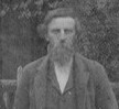


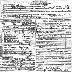
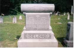
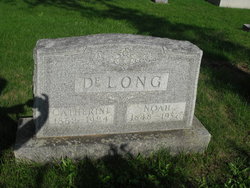
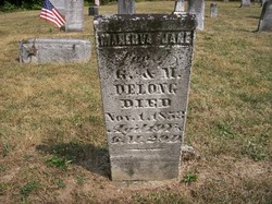
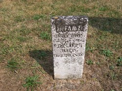
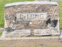
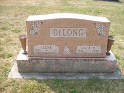
Noah DeLong
| Birth | : | 28 Jan 1848 Auglaize County, Ohio, USA |
| Death | : | 15 Jan 1937 Auglaize County, Ohio, USA |
| Burial | : | St. Peter's Churchyard, Burnley, Burnley Borough, England |
| Coordinate | : | 53.7924450, -2.2394890 |
| Plot | : | Section C, Row 1 |
frequently asked questions (FAQ):
-
Where is Noah DeLong's memorial?
Noah DeLong's memorial is located at: St. Peter's Churchyard, Burnley, Burnley Borough, England.
-
When did Noah DeLong death?
Noah DeLong death on 15 Jan 1937 in Auglaize County, Ohio, USA
-
Where are the coordinates of the Noah DeLong's memorial?
Latitude: 53.7924450
Longitude: -2.2394890
Family Members:
Parent

Spouse
Siblings

Children
Flowers:


Nearby Cemetories:
1. St. Peter's Churchyard
Burnley, Burnley Borough, England
Coordinate: 53.7924450, -2.2394890
2. St. James' Churchyard
Burnley, Burnley Borough, England
Coordinate: 53.7905590, -2.2458280
3. Ebenezer Baptist Chapel Chapelyard
Burnley, Burnley Borough, England
Coordinate: 53.7975120, -2.2397260
4. Holy Trinity Churchyard
Burnley, Burnley Borough, England
Coordinate: 53.7898290, -2.2574200
5. Burnley Cemetery
Burnley, Burnley Borough, England
Coordinate: 53.7821730, -2.2795070
6. Burnley Crematorium
Burnley, Burnley Borough, England
Coordinate: 53.7821730, -2.2795070
7. St. James' Churchyard
Briercliffe, Burnley Borough, England
Coordinate: 53.8107700, -2.2031800
8. St. John the Evangelist Churchyard
Worsthorne, Burnley Borough, England
Coordinate: 53.7877640, -2.1887420
9. All Saints Churchyard
Habergham Eaves, Burnley Borough, England
Coordinate: 53.7971060, -2.2913770
10. Marsden Friends Burial Ground
Marsden, Metropolitan Borough of Kirklees, England
Coordinate: 53.8241910, -2.2197410
11. Haggate Baptist Church Burial Ground
Burnley Borough, England
Coordinate: 53.8145048, -2.1960725
12. Hill Lane Baptist Church Churchyard
Briercliffe, Burnley Borough, England
Coordinate: 53.8161467, -2.1875368
13. St. Paul's Churchyard
Nelson, Pendle Borough, England
Coordinate: 53.8289250, -2.2157520
14. St. Anne Churchyard
Fence, Pendle Borough, England
Coordinate: 53.8304372, -2.2679552
15. Wheatley Lane Methodist Churchyard
Fence, Pendle Borough, England
Coordinate: 53.8341457, -2.2596202
16. St John Churchyard
Higham, Pendle Borough, England
Coordinate: 53.8251420, -2.2898120
17. St. John's Cemetery
Padiham, Burnley Borough, England
Coordinate: 53.7948720, -2.3145290
18. St. Leonard's Churchyard
Padiham, Burnley Borough, England
Coordinate: 53.8022600, -2.3164300
19. St Margaret Churchyard
Hapton, Burnley Borough, England
Coordinate: 53.7802400, -2.3169230
20. Wesleyan Methodist Chapel Chapelyard
Padiham, Burnley Borough, England
Coordinate: 53.8018980, -2.3181730
21. Wheatley Lane Inghamite Church Churchyard
Wheatley Lane, Pendle Borough, England
Coordinate: 53.8412800, -2.2457100
22. St. John the Divine Churchyard
Cliviger, Burnley Borough, England
Coordinate: 53.7533610, -2.1895090
23. St Leonard Churchyard Extension
Padiham, Burnley Borough, England
Coordinate: 53.7991800, -2.3222000
24. John Ecroyd's Orchard
Lancaster, City of Lancaster, England
Coordinate: 53.8201990, -2.1697920