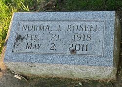
Norma Jean Gilson Rosell
| Birth | : | 21 Feb 1918 Iowa, USA |
| Death | : | 2 May 2011 Decorah, Winneshiek County, Iowa, USA |
| Burial | : | Brookwood American Military Cemetery, Brookwood, Woking Borough, England |
| Coordinate | : | 51.3014080, -0.6397010 |
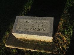
| Description | : | Norma Jean (Gilson) Rosell, age 93, of Decorah, Iowa, died early Monday morning, May 2, 2011 at the Aase Haugen Home in Decorah, Iowa. She had been a resident at Aase Haugen for the past eleven years enduring the disease of Alzheimer's. She and her devoted husband, Vance were able to be together at Aase Haugen from 2000 until his passing on November 11, 2007. Memorial services were held at 11:00 a.m. Saturday, May 7 at the Congregational United Church of Christ Church in Decorah, Iowa. Innurnment was in the Phelps Cemetery in Decorah, Iowa. Norma Jean was born February 21,... Read More |
frequently asked questions (FAQ):
-
Where is Norma Jean Gilson Rosell's memorial?
Norma Jean Gilson Rosell's memorial is located at: Brookwood American Military Cemetery, Brookwood, Woking Borough, England.
-
When did Norma Jean Gilson Rosell death?
Norma Jean Gilson Rosell death on 2 May 2011 in Decorah, Winneshiek County, Iowa, USA
-
Where are the coordinates of the Norma Jean Gilson Rosell's memorial?
Latitude: 51.3014080
Longitude: -0.6397010
Family Members:
Parent
Spouse
Siblings
Flowers:
Nearby Cemetories:
1. Brookwood American Military Cemetery
Brookwood, Woking Borough, England
Coordinate: 51.3014080, -0.6397010
2. Brookwood 1914-1918 Memorial
Brookwood, Woking Borough, England
Coordinate: 51.3007800, -0.6403300
3. Brookwood French Military Cemetery
Brookwood, Woking Borough, England
Coordinate: 51.3011700, -0.6384920
4. Brookwood 1939-1945 Memorial
Brookwood, Woking Borough, England
Coordinate: 51.3002815, -0.6409460
5. Brookwood Military Cemetery
Brookwood, Woking Borough, England
Coordinate: 51.3012619, -0.6419710
6. Brookwood Cemetery
Brookwood, Woking Borough, England
Coordinate: 51.3013535, -0.6297340
7. St Michael and All Angels Churchyard
Pirbright, Guildford Borough, England
Coordinate: 51.2945800, -0.6500000
8. Woking Crematorium
Woking, Woking Borough, England
Coordinate: 51.3122590, -0.6022630
9. St. John the Baptist Churchyard
Bisley, Surrey Heath Borough, England
Coordinate: 51.3273600, -0.6266370
10. St John the Baptist Churchyard
St Johns, Woking Borough, England
Coordinate: 51.3104700, -0.5929170
11. St Mary the Virgin Churchyard
Worplesdon, Guildford Borough, England
Coordinate: 51.2730100, -0.6067360
12. Deepcut Military Cemetery
Deepcut, Surrey Heath Borough, England
Coordinate: 51.3062170, -0.7049060
13. Holy Trinity Churchyard
West End, Surrey Heath Borough, England
Coordinate: 51.3434880, -0.6420670
14. St Mary the Virgin Churchyard
Horsell, Woking Borough, England
Coordinate: 51.3227460, -0.5703770
15. St. Mark's Churchyard
Pirbright, Guildford Borough, England
Coordinate: 51.2549050, -0.6812810
16. St Edward the Confessor Churchyard
Sutton Green, Woking Borough, England
Coordinate: 51.2741930, -0.5608230
17. Stoke New Cemetery
Guildford, Guildford Borough, England
Coordinate: 51.2543900, -0.5824700
18. Stoke Old Cemetery
Guildford, Guildford Borough, England
Coordinate: 51.2522600, -0.5828500
19. Valley End St Saviour Churchyard
Chobham, Surrey Heath Borough, England
Coordinate: 51.3647100, -0.6317100
20. St Peter's Churchyard
Frimley, Surrey Heath Borough, England
Coordinate: 51.3149770, -0.7393330
21. St Peter's Church
Old Woking, Woking Borough, England
Coordinate: 51.3017410, -0.5372560
22. Old Woking Burial Ground
Old Woking, Woking Borough, England
Coordinate: 51.3026230, -0.5351320
23. St Mary the Virgin Churchyard
Send, Guildford Borough, England
Coordinate: 51.2791230, -0.5408600
24. Windlesham Cemetery
Windlesham, Surrey Heath Borough, England
Coordinate: 51.3654000, -0.6654900


