Olive Mary “Ollie” Fish Johnson
| Birth | : | 3 Dec 1895 Charles Mix County, South Dakota, USA |
| Death | : | 10 Mar 1991 Burke, Gregory County, South Dakota, USA |
| Burial | : | Clover Hill Park Cemetery, Birmingham, Oakland County, USA |
| Coordinate | : | 42.5349998, -83.1885986 |
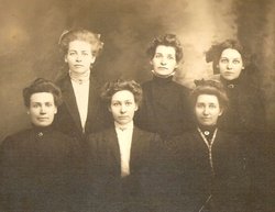
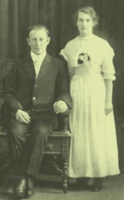
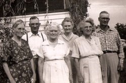
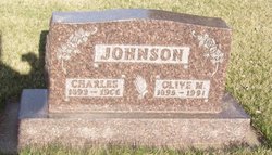
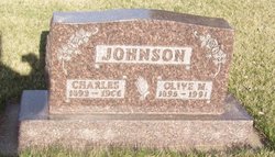
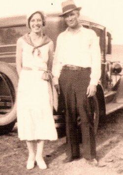
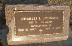
| Description | : | In the photo with her sisters, Olive is standing, third from left. Methodist Rev. Raul Gardner married Olive Mary Fish to Charles Johnson on 1-Jan-1917 (wedding photo shown). She is fifth from left in 1954 photo. They farmed in Gregory County, had 5 boys and 4 girls: Charles Leslie (b.21-Feb-1917, d.3-Sep-1989); Millie Lucille (b.21-Frb-1919);Almon Lovell (b.26-Aug-1920); George Leroy (b.21-Jan-1922); Marjorie Marie (b.29-Jan-1924); Harold Raymond (b.1-Jun-1927); Olive Irene (b.25-Dec-1928); Luella Mae (b.18-Oct-1930); and Robert Cecil "Bob" Johnson (b.31-Dec-1931). Charles died 11-Feb-1966 at St.Vincent Hospital in Sioux City,Iowa. |
frequently asked questions (FAQ):
-
Where is Olive Mary “Ollie” Fish Johnson's memorial?
Olive Mary “Ollie” Fish Johnson's memorial is located at: Clover Hill Park Cemetery, Birmingham, Oakland County, USA.
-
When did Olive Mary “Ollie” Fish Johnson death?
Olive Mary “Ollie” Fish Johnson death on 10 Mar 1991 in Burke, Gregory County, South Dakota, USA
-
Where are the coordinates of the Olive Mary “Ollie” Fish Johnson's memorial?
Latitude: 42.5349998
Longitude: -83.1885986
Family Members:
Parent
Spouse
Siblings
Children
Flowers:
Nearby Cemetories:
1. Clover Hill Park Cemetery
Birmingham, Oakland County, USA
Coordinate: 42.5349998, -83.1885986
2. Perrin Cemetery
Troy, Oakland County, USA
Coordinate: 42.5398254, -83.1857605
3. Saint James Episcopal Church Columbarium
Birmingham, Oakland County, USA
Coordinate: 42.5465088, -83.2179642
4. Acacia Park Cemetery
Beverly Hills, Oakland County, USA
Coordinate: 42.5217018, -83.2197037
5. Roseland Park Cemetery
Berkley, Oakland County, USA
Coordinate: 42.5060997, -83.1797028
6. Saint Andrews Memorial Garden
Clawson, Oakland County, USA
Coordinate: 42.5359612, -83.1460571
7. Greenwood Cemetery
Birmingham, Oakland County, USA
Coordinate: 42.5539017, -83.2238998
8. Beekman Cemetery
Southfield, Oakland County, USA
Coordinate: 42.5098076, -83.2176285
9. First United Methodist Church Memorial Garden
Birmingham, Oakland County, USA
Coordinate: 42.5454370, -83.2330870
10. Saint David Episcopal Church Columbarium
Southfield, Oakland County, USA
Coordinate: 42.5030990, -83.2096400
11. First Presbyterian Church Columbarium
Birmingham, Oakland County, USA
Coordinate: 42.5463380, -83.2351040
12. Lutheran Church of the Redeemer Columbarium
Birmingham, Oakland County, USA
Coordinate: 42.5463540, -83.2373950
13. Crooks Road Cemetery
Troy, Oakland County, USA
Coordinate: 42.5727997, -83.1680984
14. Royal Oak Cemetery
Royal Oak, Oakland County, USA
Coordinate: 42.5036011, -83.1442032
15. Saint Marys Cemetery
Royal Oak, Oakland County, USA
Coordinate: 42.5002430, -83.1444560
16. Oakview Cemetery
Royal Oak, Oakland County, USA
Coordinate: 42.5005989, -83.1393967
17. Saint Johns Episcopal Church Resurrection Garden
Royal Oak, Oakland County, USA
Coordinate: 42.4892970, -83.1574120
18. Christ Church Cranbrook Columbarium
Bloomfield Hills, Oakland County, USA
Coordinate: 42.5672188, -83.2440186
19. White Chapel Memorial Park Cemetery
Troy, Oakland County, USA
Coordinate: 42.5856018, -83.1635971
20. Northbrook Presbyterian Church Columbarium
Beverly Hills, Oakland County, USA
Coordinate: 42.5297550, -83.2657280
21. Beach Cemetery
Troy, Oakland County, USA
Coordinate: 42.5936012, -83.1980972
22. Southfield Reformed Cemetery
Southfield, Oakland County, USA
Coordinate: 42.4848420, -83.2405580
23. Beautiful Savior Lutheran Church Columbarium
Bloomfield Hills, Oakland County, USA
Coordinate: 42.5984290, -83.2092050
24. Bloomfield Hills Cemetery (Defunct)
Bloomfield Hills, Oakland County, USA
Coordinate: 42.5811111, -83.2563889

