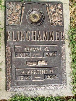
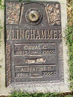
Orval George Klinghammer
| Birth | : | 22 May 1912 Portage Des Sioux, St. Charles County, Missouri, USA |
| Death | : | 21 Jul 2005 Saint Charles, St. Charles County, Missouri, USA |
| Burial | : | Crocker Park Cemetery, Barnstable, Barnstable County, USA |
| Coordinate | : | 41.6959000, -70.3780975 |
| Description | : | Son of Oscar and Marie Mallioux Klinghammer. Grandson of George and Louise Quade Klinghammer. St. Louis Post-Dispatch (MO) - July 25, 2005 Deceased Name: Orval G. Klinghammer Orval G. Klinghammer, 93, of St. Charles, died Thursday (July 21, 2005) at his residence. Mr. Klinghammer had owned B&K Market in St. Charles for 12 years. He was a meat cutter. He was a veteran of World War II, serving in the Army from 1944 to 1946. He was a member of Immanuel Lutheran Church and American Legion Post 312, where he... Read More |
frequently asked questions (FAQ):
-
Where is Orval George Klinghammer's memorial?
Orval George Klinghammer's memorial is located at: Crocker Park Cemetery, Barnstable, Barnstable County, USA.
-
When did Orval George Klinghammer death?
Orval George Klinghammer death on 21 Jul 2005 in Saint Charles, St. Charles County, Missouri, USA
-
Where are the coordinates of the Orval George Klinghammer's memorial?
Latitude: 41.6959000
Longitude: -70.3780975
Family Members:
Parent
Spouse
Siblings
Children
Flowers:
Nearby Cemetories:
1. Crocker Park Cemetery
Barnstable, Barnstable County, USA
Coordinate: 41.6959000, -70.3780975
2. West Parish Burial Ground
West Barnstable, Barnstable County, USA
Coordinate: 41.6984200, -70.3842920
3. West Barnstable Cemetery
West Barnstable, Barnstable County, USA
Coordinate: 41.7080994, -70.3728027
4. Sandy Street Cemetery
Barnstable, Barnstable County, USA
Coordinate: 41.6968994, -70.3401031
5. Marstons Mills Cemetery
Marstons Mills, Barnstable County, USA
Coordinate: 41.6612015, -70.4080963
6. Beechwood Cemetery
Centerville, Barnstable County, USA
Coordinate: 41.6561012, -70.3491974
7. Lothrop Hill Cemetery
Barnstable, Barnstable County, USA
Coordinate: 41.7028008, -70.3174973
8. Centerville Ancient Cemetery
Centerville, Barnstable County, USA
Coordinate: 41.6547012, -70.3429031
9. Saint Marys Church Memorial Gardens
Barnstable, Barnstable County, USA
Coordinate: 41.7036000, -70.3090000
10. Congregational Cemetery
Barnstable, Barnstable County, USA
Coordinate: 41.6459007, -70.3461990
11. Saint Francis Xavier Cemetery
Centerville, Barnstable County, USA
Coordinate: 41.6516991, -70.3331985
12. Percival Cemetery
Sandwich, Barnstable County, USA
Coordinate: 41.6883011, -70.4557037
13. Boardley Road Cemetery
Sandwich, Barnstable County, USA
Coordinate: 41.6870003, -70.4559021
14. Cobb's Hill Cemetery East and West
Barnstable, Barnstable County, USA
Coordinate: 41.7008018, -70.2994003
15. Hillside Cemetery
Osterville, Barnstable County, USA
Coordinate: 41.6316700, -70.3787100
16. Cedarville Cemetery
East Sandwich, Barnstable County, USA
Coordinate: 41.7397804, -70.4428864
17. Cummaquid Cemetery
Cummaquid, Barnstable County, USA
Coordinate: 41.6974700, -70.2804850
18. Wakeby Cemetery
Sandwich, Barnstable County, USA
Coordinate: 41.6725500, -70.4723100
19. Saint Peters Episcopal Church Memorial Garden
Barnstable, Barnstable County, USA
Coordinate: 41.6209700, -70.3735800
20. Iyanough Gravesite
Cummaquid, Barnstable County, USA
Coordinate: 41.7014900, -70.2754100
21. Mosswood Cemetery
Cotuit, Barnstable County, USA
Coordinate: 41.6279984, -70.4303970
22. Francis Family Cemetery
Mashpee, Barnstable County, USA
Coordinate: 41.6807900, -70.4816600
23. Quaker Meeting House Cemetery
East Sandwich, Barnstable County, USA
Coordinate: 41.7469673, -70.4591064
24. Old Quaker Meeting House Cemetery at Spring Hill
Sandwich, Barnstable County, USA
Coordinate: 41.7463100, -70.4613060


