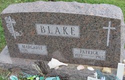
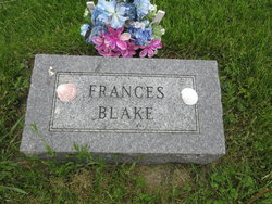
Patrick Lucius Blake
| Birth | : | 13 May 1923 Waterloo Township, Allamakee County, Iowa, USA |
| Death | : | 24 Sep 1963 Eitzen, Houston County, Minnesota, USA |
| Burial | : | St. John the Baptist Churchyard, Heaton Mersey, Metropolitan Borough of Stockport, England |
| Coordinate | : | 53.4124526, -2.2064749 |
| Description | : | Father of 13 is Killed in Farm Mishap Waukon- Patrick Blake, 40, father of 13 children ranging in age from 4 months to 18 years, was fatally injured Tuesday when he was pulled into a corn chopper. Blake, a farmer in the Dorchester area, was working on the Donald *Schwartzer farm 2 miles east of Eitzen, Minn. He was apparently cleaning the rollers on the machine when his clothing became caught and he was pulled into it. He was dead when found by others working in the field. In addition to his wife, Margaret, and 13 children,... Read More |
frequently asked questions (FAQ):
-
Where is Patrick Lucius Blake's memorial?
Patrick Lucius Blake's memorial is located at: St. John the Baptist Churchyard, Heaton Mersey, Metropolitan Borough of Stockport, England.
-
When did Patrick Lucius Blake death?
Patrick Lucius Blake death on 24 Sep 1963 in Eitzen, Houston County, Minnesota, USA
-
Where are the coordinates of the Patrick Lucius Blake's memorial?
Latitude: 53.4124526
Longitude: -2.2064749
Family Members:
Parent
Spouse
Siblings
Flowers:
Nearby Cemetories:
1. St. John the Baptist Churchyard
Heaton Mersey, Metropolitan Borough of Stockport, England
Coordinate: 53.4124526, -2.2064749
2. Heaton Mersey Congregational Churchyard
Stockport, Metropolitan Borough of Stockport, England
Coordinate: 53.4128680, -2.2038150
3. Mill Lane Cemetery
Cheadle, Metropolitan Borough of Stockport, England
Coordinate: 53.3992000, -2.2150800
4. Parsonage Gardens
Didsbury, Metropolitan Borough of Manchester, England
Coordinate: 53.4094440, -2.2302780
5. St James Churchyard
Didsbury, Metropolitan Borough of Manchester, England
Coordinate: 53.4088737, -2.2330498
6. St Mary's Churchyard
Cheadle, Metropolitan Borough of Stockport, England
Coordinate: 53.3944820, -2.2176205
7. Cheadle Cemetery
Cheadle, Metropolitan Borough of Stockport, England
Coordinate: 53.3927610, -2.2054690
8. St. Paul's Churchyard
Portwood, Metropolitan Borough of Stockport, England
Coordinate: 53.4215604, -2.1717953
9. Christ Church
Heaton Norris, Metropolitan Borough of Stockport, England
Coordinate: 53.4144000, -2.1678000
10. Saint Thomas the Apostle Heaton Chapel
Heaton Norris, Metropolitan Borough of Stockport, England
Coordinate: 53.4297783, -2.1797558
11. St. Paul's Churchyard
Withington, Metropolitan Borough of Manchester, England
Coordinate: 53.4324900, -2.2280790
12. Wesleyan Chapel
Edgeley, Metropolitan Borough of Stockport, England
Coordinate: 53.4019700, -2.1673860
13. St. Peter's Churchyard
Stockport, Metropolitan Borough of Stockport, England
Coordinate: 53.4105000, -2.1587000
14. St. Mary's Churchyard
Stockport, Metropolitan Borough of Stockport, England
Coordinate: 53.4112340, -2.1555140
15. Stockport Quaker Burial Ground (Defunct)
Stockport, Metropolitan Borough of Stockport, England
Coordinate: 53.4096205, -2.1555406
16. St Thomas Churchyard
Stockport, Metropolitan Borough of Stockport, England
Coordinate: 53.4036000, -2.1550000
17. The Parish Church of Saint Peter
Stockport, Metropolitan Borough of Stockport, England
Coordinate: 53.4084880, -2.1492930
18. Willow Grove Cemetery
Stockport, Metropolitan Borough of Stockport, England
Coordinate: 53.4252900, -2.1508100
19. Southern Cemetery
Chorlton-Cum-Hardy, Metropolitan Borough of Manchester, England
Coordinate: 53.4278060, -2.2611000
20. Stockport Cemetery and Crematorium
Stockport, Metropolitan Borough of Stockport, England
Coordinate: 53.3979110, -2.1511430
21. St Elisabeth Church
Reddish, Metropolitan Borough of Stockport, England
Coordinate: 53.4379400, -2.1633950
22. St James Churchyard
Rusholme, Metropolitan Borough of Manchester, England
Coordinate: 53.4490050, -2.2151450
23. Manchester Crematorium
Manchester, Metropolitan Borough of Manchester, England
Coordinate: 53.4306520, -2.2669990
24. Former Saint Johns Churchyard
Longsight, Metropolitan Borough of Manchester, England
Coordinate: 53.4570760, -2.2025800

