
| Birth | : | Feb 1828 Muker, Richmondshire District, North Yorkshire, England |
| Death | : | Jan 1905 Lancashire, England |
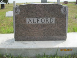
| Burial | : | St. John the Divine Churchyard, Cliviger, Burnley Borough, England |
| Coordinate | : | 53.7533610, -2.1895090 |
| Description | : | Phillis Reynoldson was born at Muker in Swaledale, North Yorkshire, England in February of 1828. She was the daughter of Edward Reynoldson and Phillis Whitfield Reynoldson and was Baptised at St. Mary's Church in Muker on 28 Feb 1828. She married Thomas Alderson in Muker in 1847. When Thomas was killed in the Cliviger Coal Mine in 1866, she was left to raise seven chldren. In 1869 she married Johnson Tindall and the couple had one daughter, Elizabeth Tindall. Phillis died in 1905 at the age of 77.∼Phillis (Phyllis) REYNOLDSON was born in... Read More |
frequently asked questions (FAQ):
-
Where is Phillis Reynoldson Alderson's memorial?
Phillis Reynoldson Alderson's memorial is located at: St. John the Divine Churchyard, Cliviger, Burnley Borough, England.
-
When did Phillis Reynoldson Alderson death?
Phillis Reynoldson Alderson death on Jan 1905 in Lancashire, England
-
Where are the coordinates of the Phillis Reynoldson Alderson's memorial?
Latitude: 53.7533610
Longitude: -2.1895090
Family Members:
Spouse

Children
Flowers:


Nearby Cemetories:
1. St. John the Divine Churchyard
Cliviger, Burnley Borough, England
Coordinate: 53.7533610, -2.1895090
2. Mount Zion Methodist Chapleyard
Cornholme, Metropolitan Borough of Calderdale, England
Coordinate: 53.7331400, -2.1457800
3. St. John the Evangelist Churchyard
Worsthorne, Burnley Borough, England
Coordinate: 53.7877640, -2.1887420
4. Vale Baptist Chapelyard
Cornholme, Metropolitan Borough of Calderdale, England
Coordinate: 53.7321800, -2.1357300
5. Shore Baptist Chapelyard
Cornholme, Metropolitan Borough of Calderdale, England
Coordinate: 53.7358900, -2.1312700
6. Lumb Baptist Church Cemetery
Waterfoot, Rossendale Borough, England
Coordinate: 53.7229340, -2.2455170
7. Saint Michael on the Hill Churchyard
Lumb, Rossendale Borough, England
Coordinate: 53.7201000, -2.2479300
8. St. Peter's Churchyard
Burnley, Burnley Borough, England
Coordinate: 53.7924450, -2.2394890
9. Ebenezer Particular Baptist Chapel Chapelyard
Bacup, Rossendale Borough, England
Coordinate: 53.7045700, -2.1997500
10. St. James' Churchyard
Burnley, Burnley Borough, England
Coordinate: 53.7905590, -2.2458280
11. St John the Evangelist Churchyard
Bacup, Rossendale Borough, England
Coordinate: 53.7037300, -2.2019600
12. Cloughfoot Independent Congregational Chapelyard
Todmorden, Metropolitan Borough of Calderdale, England
Coordinate: 53.7113850, -2.1379180
13. Ebenezer Baptist Chapel Chapelyard
Burnley, Burnley Borough, England
Coordinate: 53.7975120, -2.2397260
14. Holy Trinity Churchyard
Burnley, Burnley Borough, England
Coordinate: 53.7898290, -2.2574200
15. Providence Free United Methodist Graveyard
Crawshawbooth, Rossendale Borough, England
Coordinate: 53.7442070, -2.2825700
16. St. James' Churchyard
Briercliffe, Burnley Borough, England
Coordinate: 53.8107700, -2.2031800
17. Goodshaw Particular Baptist Chapel Graveyard
Goodshaw, Rossendale Borough, England
Coordinate: 53.7328210, -2.2815530
18. St. Mary and All Saints Churchyard
Goodshaw, Rossendale Borough, England
Coordinate: 53.7315270, -2.2828940
19. Burnley Cemetery
Burnley, Burnley Borough, England
Coordinate: 53.7821730, -2.2795070
20. Burnley Crematorium
Burnley, Burnley Borough, England
Coordinate: 53.7821730, -2.2795070
21. Saint Anne's Churchyard Edgeside
Waterfoot, Rossendale Borough, England
Coordinate: 53.7031600, -2.2482700
22. Haggate Baptist Church Burial Ground
Burnley Borough, England
Coordinate: 53.8145048, -2.1960725
23. Hill Lane Baptist Church Churchyard
Briercliffe, Burnley Borough, England
Coordinate: 53.8161467, -2.1875368
24. Rehoboth Chapel
Goodshaw, Rossendale Borough, England
Coordinate: 53.7355870, -2.2914730