
| Birth | : | 1826 England |
| Death | : | 25 Jul 1866 England |
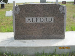
| Burial | : | St. John the Divine Churchyard, Cliviger, Burnley Borough, England |
| Coordinate | : | 53.7533610, -2.1895090 |
| Description | : | The son of Thomas & Dinah Alderson, Thomas was born at Muker in Swaledale in North Yorkshire in 1826 He was the husband of Phillis REYNOLDSON and the father of Thomas 1848-1849; Phillis 180-1850; Thomas 1851-1927; Edward 1853-1940; Dinah 1855-1873; Eleanor 1857-1932; Phillis 1860- ; John George 1862-1941; Catherine 1865-1865; and James 1865-1879. When lead mining declined Thomas took a position as a fireman with the Cliviger Coal Company in Cliviger near Burnley, Lancashire. The Leeds Mercury, Saturday, July 28, 1866, ran a story about the accident that took the lives of Thomas and two other miners at the... Read More |
frequently asked questions (FAQ):
-
Where is Thomas Alderson's memorial?
Thomas Alderson's memorial is located at: St. John the Divine Churchyard, Cliviger, Burnley Borough, England.
-
When did Thomas Alderson death?
Thomas Alderson death on 25 Jul 1866 in England
-
Where are the coordinates of the Thomas Alderson's memorial?
Latitude: 53.7533610
Longitude: -2.1895090
Family Members:
Spouse

Children
Flowers:


Nearby Cemetories:
1. St. John the Divine Churchyard
Cliviger, Burnley Borough, England
Coordinate: 53.7533610, -2.1895090
2. Mount Zion Methodist Chapleyard
Cornholme, Metropolitan Borough of Calderdale, England
Coordinate: 53.7331400, -2.1457800
3. St. John the Evangelist Churchyard
Worsthorne, Burnley Borough, England
Coordinate: 53.7877640, -2.1887420
4. Vale Baptist Chapelyard
Cornholme, Metropolitan Borough of Calderdale, England
Coordinate: 53.7321800, -2.1357300
5. Shore Baptist Chapelyard
Cornholme, Metropolitan Borough of Calderdale, England
Coordinate: 53.7358900, -2.1312700
6. Lumb Baptist Church Cemetery
Waterfoot, Rossendale Borough, England
Coordinate: 53.7229340, -2.2455170
7. Saint Michael on the Hill Churchyard
Lumb, Rossendale Borough, England
Coordinate: 53.7201000, -2.2479300
8. St. Peter's Churchyard
Burnley, Burnley Borough, England
Coordinate: 53.7924450, -2.2394890
9. Ebenezer Particular Baptist Chapel Chapelyard
Bacup, Rossendale Borough, England
Coordinate: 53.7045700, -2.1997500
10. St. James' Churchyard
Burnley, Burnley Borough, England
Coordinate: 53.7905590, -2.2458280
11. St John the Evangelist Churchyard
Bacup, Rossendale Borough, England
Coordinate: 53.7037300, -2.2019600
12. Cloughfoot Independent Congregational Chapelyard
Todmorden, Metropolitan Borough of Calderdale, England
Coordinate: 53.7113850, -2.1379180
13. Ebenezer Baptist Chapel Chapelyard
Burnley, Burnley Borough, England
Coordinate: 53.7975120, -2.2397260
14. Holy Trinity Churchyard
Burnley, Burnley Borough, England
Coordinate: 53.7898290, -2.2574200
15. Providence Free United Methodist Graveyard
Crawshawbooth, Rossendale Borough, England
Coordinate: 53.7442070, -2.2825700
16. St. James' Churchyard
Briercliffe, Burnley Borough, England
Coordinate: 53.8107700, -2.2031800
17. Goodshaw Particular Baptist Chapel Graveyard
Goodshaw, Rossendale Borough, England
Coordinate: 53.7328210, -2.2815530
18. St. Mary and All Saints Churchyard
Goodshaw, Rossendale Borough, England
Coordinate: 53.7315270, -2.2828940
19. Burnley Cemetery
Burnley, Burnley Borough, England
Coordinate: 53.7821730, -2.2795070
20. Burnley Crematorium
Burnley, Burnley Borough, England
Coordinate: 53.7821730, -2.2795070
21. Saint Anne's Churchyard Edgeside
Waterfoot, Rossendale Borough, England
Coordinate: 53.7031600, -2.2482700
22. Haggate Baptist Church Burial Ground
Burnley Borough, England
Coordinate: 53.8145048, -2.1960725
23. Hill Lane Baptist Church Churchyard
Briercliffe, Burnley Borough, England
Coordinate: 53.8161467, -2.1875368
24. Rehoboth Chapel
Goodshaw, Rossendale Borough, England
Coordinate: 53.7355870, -2.2914730