| Birth | : | 7 Jul 1943 Surry County, North Carolina, USA |
| Death | : | 14 Aug 2019 Dobson, Surry County, North Carolina, USA |
| Burial | : | Friendly Chapel Church Cemetery, Pilot Mountain, Surry County, USA |
| Coordinate | : | 36.3635292, -80.4816132 |
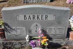
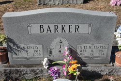
| Description | : | Mrs. Polly Mae Barker Reid age 76 of Pilot Mountain went home to be with the Lord on Wednesday August 14th at Woltz Hospice Home in Dobson NC. She was born July 7th 1943, in Surry county the daughter of the late Edd (Kim) and Ethel May Ferrell Barker. Mom was a devoted child of God, a Loving Wife, Mother, Grandmother, Great Grandmother, and a dedicated member of Friendly Chapel Church of Pilot Mountain since 1966. Mom was a member of the missionary women and enjoyed helping others, visiting the shut in and elderly as well as assisting... Read More |
frequently asked questions (FAQ):
-
Where is Polly Mae Barker Reid's memorial?
Polly Mae Barker Reid's memorial is located at: Friendly Chapel Church Cemetery, Pilot Mountain, Surry County, USA.
-
When did Polly Mae Barker Reid death?
Polly Mae Barker Reid death on 14 Aug 2019 in Dobson, Surry County, North Carolina, USA
-
Where are the coordinates of the Polly Mae Barker Reid's memorial?
Latitude: 36.3635292
Longitude: -80.4816132
Family Members:
Parent
Spouse
Siblings
Flowers:
Nearby Cemetories:
1. Friendly Chapel Church Cemetery
Pilot Mountain, Surry County, USA
Coordinate: 36.3635292, -80.4816132
2. Stone Family Cemetery
Pilot Mountain, Surry County, USA
Coordinate: 36.3695070, -80.4689960
3. John Denny Cemetery
Pilot Mountain, Surry County, USA
Coordinate: 36.3755989, -80.4910965
4. Lawrence Cemetery
Pilot Mountain, Surry County, USA
Coordinate: 36.3716080, -80.4537230
5. Whitakers Chapel United Methodist Church Cemetery
Pilot Mountain, Surry County, USA
Coordinate: 36.3763008, -80.5105057
6. Lovells Chapel Church Cemetery
Pilot Mountain, Surry County, USA
Coordinate: 36.3879160, -80.4652290
7. Pilot Mountain City Cemetery
Pilot Mountain, Surry County, USA
Coordinate: 36.3918343, -80.4809418
8. Pinnacle View Baptist Church Cemetery
Shoals, Surry County, USA
Coordinate: 36.3454700, -80.5089900
9. Carey Bird Denny Cemetery
Pilot Mountain, Surry County, USA
Coordinate: 36.3582000, -80.5177500
10. Rescue Baptist Church Cemetery
Pilot Mountain, Surry County, USA
Coordinate: 36.3898080, -80.4613240
11. Green Family Cemetery
Pilot Mountain, Surry County, USA
Coordinate: 36.3956630, -80.4833990
12. Bennett Cemetery
Pilot Mountain, Surry County, USA
Coordinate: 36.3988991, -80.4957962
13. Tucker-Stone Cemetery
Surry County, USA
Coordinate: 36.3990000, -80.4954167
14. Ararat-Cedar Hill Primitive Baptist Church
Cedar Hill, Surry County, USA
Coordinate: 36.3671265, -80.5306778
15. John Wesley Hill Cemetery
Pilot Mountain, Surry County, USA
Coordinate: 36.4000282, -80.5012817
16. King Family Cemetery
Pilot Mountain, Surry County, USA
Coordinate: 36.3307780, -80.4532780
17. Beulahland Baptist Church Cemetery
Pilot Mountain, Surry County, USA
Coordinate: 36.4037330, -80.4954900
18. Pilot View Cemetery
Shoals, Surry County, USA
Coordinate: 36.3298440, -80.5155410
19. Azariah Denny Family Cemetery
Pilot Mountain, Surry County, USA
Coordinate: 36.3647220, -80.5367780
20. Cox Cemetery
Pilot Mountain, Surry County, USA
Coordinate: 36.3743890, -80.5353890
21. Sulphur Springs Baptist Church Cemetery
Pilot Mountain, Surry County, USA
Coordinate: 36.4074440, -80.5108871
22. Fairview United Methodist Church Cemetery
Shoals, Surry County, USA
Coordinate: 36.3126945, -80.5045853
23. William C. Patterson Cemetery
Siloam, Surry County, USA
Coordinate: 36.3591330, -80.5502130
24. Gilliam Cemetery
Shoals, Surry County, USA
Coordinate: 36.3088989, -80.4993973


