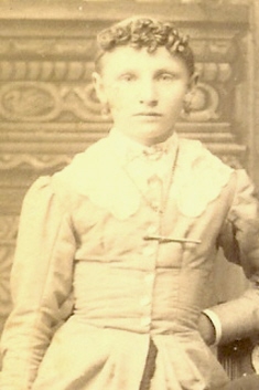
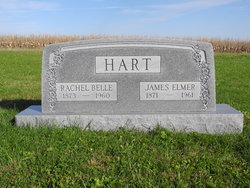
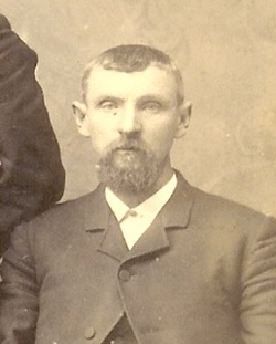
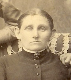
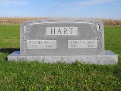
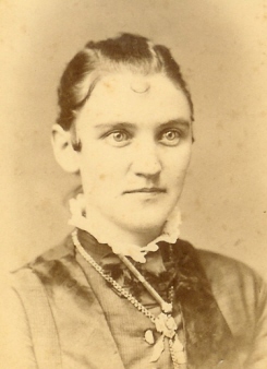
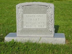
Rachel Belle Keever Hart
| Birth | : | 28 Mar 1873 Huntsville, Randolph County, Indiana, USA |
| Death | : | 27 Jul 1960 Oregon, Holt County, Missouri, USA |
| Burial | : | Grace Lutheran Cemetery, Gladstone, Jefferson County, USA |
| Coordinate | : | 40.1620670, -97.3522350 |
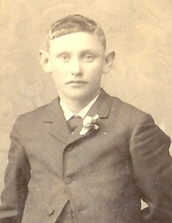
| Description | : | Rachel "Belle" Keever Hart, daughter of Elias J and Malinda Hunt Keever, married James Elmer HART |
frequently asked questions (FAQ):
-
Where is Rachel Belle Keever Hart's memorial?
Rachel Belle Keever Hart's memorial is located at: Grace Lutheran Cemetery, Gladstone, Jefferson County, USA.
-
When did Rachel Belle Keever Hart death?
Rachel Belle Keever Hart death on 27 Jul 1960 in Oregon, Holt County, Missouri, USA
-
Where are the coordinates of the Rachel Belle Keever Hart's memorial?
Latitude: 40.1620670
Longitude: -97.3522350
Family Members:
Parent
Spouse
Siblings
Children
Flowers:

Honoring your Memory today, Belle, Rest In Eternal Peace
Left by Anonymous on 15 Aug 2006
Left by Anonymous on 07 Sep 2006

Left by Anonymous on 22 Jan 2007

In Memory on this Memorial Day, 2014
Left by Anonymous on 27 May 2014

In remembrance on this Memorial Day 2020
Left by Anonymous on 24 May 2020

Left by Anonymous on 18 Feb 2021
Nearby Cemetories:
1. Grace Lutheran Cemetery
Gladstone, Jefferson County, USA
Coordinate: 40.1620670, -97.3522350
2. Zion United Church of Christ Cemetery
Gladstone, Jefferson County, USA
Coordinate: 40.1630000, -97.2910000
3. Union Cemetery
Gilead, Thayer County, USA
Coordinate: 40.1319008, -97.4047012
4. Meridian Presbyterian Cemetery
Meridian Township, Jefferson County, USA
Coordinate: 40.2178001, -97.3625031
5. Mount Gilead Cemetery
Gilead, Thayer County, USA
Coordinate: 40.1906000, -97.4246500
6. Catholic Cemetery
Alexandria, Thayer County, USA
Coordinate: 40.2202988, -97.3878021
7. Kennedy Lone Grave
Gilead, Thayer County, USA
Coordinate: 40.1715900, -97.4425500
8. Pleasant Hill Cemetery
Jefferson County, USA
Coordinate: 40.1595910, -97.2573280
9. Woltemath Lone Grave
Alexandria, Thayer County, USA
Coordinate: 40.2343600, -97.3691800
10. Moles Cemetery
Powell, Jefferson County, USA
Coordinate: 40.2015100, -97.2647950
11. Hunt Family Plot
Reynolds, Jefferson County, USA
Coordinate: 40.0868380, -97.3115940
12. Saint Paul's Lutheran Church Cemetery
Gilead, Thayer County, USA
Coordinate: 40.1108000, -97.4449000
13. Rose Creek Cemetery
Rose Creek Township, Thayer County, USA
Coordinate: 40.0705986, -97.3694000
14. Powell Cemetery
Powell, Jefferson County, USA
Coordinate: 40.2332993, -97.2742004
15. Alexandria Cemetery
Alexandria, Thayer County, USA
Coordinate: 40.2489014, -97.4060974
16. Helvey Cemetery
Helvey, Jefferson County, USA
Coordinate: 40.2347354, -97.2533342
17. Huber Cemetery
Reynolds, Jefferson County, USA
Coordinate: 40.0493000, -97.3085000
18. George Winslow Gravesite
Fairbury, Jefferson County, USA
Coordinate: 40.2074800, -97.2061580
19. Thayer County Poor Farm Cemetery
Hebron, Thayer County, USA
Coordinate: 40.1585900, -97.5173370
20. Richland Center Cemetery
Jefferson County, USA
Coordinate: 40.2186012, -97.1900024
21. Silver Creek Cemetery
Jefferson County, USA
Coordinate: 40.0522003, -97.2367020
22. Williams Cemetery
Thayer County, USA
Coordinate: 40.0321999, -97.4349976
23. Zion Lutheran Cemetery
Hubbell, Thayer County, USA
Coordinate: 40.0437400, -97.4629400
24. King David Fisher Gravesite
Hebron, Thayer County, USA
Coordinate: 40.1509440, -97.5438060

