
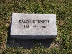
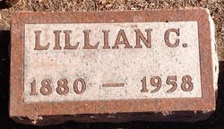
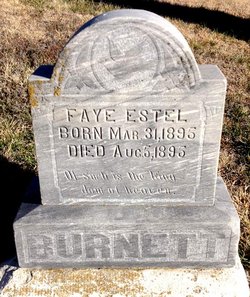
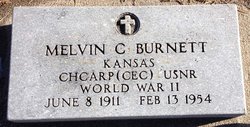
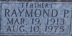
Ralph Lewis Burnett
| Birth | : | 26 Aug 1885 Wrightstown, Brown County, Wisconsin, USA |
| Death | : | May 1918 Concordia, Cloud County, Kansas, USA |
| Burial | : | Glasco Cemetery, Glasco, Cloud County, USA |
| Coordinate | : | 39.3574000, -97.8265000 |
| Plot | : | 6GE24 |
| Description | : | Glasco Sun, May 16, 1918, page 1: Fatal Accident The community was greatly saddened Sunday evening when it was learned that an accident had befalled Ralph Burnett and that his chances for recovery were very slight. He and his family had been spending the day at the Dave Teasley home and after dinner the men and boys went over to the pasture a little north of the Teasley home where there were some coyote dens. They found a promising hole and began digging to find some coyote pups. As we understand the story, Ralph and Bert Joyce were doing... Read More |
frequently asked questions (FAQ):
-
Where is Ralph Lewis Burnett's memorial?
Ralph Lewis Burnett's memorial is located at: Glasco Cemetery, Glasco, Cloud County, USA.
-
When did Ralph Lewis Burnett death?
Ralph Lewis Burnett death on May 1918 in Concordia, Cloud County, Kansas, USA
-
Where are the coordinates of the Ralph Lewis Burnett's memorial?
Latitude: 39.3574000
Longitude: -97.8265000
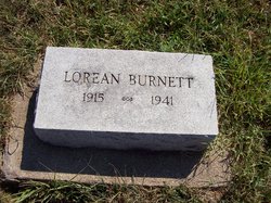
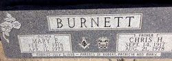
Family Members:
Parent

Spouse
Siblings

Children
Flowers:


Nearby Cemetories:
1. Glasco Cemetery
Glasco, Cloud County, USA
Coordinate: 39.3574000, -97.8265000
2. Saint Marys Catholic Cemetery
Glasco, Cloud County, USA
Coordinate: 39.3574000, -97.8245000
3. Simpson Cemetery
Simpson, Mitchell County, USA
Coordinate: 39.3633003, -97.9471970
4. Bethel Cemetery
Meredith Township, Cloud County, USA
Coordinate: 39.3506000, -97.7029000
5. Delphos Cemetery
Delphos, Ottawa County, USA
Coordinate: 39.2778015, -97.7416992
6. Saint Paul Cemetery
Delphos, Ottawa County, USA
Coordinate: 39.2677994, -97.7518997
7. Asherville Cemetery
Asherville, Mitchell County, USA
Coordinate: 39.4205000, -97.9672900
8. Morrison Cemetery
Center Township, Cloud County, USA
Coordinate: 39.4817009, -97.7975006
9. Summit Cemetery
Jamestown, Cloud County, USA
Coordinate: 39.4813200, -97.8628800
10. Green Mound Cemetery
Asherville, Mitchell County, USA
Coordinate: 39.3203011, -97.9858017
11. Coursen Grove Cemetery
Simpson, Mitchell County, USA
Coordinate: 39.3060989, -97.9792023
12. Hall Cemetery
Cloud County, USA
Coordinate: 39.4455986, -97.7033005
13. Saint Peters Cemetery
Miltonvale, Cloud County, USA
Coordinate: 39.3652350, -97.6483570
14. Bell-Bogardus Cemetery
Asherville, Mitchell County, USA
Coordinate: 39.4242410, -97.9919970
15. Bohemian National Cemetery
Ada, Ottawa County, USA
Coordinate: 39.2193870, -97.9054030
16. Wilcox Cemetery
Cloud County, USA
Coordinate: 39.4925003, -97.7313995
17. West Asher Cemetery
Scottsville, Mitchell County, USA
Coordinate: 39.4815000, -97.9661600
18. Baldwin Cemetery
Ottawa County, USA
Coordinate: 39.2061005, -97.9111023
19. Kindel Cemetery
Center Township, Cloud County, USA
Coordinate: 39.4519005, -97.6464005
20. Smith Cemetery
Asherville, Mitchell County, USA
Coordinate: 39.4516690, -98.0098850
21. McBride Cemetery
Beloit, Mitchell County, USA
Coordinate: 39.4808006, -97.9907990
22. Enterprise Cemetery
Cloud County, USA
Coordinate: 39.4230995, -97.6106033
23. Shiloh Cemetery
Beloit, Mitchell County, USA
Coordinate: 39.3574982, -98.0594025
24. Summit Cemetery #3
Macyville, Cloud County, USA
Coordinate: 39.5258330, -97.9194440