
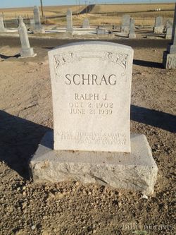
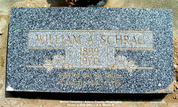
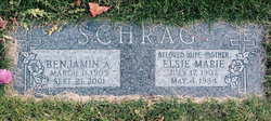
Ralph Schrag
| Birth | : | 2 Oct 1902 Ritzville, Adams County, Washington, USA |
| Death | : | 21 Jun 1939 Spokane, Spokane County, Washington, USA |
| Burial | : | Rockville Cemetery, Rockville, Montgomery County, USA |
| Coordinate | : | 39.0844002, -77.1260986 |
| Description | : | Ritzville Journal-Times, Thursday, June 22, 1939, issue Dust Blamed For Fatal Accident Ralph Schrag Fatally Injured Dust was blamed today by the sheriff's office for the fatal injury to Ralph Schrag, 36, Ritzville farmer, who died last night at Sacred Heart hospital, Spokane, less than 12 hours after his automobile collided almost head-on with a heavy truck two miles south of Batum on the Batum road. Sheriff Joe Schafer said this morning that neither driver was blamed for the accident and that it was due to heavy dust on the highway. A car driven by Schrag collided with a truck driven by Tennis Tennison of... Read More |
frequently asked questions (FAQ):
-
Where is Ralph Schrag's memorial?
Ralph Schrag's memorial is located at: Rockville Cemetery, Rockville, Montgomery County, USA.
-
When did Ralph Schrag death?
Ralph Schrag death on 21 Jun 1939 in Spokane, Spokane County, Washington, USA
-
Where are the coordinates of the Ralph Schrag's memorial?
Latitude: 39.0844002
Longitude: -77.1260986
Family Members:
Parent
Siblings
Flowers:


Nearby Cemetories:
1. Rockville Cemetery
Rockville, Montgomery County, USA
Coordinate: 39.0844002, -77.1260986
2. New Saint Mary's Catholic Church Cemetery
Rockville, Montgomery County, USA
Coordinate: 39.0830994, -77.1268997
3. Avery Road Colored Cemetery
Rockville, Montgomery County, USA
Coordinate: 39.0897220, -77.1255560
4. Rockville United Church Memorial Garden
Rockville, Montgomery County, USA
Coordinate: 39.0783570, -77.1158440
5. Old Saint Mary's Catholic Church Cemetery
Rockville, Montgomery County, USA
Coordinate: 39.0819830, -77.1453850
6. Martin Family Cemetery
Rockville, Montgomery County, USA
Coordinate: 39.0960100, -77.1428960
7. Lincoln Park Cemetery
Rockville, Montgomery County, USA
Coordinate: 39.0954300, -77.1452900
8. Christ Episcopal Church Columbarium
Rockville, Montgomery County, USA
Coordinate: 39.0823100, -77.1528500
9. Rockville United Methodist Church Columbarium
Rockville, Montgomery County, USA
Coordinate: 39.0839060, -77.1554180
10. Rockville Baptist Cemetery
Rockville, Montgomery County, USA
Coordinate: 39.0835400, -77.1562300
11. Parklawn Memorial Park and Menorah Gardens
Rockville, Montgomery County, USA
Coordinate: 39.0639000, -77.1091995
12. Montgomery County Poor Farm Cemetery
Rockville, Montgomery County, USA
Coordinate: 39.0727400, -77.1540500
13. Haiti Cemetery
Rockville, Montgomery County, USA
Coordinate: 39.0931000, -77.1573100
14. Higgins Family Cemetery
Rockville, Montgomery County, USA
Coordinate: 39.0597400, -77.1162300
15. Prather Family Cemetery
Montgomery County, USA
Coordinate: 39.1133330, -77.1147220
16. Faith United Methodist Church Memorial Garden
Rockville, Montgomery County, USA
Coordinate: 39.0536300, -77.1392600
17. Aspin Hill Memorial Park
Silver Spring, Montgomery County, USA
Coordinate: 39.0799600, -77.0772300
18. Crabb Family Cemetery
Derwood, Montgomery County, USA
Coordinate: 39.1151300, -77.1582400
19. Gate of Heaven Cemetery
Silver Spring, Montgomery County, USA
Coordinate: 39.0825005, -77.0738983
20. Derwood Cemetery
Derwood, Montgomery County, USA
Coordinate: 39.1186400, -77.1580800
21. Mount Pleasant Methodist Church Cemetery
Norbeck, Montgomery County, USA
Coordinate: 39.1104800, -77.0810960
22. Trinity Lutheran Church Columbarium
Rockville, Montgomery County, USA
Coordinate: 39.0387727, -77.1235788
23. Saint Lukes Lutheran Cemetery
Derwood, Montgomery County, USA
Coordinate: 39.1304800, -77.1494800
24. Beall Cemetery
Silver Spring, Montgomery County, USA
Coordinate: 39.0877991, -77.0607986