
| Birth | : | 10 Mar 1928 Logan, Harrison County, Iowa, USA |
| Death | : | 14 Feb 2013 Cabot, Lonoke County, Arkansas, USA |
| Burial | : | Ridgewood Cemetery, Council Bluffs, Pottawattamie County, USA |
| Coordinate | : | 41.2694016, -95.8272018 |
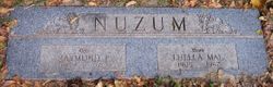
| Description | : | Ramona May Hoffschneider, age 84, of Cabot, Ark., passed away Thursday, February 14, 2013, surrounded by her family. She was born March 10, 1928, in Logan, Iowa, to the late Raymond and Louella Johnson Nuzum. Ramona worked for Campbell Soup Company in Omaha, Neb., and retired after 37 years of service. In addition to her parents, she was preceded in death by her husband, Loren Hoffschneider; and four siblings, Rosie, Arnie, Joe and Doris. Survivors are her two daughters, Rebecca Woods, of Cabot and Carolyn Myers, of Council Bluffs, Iowa; five grandchildren, Rick, Jennifer, Eddie,... Read More |
frequently asked questions (FAQ):
-
Where is Ramona May Nuzum Hoffschneider's memorial?
Ramona May Nuzum Hoffschneider's memorial is located at: Ridgewood Cemetery, Council Bluffs, Pottawattamie County, USA.
-
When did Ramona May Nuzum Hoffschneider death?
Ramona May Nuzum Hoffschneider death on 14 Feb 2013 in Cabot, Lonoke County, Arkansas, USA
-
Where are the coordinates of the Ramona May Nuzum Hoffschneider's memorial?
Latitude: 41.2694016
Longitude: -95.8272018
Family Members:
Parent

Spouse

Siblings


Flowers:


Nearby Cemetories:
1. Ridgewood Cemetery
Council Bluffs, Pottawattamie County, USA
Coordinate: 41.2694016, -95.8272018
2. Walnut Hill Cemetery
Council Bluffs, Pottawattamie County, USA
Coordinate: 41.2719002, -95.8255997
3. Bikhor Cholim Cemetery
Council Bluffs, Pottawattamie County, USA
Coordinate: 41.2703670, -95.8229350
4. Oak Hill Cemetery
Council Bluffs, Pottawattamie County, USA
Coordinate: 41.2700900, -95.8226400
5. Memorial Park Cemetery
Council Bluffs, Pottawattamie County, USA
Coordinate: 41.2644005, -95.8261032
6. Saint Joseph Cemetery
Council Bluffs, Pottawattamie County, USA
Coordinate: 41.2722015, -95.8208008
7. Green Valley Cemetery
Council Bluffs, Pottawattamie County, USA
Coordinate: 41.2743988, -95.8225021
8. Cedar Lawn Cemetery
Council Bluffs, Pottawattamie County, USA
Coordinate: 41.2694016, -95.8182983
9. Clark Cemetery
Pottawattamie County, USA
Coordinate: 41.2551610, -95.8223390
10. Fairview Cemetery
Council Bluffs, Pottawattamie County, USA
Coordinate: 41.2703018, -95.8480988
11. Garner Cemetery
Council Bluffs, Pottawattamie County, USA
Coordinate: 41.2956161, -95.8001709
12. Stoker-Graybill Cemetery
Council Bluffs, Pottawattamie County, USA
Coordinate: 41.2532620, -95.7751770
13. Maple Grove Cemetery
Council Bluffs, Pottawattamie County, USA
Coordinate: 41.2265560, -95.8187100
14. Evans Cemetery
Crescent, Pottawattamie County, USA
Coordinate: 41.3255997, -95.8368988
15. Lewis Township Cemetery
Council Bluffs, Pottawattamie County, USA
Coordinate: 41.2117004, -95.7938995
16. Gregg Cemetery
Weston, Pottawattamie County, USA
Coordinate: 41.3330000, -95.7931000
17. Council Point Cemetery
Council Bluffs, Pottawattamie County, USA
Coordinate: 41.2110830, -95.8788610
18. Hazel Dell Cemetery
Council Bluffs, Pottawattamie County, USA
Coordinate: 41.3489723, -95.7939911
19. Trinity Cathedral Columbarium
Omaha, Douglas County, USA
Coordinate: 41.2603900, -95.9393660
20. Saint Columbanus Cemetery
Weston, Pottawattamie County, USA
Coordinate: 41.3429440, -95.7435260
21. Crescent Cemetery
Crescent, Pottawattamie County, USA
Coordinate: 41.3664894, -95.8566208
22. Prospect Hill Cemetery
Omaha, Douglas County, USA
Coordinate: 41.2780991, -95.9593964
23. First Central Congregational Columbarium
Omaha, Douglas County, USA
Coordinate: 41.2563456, -95.9658365
24. Nash Chapel Crypt
Omaha, Douglas County, USA
Coordinate: 41.2665090, -95.9721790