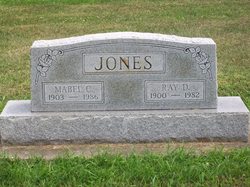
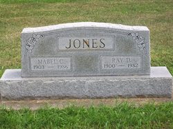
Ray Daniel “Casey” Jones
| Birth | : | 26 Sep 1900 Marshall County, Indiana, USA |
| Death | : | 11 Nov 1982 South Bend, St. Joseph County, Indiana, USA |
| Burial | : | Archers Chapel Methodist Cemetery, Frog Jump, Crockett County, USA |
| Coordinate | : | 35.8115250, -89.3406590 |
| Plot | : | Section 11, Row 8 |
| Description | : | Published in the Rochester(IN) Sentinel, Friday, November 12, 1982 Ray D. "Casey" JONES, 82, of 317 E. 10th St., formerly of 1015 Jefferson St., died at 5 p.m. Thursday in St. Joseph's Medical Center at South Bend, where he was a patient for 11 days. He had been in failing health for one year. He was born Sept. 26, 1900 in the Santa Anna community near Argos to James F. and Sarah A. GUISE JONES. He had resided most of his life in Fulton County. His first marriage was to Mildred EASH, who died in 1925. His second marriage was... Read More |
frequently asked questions (FAQ):
-
Where is Ray Daniel “Casey” Jones's memorial?
Ray Daniel “Casey” Jones's memorial is located at: Archers Chapel Methodist Cemetery, Frog Jump, Crockett County, USA.
-
When did Ray Daniel “Casey” Jones death?
Ray Daniel “Casey” Jones death on 11 Nov 1982 in South Bend, St. Joseph County, Indiana, USA
-
Where are the coordinates of the Ray Daniel “Casey” Jones's memorial?
Latitude: 35.8115250
Longitude: -89.3406590
Family Members:
Parent
Spouse
Siblings
Children
Flowers:
Nearby Cemetories:
1. Archers Chapel Methodist Cemetery
Frog Jump, Crockett County, USA
Coordinate: 35.8115250, -89.3406590
2. Buck Cemetery
Frog Jump, Crockett County, USA
Coordinate: 35.8315620, -89.3441880
3. Rowland Cemetery
Chestnut Bluff, Crockett County, USA
Coordinate: 35.8534820, -89.3267150
4. Lebanon United Methodist Church Cemetery
Friendship, Crockett County, USA
Coordinate: 35.8450880, -89.3062070
5. Carter Cemetery
Chestnut Bluff, Crockett County, USA
Coordinate: 35.8500090, -89.3122250
6. Glenn Cemetery
Crockett County, USA
Coordinate: 35.8509390, -89.3087660
7. Bucks Chapel Church Cemetery
Frog Jump, Crockett County, USA
Coordinate: 35.8126320, -89.2813750
8. Brooks Cemetery
Chestnut Bluff, Crockett County, USA
Coordinate: 35.8593500, -89.3319110
9. Trinity C.M.E. Church Cemetery
Gates, Lauderdale County, USA
Coordinate: 35.8409220, -89.3884490
10. Beasley-Albritton Cemetery
Chestnut Bluff, Crockett County, USA
Coordinate: 35.8584710, -89.3160610
11. Dean Cemetery
Frog Jump, Crockett County, USA
Coordinate: 35.8162630, -89.2778440
12. Eureka Church Cemetery
Forked Deer, Haywood County, USA
Coordinate: 35.7746300, -89.3847740
13. Parker - York Cemetery
Chestnut Bluff, Crockett County, USA
Coordinate: 35.8625990, -89.3290210
14. Bain Cemetery
Haywood County, USA
Coordinate: 35.7650574, -89.3750532
15. Siloam Cemetery
Dog Hill, Crockett County, USA
Coordinate: 35.8398940, -89.2832260
16. South Fork Cemetery
Chestnut Bluff, Crockett County, USA
Coordinate: 35.8646420, -89.3206200
17. Concord Church Cemetery
Gates, Lauderdale County, USA
Coordinate: 35.8152770, -89.4106200
18. Riddick Cemetery #2
Crockett County, USA
Coordinate: 35.8347200, -89.2718080
19. Poston-Wyse Cemetery
Johnsons Grove, Crockett County, USA
Coordinate: 35.7769700, -89.2775020
20. Gates Cemetery
Gates, Lauderdale County, USA
Coordinate: 35.8441340, -89.4063170
21. Willette Family Cemetery
Gates, Lauderdale County, USA
Coordinate: 35.8441130, -89.4063360
22. Rhodes Cemetery
Gates, Lauderdale County, USA
Coordinate: 35.8440770, -89.4131660
23. Crockett Cemetery
Gates, Lauderdale County, USA
Coordinate: 35.8502230, -89.4106960
24. White Cemetery
Johnsons Grove, Crockett County, USA
Coordinate: 35.7740020, -89.2676850


