
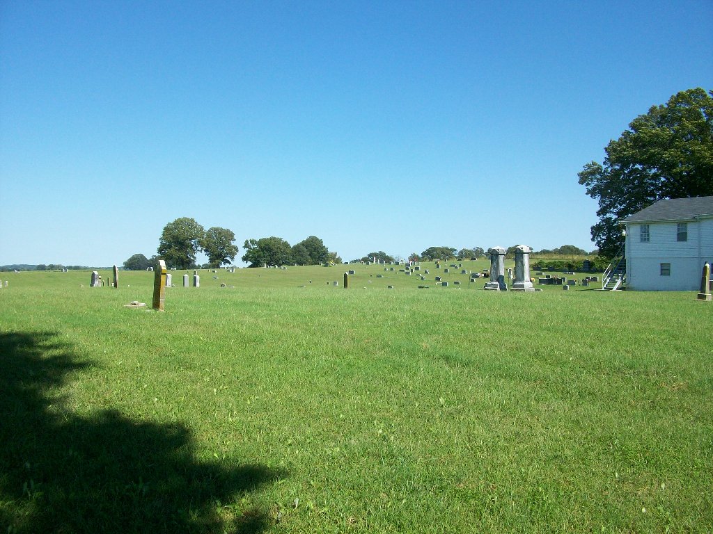
| Memorials | : | 2 |
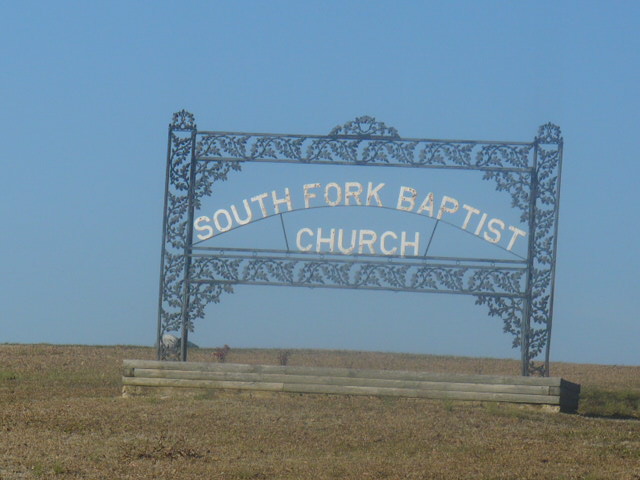
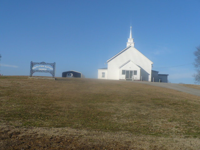
| Location | : | Chestnut Bluff, Crockett County, USA |
| Coordinate | : | 35.8646420, -89.3206200 |
| Description | : | From the intersection of Chestnut Bluff Rd. & US-412 E, south of Friendship, travel southwest on Chestnut Bluff Rd. for 4.7 mi.; turning west (right) to continue on Chestnut Bluff Rd., going 0.4 mi.; turning north (right) near 7342 Chestnut Bluff Rd., onto South Fork Cemetery Rd., going about 0.1 mi., passing the church, to this 'deeded' cemetery on the west (left), as notated on USGS topo maps. |
frequently asked questions (FAQ):
-
Where is South Fork Cemetery?
South Fork Cemetery is located at South Fork Cemetery Road Chestnut Bluff, Crockett County ,Tennessee ,USA.
-
South Fork Cemetery cemetery's updated grave count on graveviews.com?
2 memorials
-
Where are the coordinates of the South Fork Cemetery?
Latitude: 35.8646420
Longitude: -89.3206200
Nearby Cemetories:
1. Parker - York Cemetery
Chestnut Bluff, Crockett County, USA
Coordinate: 35.8625990, -89.3290210
2. Beasley-Albritton Cemetery
Chestnut Bluff, Crockett County, USA
Coordinate: 35.8584710, -89.3160610
3. Brooks Cemetery
Chestnut Bluff, Crockett County, USA
Coordinate: 35.8593500, -89.3319110
4. Rowland Cemetery
Chestnut Bluff, Crockett County, USA
Coordinate: 35.8534820, -89.3267150
5. Carter Cemetery
Chestnut Bluff, Crockett County, USA
Coordinate: 35.8500090, -89.3122250
6. Glenn Cemetery
Crockett County, USA
Coordinate: 35.8509390, -89.3087660
7. Lebanon United Methodist Church Cemetery
Friendship, Crockett County, USA
Coordinate: 35.8450880, -89.3062070
8. Stallcup Family Cemetery
Cross Roads, Dyer County, USA
Coordinate: 35.8980720, -89.3245320
9. Buck Cemetery
Frog Jump, Crockett County, USA
Coordinate: 35.8315620, -89.3441880
10. Siloam Cemetery
Dog Hill, Crockett County, USA
Coordinate: 35.8398940, -89.2832260
11. Browder Family Cemetery
Broadview, Crockett County, USA
Coordinate: 35.8646890, -89.2623010
12. Cock and Irvin Cemetery
Hawkinsville, Dyer County, USA
Coordinate: 35.9104430, -89.3046210
13. Riddick Cemetery #2
Crockett County, USA
Coordinate: 35.8347200, -89.2718080
14. Zion Hill Church Cemetery
Friendship, Dyer County, USA
Coordinate: 35.9095110, -89.2900760
15. Antioch Cemetery
Friendship, Crockett County, USA
Coordinate: 35.8581090, -89.2577800
16. Floyds Chapel Cemetery
Broadview, Crockett County, USA
Coordinate: 35.8403860, -89.2592840
17. Archers Chapel Methodist Cemetery
Frog Jump, Crockett County, USA
Coordinate: 35.8115250, -89.3406590
18. Mount Pisgah Cemetery
Friendship, Dyer County, USA
Coordinate: 35.9162470, -89.2901740
19. Scarborough Cemetery
Broadview, Crockett County, USA
Coordinate: 35.8432570, -89.2546330
20. Jordan Cemetery
Halls, Lauderdale County, USA
Coordinate: 35.8795030, -89.3917070
21. Dean Cemetery
Frog Jump, Crockett County, USA
Coordinate: 35.8162630, -89.2778440
22. Mount Moriah Cemetery
Friendship, Crockett County, USA
Coordinate: 35.8955420, -89.2576300
23. Trinity C.M.E. Church Cemetery
Gates, Lauderdale County, USA
Coordinate: 35.8409220, -89.3884490
24. Palestine Cemetery
Bruceville, Dyer County, USA
Coordinate: 35.9183080, -89.3536090