
| Memorials | : | 2 |
| Location | : | Chestnut Bluff, Crockett County, USA |
| Coordinate | : | 35.8625990, -89.3290210 |
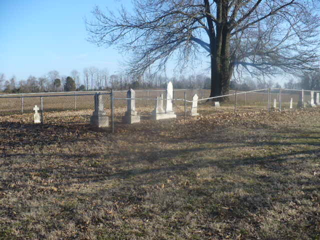
| Description | : | Very accessible. Located directly across the road from the First Christian Church at Chestnut Bluff. The nearest intersection is Eli Young Rd., also known as Bruceville Slab Rd., which intersects Chestnut Bluff-Maury City Rd. in front of the Gilliand house at 7935 Chestnut Bluff-Maury City Rd. Coming from Dyer CO on the Bruceville Slab Rd., and turning east (left) onto Chestnut Bluff-Maury City Rd., the cemetery is to your immediate right, abt. 500 feet south down the well-kept farm lane, which goes straight to the cemetery. |
frequently asked questions (FAQ):
-
Where is Parker - York Cemetery?
Parker - York Cemetery is located at 7935 Chestnut Bluff-Maury City Road Chestnut Bluff, Crockett County ,Tennessee ,USA.
-
Parker - York Cemetery cemetery's updated grave count on graveviews.com?
2 memorials
-
Where are the coordinates of the Parker - York Cemetery?
Latitude: 35.8625990
Longitude: -89.3290210
Nearby Cemetories:
1. Brooks Cemetery
Chestnut Bluff, Crockett County, USA
Coordinate: 35.8593500, -89.3319110
2. South Fork Cemetery
Chestnut Bluff, Crockett County, USA
Coordinate: 35.8646420, -89.3206200
3. Rowland Cemetery
Chestnut Bluff, Crockett County, USA
Coordinate: 35.8534820, -89.3267150
4. Beasley-Albritton Cemetery
Chestnut Bluff, Crockett County, USA
Coordinate: 35.8584710, -89.3160610
5. Carter Cemetery
Chestnut Bluff, Crockett County, USA
Coordinate: 35.8500090, -89.3122250
6. Glenn Cemetery
Crockett County, USA
Coordinate: 35.8509390, -89.3087660
7. Lebanon United Methodist Church Cemetery
Friendship, Crockett County, USA
Coordinate: 35.8450880, -89.3062070
8. Buck Cemetery
Frog Jump, Crockett County, USA
Coordinate: 35.8315620, -89.3441880
9. Stallcup Family Cemetery
Cross Roads, Dyer County, USA
Coordinate: 35.8980720, -89.3245320
10. Siloam Cemetery
Dog Hill, Crockett County, USA
Coordinate: 35.8398940, -89.2832260
11. Cock and Irvin Cemetery
Hawkinsville, Dyer County, USA
Coordinate: 35.9104430, -89.3046210
12. Archers Chapel Methodist Cemetery
Frog Jump, Crockett County, USA
Coordinate: 35.8115250, -89.3406590
13. Trinity C.M.E. Church Cemetery
Gates, Lauderdale County, USA
Coordinate: 35.8409220, -89.3884490
14. Jordan Cemetery
Halls, Lauderdale County, USA
Coordinate: 35.8795030, -89.3917070
15. Riddick Cemetery #2
Crockett County, USA
Coordinate: 35.8347200, -89.2718080
16. Browder Family Cemetery
Broadview, Crockett County, USA
Coordinate: 35.8646890, -89.2623010
17. Zion Hill Church Cemetery
Friendship, Dyer County, USA
Coordinate: 35.9095110, -89.2900760
18. Antioch Cemetery
Friendship, Crockett County, USA
Coordinate: 35.8581090, -89.2577800
19. Palestine Cemetery
Bruceville, Dyer County, USA
Coordinate: 35.9183080, -89.3536090
20. Floyds Chapel Cemetery
Broadview, Crockett County, USA
Coordinate: 35.8403860, -89.2592840
21. Dean Cemetery
Frog Jump, Crockett County, USA
Coordinate: 35.8162630, -89.2778440
22. Mount Pisgah Cemetery
Friendship, Dyer County, USA
Coordinate: 35.9162470, -89.2901740
23. Bucks Chapel Church Cemetery
Frog Jump, Crockett County, USA
Coordinate: 35.8126320, -89.2813750
24. Scarborough Cemetery
Broadview, Crockett County, USA
Coordinate: 35.8432570, -89.2546330