

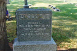
Reuben Lyman Blodgett
| Birth | : | 13 Mar 1832 Prattsburgh, Steuben County, New York, USA |
| Death | : | 29 May 1901 Alvin, Brazoria County, Texas, USA |
| Burial | : | Friends Burial Ground, York, York Unitary Authority, England |
| Coordinate | : | 53.9478920, -1.0618450 |
| Plot | : | Block 7 Lot 84 |
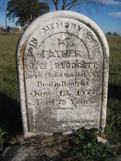
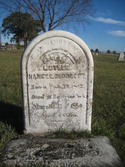
| Description | : | Reuben L. Blodgett was the son of John Emery Blodgett and Nancy Gillett. John and Reuben both lived in Beatrice, NE. We don't know what Reuben was doing in Texas when he died - but he was traveling, and living in Arkansas in 1900. Obit. from the Evening Times of Beatrice, June 6, 1901. Reuben L. Blodgett was born in Prattsburg, New York, March 13, 1832, and died in Alvin, Texas, May 29, 1901. His youth and early manhood was spent in Ohio and Illinois. At Sandwich, Ill. he was married to Sarah A. Gibson, Sept 24,... Read More |
frequently asked questions (FAQ):
-
Where is Reuben Lyman Blodgett's memorial?
Reuben Lyman Blodgett's memorial is located at: Friends Burial Ground, York, York Unitary Authority, England.
-
When did Reuben Lyman Blodgett death?
Reuben Lyman Blodgett death on 29 May 1901 in Alvin, Brazoria County, Texas, USA
-
Where are the coordinates of the Reuben Lyman Blodgett's memorial?
Latitude: 53.9478920
Longitude: -1.0618450
Family Members:
Parent
Spouse
Siblings

Children
Flowers:


Nearby Cemetories:
1. Friends Burial Ground
York, York Unitary Authority, England
Coordinate: 53.9478920, -1.0618450
2. York Cemetery
York, York Unitary Authority, England
Coordinate: 53.9503960, -1.0723530
3. St Edward's-without-Walmgate (Defunct)
York, York Unitary Authority, England
Coordinate: 53.9547280, -1.0657383
4. St. Lawrence's Churchyard
York, York Unitary Authority, England
Coordinate: 53.9540530, -1.0688730
5. St Helen Churchyard
York, York Unitary Authority, England
Coordinate: 53.9509330, -1.0753630
6. St Paul Churchyard
Heslington, York Unitary Authority, England
Coordinate: 53.9471780, -1.0445150
7. St George Churchyard
York, York Unitary Authority, England
Coordinate: 53.9548420, -1.0757670
8. St Margaret Churchyard
York, York Unitary Authority, England
Coordinate: 53.9565370, -1.0729530
9. York Castle Prison Cemetery
York, York Unitary Authority, England
Coordinate: 53.9551950, -1.0782660
10. St Denys Churchyard
York, York Unitary Authority, England
Coordinate: 53.9567080, -1.0762240
11. St Clement Priory Churchyard (Defunct)
York, York Unitary Authority, England
Coordinate: 53.9524710, -1.0827970
12. Greyfriars Abbey Church (Defunct)
York, York Unitary Authority, England
Coordinate: 53.9553090, -1.0814240
13. St John Churchyard
York, York Unitary Authority, England
Coordinate: 53.9591850, -1.0761680
14. St Oswald's Old Churchyard
Fulford, York Unitary Authority, England
Coordinate: 53.9391350, -1.0809020
15. St. Mary Castlegate Churchyard
York, York Unitary Authority, England
Coordinate: 53.9570800, -1.0804370
16. All Saints Peasholme (Defunct)
York, York Unitary Authority, England
Coordinate: 53.9597200, -1.0759220
17. St Crux Hungate Burial Ground
York, York Unitary Authority, England
Coordinate: 53.9593540, -1.0774470
18. St Saviour Churchyard
York, York Unitary Authority, England
Coordinate: 53.9596100, -1.0780000
19. All Saints Pavement Churchyard
York, York Unitary Authority, England
Coordinate: 53.9581090, -1.0808820
20. Friends Burial Ground
York, York Unitary Authority, England
Coordinate: 53.9550140, -1.0846700
21. St Crux Churchyard
York, York Unitary Authority, England
Coordinate: 53.9589890, -1.0795460
22. St Cuthbert Churchyard
York, York Unitary Authority, England
Coordinate: 53.9609180, -1.0752310
23. Central Methodist Hall
York, York Unitary Authority, England
Coordinate: 53.9594090, -1.0788330
24. St Clement Church
York, York Unitary Authority, England
Coordinate: 53.9511660, -1.0871720