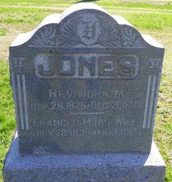
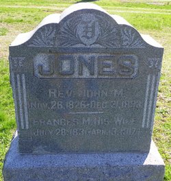
Rev John M Jones
| Birth | : | 26 Nov 1826 Tennessee, USA |
| Death | : | 21 Dec 1893 Kansas, USA |
| Burial | : | Sizemore Cemetery, Creekville, Clay County, USA |
| Coordinate | : | 37.0851900, -83.5337500 |
| Description | : | John M. Jones married Frances M. Grisham November 23, 1848 in Montgomery County. (Illinois marriage index) They are recorded with their infant daughter, Sarah, living with Hugh & Sarah Jones, ages 55 and 56, in the 1850 Southwest, Montgomery County, Illinois census. Sarah Jones, 66, born in South Carolina, is also recorded with John and Frances in the 1860 Township 8 N, Range 5 W, Montgomery County, Illinois census. (post office Litchfield) Sarah is recorded as age 10 in 1860; Mary, 8; Wesley, 6; & Emily, 4. This family is... Read More |
frequently asked questions (FAQ):
-
Where is Rev John M Jones's memorial?
Rev John M Jones's memorial is located at: Sizemore Cemetery, Creekville, Clay County, USA.
-
When did Rev John M Jones death?
Rev John M Jones death on 21 Dec 1893 in Kansas, USA
-
Where are the coordinates of the Rev John M Jones's memorial?
Latitude: 37.0851900
Longitude: -83.5337500
Family Members:
Parent
Spouse
Children
Flowers:
Nearby Cemetories:
1. Sizemore Cemetery
Creekville, Clay County, USA
Coordinate: 37.0851900, -83.5337500
2. Sizemore-Gilbert Cemetery
Leslie County, USA
Coordinate: 37.0807500, -83.5507900
3. Mosley-Napier Cemetery
Marcum, Clay County, USA
Coordinate: 37.0854400, -83.5520000
4. Orville Napier Cemetery
Creekville, Clay County, USA
Coordinate: 37.0895100, -83.5552900
5. Felix Grundy Gilbert Gravesite
Marcum, Clay County, USA
Coordinate: 37.0966700, -83.5562100
6. John Gilbert Cemetery
Marcum, Clay County, USA
Coordinate: 37.0997500, -83.5572900
7. John Sizemore Cemetery
Marcum, Clay County, USA
Coordinate: 37.1068800, -83.5515600
8. General Bowling Cemetery
Marcum, Clay County, USA
Coordinate: 37.1107000, -83.5581100
9. Stewart Cemetery
Clay County, USA
Coordinate: 37.0632580, -83.5715500
10. Langdon Cemetery
Marcum, Clay County, USA
Coordinate: 37.1138200, -83.5649200
11. Reynolds Cemetery
Clay County, USA
Coordinate: 37.0510000, -83.5103200
12. Asher Cemetery
Leslie County, USA
Coordinate: 37.0370010, -83.5391040
13. Ledford Cemetery #1
Peabody, Clay County, USA
Coordinate: 37.1296900, -83.5702700
14. Hoskins Family Cemetery #1
Peabody, Clay County, USA
Coordinate: 37.1183014, -83.5875015
15. Holland Cemetery
Peabody, Clay County, USA
Coordinate: 37.1160700, -83.5915300
16. Arnetts Cemetery
Peabody, Clay County, USA
Coordinate: 37.1116982, -83.5999985
17. Bowens Creek Cemetery
Essie, Leslie County, USA
Coordinate: 37.0432281, -83.4800292
18. Upper Jack's Creek Roark Family Cemetery
Roark, Leslie County, USA
Coordinate: 37.0235240, -83.5184100
19. Collett Cemetery
Essie, Leslie County, USA
Coordinate: 37.0295972, -83.4831472
20. Asher Cemetery
Queendale, Clay County, USA
Coordinate: 37.0156800, -83.5262400
21. Gibson-Begley Cemetery
Leslie County, USA
Coordinate: 37.1532020, -83.5075410
22. Dogwood Lane Cemetery
Essie, Leslie County, USA
Coordinate: 37.0714560, -83.4426350
23. Earl's Family Cemetery
Bear Branch, Leslie County, USA
Coordinate: 37.1442417, -83.4747617
24. Albert Morgan Cemetery
Essie, Leslie County, USA
Coordinate: 37.0757400, -83.4398420


