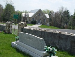
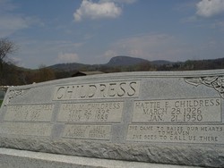
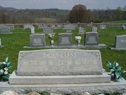
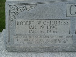
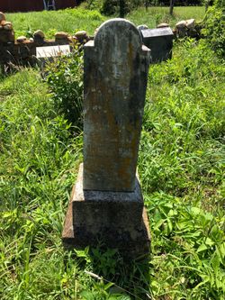
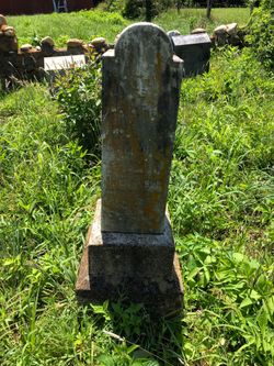
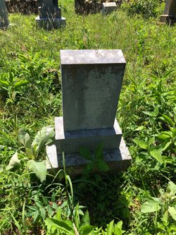
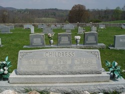
Rev Robert Walter “Bob” Childress Sr.
| Birth | : | 19 Jan 1890 Patrick County, Virginia, USA |
| Death | : | 16 Jan 1956 Roanoke, Roanoke City, Virginia, USA |
| Burial | : | Holy Trinity Churchyard, Hoghton, Chorley Borough, England |
| Coordinate | : | 53.7279300, -2.5848550 |
| Plot | : | Lat: 36.77800 - LON: 80.51750 |
| Description | : | Minister: Born in rural Patrick County, Virginia in the shadow of Buffalo Mountain. He graduated from Davidson College as a Presbyterian Minister and began his ministry at a small Presbyterian Church in Mt. Airy, North Carolina. A short time later he accepted the ministry of a second church in the Buffalo Mountain area of Floyd County, Virginia and in June 1926, he and his family moved to to the area. Over the years he would often travel more than 100-mile each Sunday, preaching as many as 5-sermons in five different churches. In the 1940's and 1950's he continue to widen... Read More |
frequently asked questions (FAQ):
-
Where is Rev Robert Walter “Bob” Childress Sr.'s memorial?
Rev Robert Walter “Bob” Childress Sr.'s memorial is located at: Holy Trinity Churchyard, Hoghton, Chorley Borough, England.
-
When did Rev Robert Walter “Bob” Childress Sr. death?
Rev Robert Walter “Bob” Childress Sr. death on 16 Jan 1956 in Roanoke, Roanoke City, Virginia, USA
-
Where are the coordinates of the Rev Robert Walter “Bob” Childress Sr.'s memorial?
Latitude: 53.7279300
Longitude: -2.5848550
Family Members:
Parent
Spouse
Siblings
Children
Flowers:

God Bless You Rev. Bob.I just finished reading The Man Who Moved a Mountain. You were a truly incredible man. I hope I can visit one of your wonderful churches someday. May God bless your family also.I know you are missed.
Left by Anonymous on 21 Sep 2007
Left by Anonymous on 04 Jan 2016
Left by Anonymous on 24 Jun 2016

Rest In Peace...
Left by Anonymous on 15 Jan 2020
You seemed so real in the book, I felt I knew you.
Left by Anonymous on 05 Sep 2020

I read about your life and ministry in this month's Gab article, "Hall of Men: A Toast to Bob Childress." Couldn't help but note the similarities with the character of Dr. MacNeill in "Christy," by famed author Catherine Marshall. Rest well now. †?
Left by Anonymous on 19 Apr 2022
Nearby Cemetories:
1. Holy Trinity Churchyard
Hoghton, Chorley Borough, England
Coordinate: 53.7279300, -2.5848550
2. St. Josephs Roman Catholic Churchyard
Brindle, Chorley Borough, England
Coordinate: 53.7350780, -2.5880640
3. St James's Churchyard
Brindle, Chorley Borough, England
Coordinate: 53.7133333, -2.6086111
4. Pleasington Priory
Pleasington, Blackburn with Darwen Unitary Authority, England
Coordinate: 53.7348590, -2.5433060
5. Pleasington Cemetery and Crematorium
Blackburn, Blackburn with Darwen Unitary Authority, England
Coordinate: 53.7388880, -2.5368710
6. St Paul's Churchyard
Withnell, Chorley Borough, England
Coordinate: 53.6970740, -2.5592150
7. All Saints Churchyard
Walton-le-Dale, South Ribble Borough, England
Coordinate: 53.7407250, -2.6408280
8. Our Lady and St Patrick's Church
Walton-le-Dale, South Ribble Borough, England
Coordinate: 53.7407250, -2.6408280
9. St. Bedes Churchyard
Clayton-le-Woods, Chorley Borough, England
Coordinate: 53.7079260, -2.6390320
10. St. Mary's and St. John RC Churchyard, Southworth
Samlesbury, South Ribble Borough, England
Coordinate: 53.7676690, -2.6183400
11. St. Saviour's Churchyard
Bamber Bridge, South Ribble Borough, England
Coordinate: 53.7197301, -2.6598985
12. St Stephen Churchyard
Tockholes, Blackburn with Darwen Unitary Authority, England
Coordinate: 53.7058350, -2.5169320
13. St. Leonard the Less Churchyard
Samlesbury, South Ribble Borough, England
Coordinate: 53.7680000, -2.6237000
14. St. Chad's South Hill Churchyard
Wheelton, Chorley Borough, England
Coordinate: 53.6826040, -2.6125010
15. St Mary's Churchyard Brownedge
Bamber Bridge, South Ribble Borough, England
Coordinate: 53.7305472, -2.6669416
16. New Row Methodist Church
Blackburn with Darwen Unitary Authority, England
Coordinate: 53.7208950, -2.5023720
17. St Barnabas Churchyard
Heapey, Chorley Borough, England
Coordinate: 53.6792520, -2.6043310
18. St John the Evangelist Churchyard
Whittle-le-Woods, Chorley Borough, England
Coordinate: 53.6883280, -2.6400320
19. St Leonard Churchyard
Walton-le-Dale, South Ribble Borough, England
Coordinate: 53.7476530, -2.6666950
20. St. Mary's Churchyard
Mellor, Ribble Valley Borough, England
Coordinate: 53.7728600, -2.5312400
21. Mellor Methodist Churchyard
Blackburn, Blackburn with Darwen Unitary Authority, England
Coordinate: 53.7742950, -2.5255060
22. St Leonard Churchyard
Balderstone, Ribble Valley Borough, England
Coordinate: 53.7860070, -2.5609380
23. St Paul's
Blackburn, Blackburn with Darwen Unitary Authority, England
Coordinate: 53.7491222, -2.4891266
24. St. Peter's Churchyard
Blackburn, Blackburn with Darwen Unitary Authority, England
Coordinate: 53.7448110, -2.4865070

