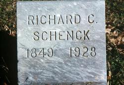
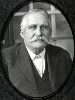
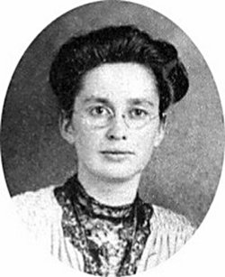
Richard Cox Schenck
| Birth | : | 7 Jan 1849 Warren County, Ohio, USA |
| Death | : | 6 Jul 1928 Harper County, Kansas, USA |
| Burial | : | Sulphur Springs Baptist Cemetery, Harris, Rutherford County, USA |
| Coordinate | : | 35.2646130, -81.8917710 |
frequently asked questions (FAQ):
-
Where is Richard Cox Schenck's memorial?
Richard Cox Schenck's memorial is located at: Sulphur Springs Baptist Cemetery, Harris, Rutherford County, USA.
-
When did Richard Cox Schenck death?
Richard Cox Schenck death on 6 Jul 1928 in Harper County, Kansas, USA
-
Where are the coordinates of the Richard Cox Schenck's memorial?
Latitude: 35.2646130
Longitude: -81.8917710
Family Members:
Parent
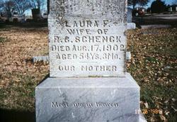
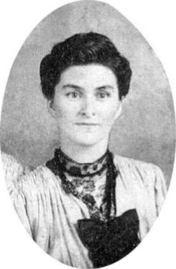
Spouse
Siblings
Children
Flowers:
Nearby Cemetories:
1. Sulphur Springs Baptist Cemetery
Harris, Rutherford County, USA
Coordinate: 35.2646130, -81.8917710
2. New Bethel Baptist Cemetery
Forest City, Rutherford County, USA
Coordinate: 35.2505264, -81.8770294
3. Morning Star Baptist Cemetery
Forest City, Rutherford County, USA
Coordinate: 35.2851830, -81.8952620
4. Sulphur Springs Holiness Cemetery
Danieltown, Rutherford County, USA
Coordinate: 35.2844250, -81.9004050
5. Doggett Grove AME Zion Cemetery
Forest City, Rutherford County, USA
Coordinate: 35.2808050, -81.8686810
6. Harris First Baptist Cemetery
Harris, Rutherford County, USA
Coordinate: 35.2428850, -81.8752240
7. New Bethel AME Zion Cemetery
Forest City, Rutherford County, USA
Coordinate: 35.2816470, -81.8682090
8. Holly Springs Baptist Church Cemetery
Forest City, Rutherford County, USA
Coordinate: 35.2508950, -81.9189940
9. New Bethel Independent Church Cemetery
Forest City, Rutherford County, USA
Coordinate: 35.2802970, -81.8657590
10. Tanners Grove United Methodist Cemetery
Rutherford County, USA
Coordinate: 35.2905410, -81.9049720
11. Hopewell AME Zion Church Cemetery
Harris, Rutherford County, USA
Coordinate: 35.2426750, -81.8690230
12. Doggett Cemetery
Forest City, Rutherford County, USA
Coordinate: 35.2932710, -81.8780670
13. Wesley Chapel Memorial Cemetery
Harris, Rutherford County, USA
Coordinate: 35.2369960, -81.8734430
14. Word of Faith Fellowship Cemetery
Spindale, Rutherford County, USA
Coordinate: 35.2931390, -81.9189950
15. Danieltown Baptist Church Cemetery
Danieltown, Rutherford County, USA
Coordinate: 35.2977100, -81.9127880
16. Jerusalem Baptist Church Cemetery
Forest City, Rutherford County, USA
Coordinate: 35.2417000, -81.8553200
17. Bethany Baptist Church Cemetery
Forest City, Rutherford County, USA
Coordinate: 35.3029200, -81.8933260
18. Trout Family Cemetery
Sandy Mush, Rutherford County, USA
Coordinate: 35.2762150, -81.8428660
19. Rutherford County Memorial Cemetery
Forest City, Rutherford County, USA
Coordinate: 35.2463989, -81.8443985
20. McDonald Family Cemetery
Forest City, Rutherford County, USA
Coordinate: 35.3075850, -81.8876240
21. Floyd's Creek Baptist Church Cemetery
Forest City, Rutherford County, USA
Coordinate: 35.2386017, -81.8491974
22. Providence United Methodist Church Cemetery
Forest City, Rutherford County, USA
Coordinate: 35.2633018, -81.8305969
23. Morrow Curve Cemetery
Alexander Mills, Rutherford County, USA
Coordinate: 35.3007300, -81.8490800
24. Alexander Mills Cemetery
Alexander Mills, Rutherford County, USA
Coordinate: 35.3059100, -81.8566200

