
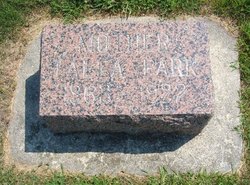
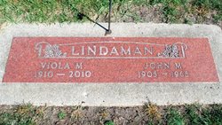
| Birth | : | 26 Sep 1866 Germany |
| Death | : | 30 May 1955 Iowa City, Johnson County, Iowa, USA |
| Burial | : | St. Andrew's Churchyard, Banwell, North Somerset Unitary Authority, England |
| Coordinate | : | 51.3280700, -2.8637000 |
| Description | : | Rieke Lindaman died at two o'clock Monday morning in the University hospital at Iowa City. He had been afflicted with hardening of the arteries several years. Four years ago he had one of his legs amputated. In late months his other leg became affected and it had been decided to amputate that leg also, but death came before the second operation was performed. He was 88 years old. Mr. Lindaman was born in Eastfriesland, Germany, Sept. 26th, 1866. He came to this country and to this county in his youth and much of his active... Read More |
frequently asked questions (FAQ):
-
Where is Rieke O Lindeman's memorial?
Rieke O Lindeman's memorial is located at: St. Andrew's Churchyard, Banwell, North Somerset Unitary Authority, England.
-
When did Rieke O Lindeman death?
Rieke O Lindeman death on 30 May 1955 in Iowa City, Johnson County, Iowa, USA
-
Where are the coordinates of the Rieke O Lindeman's memorial?
Latitude: 51.3280700
Longitude: -2.8637000
Family Members:
Parent

Spouse
Siblings
Children
Flowers:


Nearby Cemetories:
1. St. Andrew's Churchyard
Banwell, North Somerset Unitary Authority, England
Coordinate: 51.3280700, -2.8637000
2. Banwell War Memorial
Banwell, North Somerset Unitary Authority, England
Coordinate: 51.3278233, -2.8648124
3. Winscombe and Sandford Cemetery
Winscombe, North Somerset Unitary Authority, England
Coordinate: 51.3223861, -2.8386889
4. The Blessed Virgin Mary
Axbridge, Sedgemoor District, England
Coordinate: 51.3112017, -2.8913443
5. St. James the Great Churchyard
Winscombe, North Somerset Unitary Authority, England
Coordinate: 51.3059750, -2.8456900
6. St. Augustine's Parish Churchyard
Locking, North Somerset Unitary Authority, England
Coordinate: 51.3322900, -2.9147683
7. Saint Andrew Churchyard
Compton Bishop, Sedgemoor District, England
Coordinate: 51.2943290, -2.8678900
8. Saint John the Baptist Churchyard
Churchill, North Somerset Unitary Authority, England
Coordinate: 51.3384750, -2.8092710
9. St Andrew's Church
Loxton, North Somerset Unitary Authority, England
Coordinate: 51.2981560, -2.8962140
10. Holy Saviour Churchyard
Puxton, North Somerset Unitary Authority, England
Coordinate: 51.3652680, -2.8536510
11. Methodist Church Burial Ground
Churchill, North Somerset Unitary Authority, England
Coordinate: 51.3344140, -2.8000610
12. Shipham Cemetery
Shipham, Sedgemoor District, England
Coordinate: 51.3201930, -2.7992390
13. St Mary the Virgin Churchyard
Hutton, North Somerset Unitary Authority, England
Coordinate: 51.3228030, -2.9306350
14. St Leonard's Churchyard
Shipham, Sedgemoor District, England
Coordinate: 51.3130980, -2.8001830
15. St Michael and All Angels
Rowberrow, North Somerset Unitary Authority, England
Coordinate: 51.3240000, -2.7915000
16. St Anne's Church Hewish
Weston-super-Mare, North Somerset Unitary Authority, England
Coordinate: 51.3740520, -2.8666300
17. St Mark Churchyard
Weston-super-Mare, North Somerset Unitary Authority, England
Coordinate: 51.3640650, -2.9195540
18. St. John the Baptist Churchyard
Axbridge, Sedgemoor District, England
Coordinate: 51.2876300, -2.8162900
19. St. Michael Sanatorium Cemetery
Axbridge, Sedgemoor District, England
Coordinate: 51.2904100, -2.8056900
20. St Mary's Church
Lower Langford, North Somerset Unitary Authority, England
Coordinate: 51.3399805, -2.7813469
21. St Andrew Churchyard
Congresbury, North Somerset Unitary Authority, England
Coordinate: 51.3701100, -2.8121320
22. St. Martin's Churchyard
Worle, North Somerset Unitary Authority, England
Coordinate: 51.3609960, -2.9301250
23. St. John the Baptist Churchyard
Biddisham, Sedgemoor District, England
Coordinate: 51.2764090, -2.8878950
24. Saint Peter and St. Paul Churchyard
Bleadon, North Somerset Unitary Authority, England
Coordinate: 51.3074000, -2.9458300