
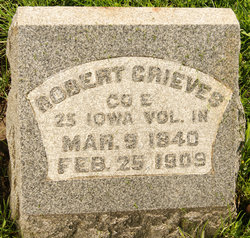
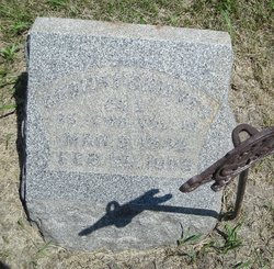

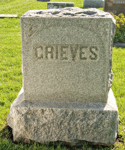
Robert Grieves
| Birth | : | 8 Mar 1840 Chillicothe, Ross County, Ohio, USA |
| Death | : | 25 Feb 1909 Clarinda, Page County, Iowa, USA |
| Burial | : | St. John The Baptist Churchyard, Boldre, New Forest District, England |
| Coordinate | : | 50.7924070, -1.5422530 |
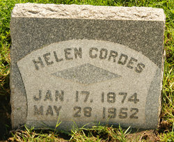
| Inscription | : | Aged 69 years |
| Description | : | Adams County Union-Republican (Corning, Iowa), Wednesday, March 10, 1909, [p. 1] Robert Grieves who was taken to the hospital at Clarinda some time ago from Nodaway died Thursday evening February 25th at that place. His death was due to a sunstroke which he received May 22, 1863, when the 25th Iowa Infantry, of which he was a member, took part in the charge upon Vicksburg. Mr. Grieves was born in Chillicothe, Ohio, March 9, 1840, and moved to Taylor County in 1875, where he resided until 1899 when he moved to Nodaway. He leaves a wife and two daughters to morn... Read More |
frequently asked questions (FAQ):
-
Where is Robert Grieves's memorial?
Robert Grieves's memorial is located at: St. John The Baptist Churchyard, Boldre, New Forest District, England.
-
When did Robert Grieves death?
Robert Grieves death on 25 Feb 1909 in Clarinda, Page County, Iowa, USA
-
Where are the coordinates of the Robert Grieves's memorial?
Latitude: 50.7924070
Longitude: -1.5422530
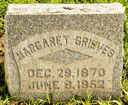
Family Members:
Spouse
Children
Flowers:


Nearby Cemetories:
1. St. John The Baptist Churchyard
Boldre, New Forest District, England
Coordinate: 50.7924070, -1.5422530
2. St Nicholas Churchyard
Brockenhurst, New Forest District, England
Coordinate: 50.8146060, -1.5681240
3. St Mary Churchyard
South Baddesley, New Forest District, England
Coordinate: 50.7691430, -1.5026160
4. St. Thomas the Apostle Churchyard
Lymington, New Forest District, England
Coordinate: 50.7576410, -1.5451200
5. Lymington Cemetery
Lymington, New Forest District, England
Coordinate: 50.7576200, -1.5576200
6. St. Mark's Churchyard
Pennington, New Forest District, England
Coordinate: 50.7545700, -1.5631100
7. St Luke Churchyard
Sway, New Forest District, England
Coordinate: 50.7839000, -1.6058800
8. Sway Cemetery
Sway, New Forest District, England
Coordinate: 50.7930690, -1.6131930
9. East Boldre Old Chapelyard
East Boldre, New Forest District, England
Coordinate: 50.8100600, -1.4756000
10. East Boldre Baptist Chapelyard
East Boldre, New Forest District, England
Coordinate: 50.8044770, -1.4707650
11. St Paul Churchyard
East Boldre, New Forest District, England
Coordinate: 50.8011710, -1.4693300
12. Beaulieu Cemetery
Beaulieu, New Forest District, England
Coordinate: 50.8046600, -1.4594000
13. All Saints Churchyard
Hordle, New Forest District, England
Coordinate: 50.7549400, -1.6136200
14. Blessed Virgin and Holy Child Churchyard
Beaulieu, New Forest District, England
Coordinate: 50.8216320, -1.4501550
15. Ashley Baptist Cemetery
New Milton, New Forest District, England
Coordinate: 50.7529200, -1.6336400
16. All Saints Churchyard
Milford-on-Sea, New Forest District, England
Coordinate: 50.7278170, -1.5897770
17. Lyndhurst Cemetery
Lyndhurst, New Forest District, England
Coordinate: 50.8723000, -1.5644600
18. Milford Road Cemetery
New Milton, New Forest District, England
Coordinate: 50.7472700, -1.6502700
19. St Michael and All Angels Churchyard
Lyndhurst, New Forest District, England
Coordinate: 50.8722520, -1.5778710
20. Christ Church Churchyard
Emery Down, New Forest District, England
Coordinate: 50.8742900, -1.5935600
21. New Milton Cemetery
New Milton, New Forest District, England
Coordinate: 50.7507690, -1.6650340
22. St Mary Magdalene Churchyard
New Milton, New Forest District, England
Coordinate: 50.7481200, -1.6645700
23. St James Churchyard
Yarmouth, Isle of Wight Unitary Authority, England
Coordinate: 50.7055370, -1.4991890
24. St Katherine Churchyard
Exbury and Lepe, New Forest District, England
Coordinate: 50.8003950, -1.3957510