
| Memorials | : | 6 |
| Location | : | Lyndhurst, New Forest District, England |
| Coordinate | : | 50.8722520, -1.5778710 |
frequently asked questions (FAQ):
-
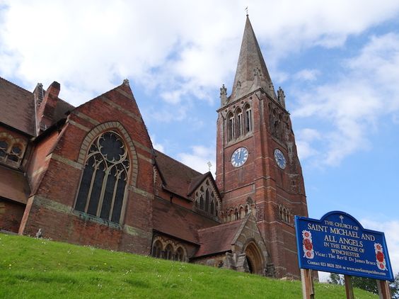
Where is St Michael and All Angels Churchyard?
St Michael and All Angels Churchyard is located at High Street Lyndhurst, New Forest District ,Hampshire , SO43 7BDEngland.
-
St Michael and All Angels Churchyard cemetery's updated grave count on graveviews.com?
3 memorials
-
Where are the coordinates of the St Michael and All Angels Churchyard?
Latitude: 50.8722520
Longitude: -1.5778710
Nearby Cemetories:
1. Lyndhurst Cemetery
Lyndhurst, New Forest District, England
Coordinate: 50.8723000, -1.5644600
2. Christ Church Churchyard
Emery Down, New Forest District, England
Coordinate: 50.8742900, -1.5935600
3. All Saints Churchyard
Minstead, New Forest District, England
Coordinate: 50.8967200, -1.6017160
4. Christ Church Churchyard
Ashurst, New Forest District, England
Coordinate: 50.8960200, -1.5054200
5. St. Matthew's Churchyard
Netley Marsh, New Forest District, England
Coordinate: 50.9161620, -1.5285530
6. St Nicholas Churchyard
Brockenhurst, New Forest District, England
Coordinate: 50.8146060, -1.5681240
7. St. Mary's Churchyard
Copythorne, New Forest District, England
Coordinate: 50.9307300, -1.5641400
8. Eling Cemetery
Eling, New Forest District, England
Coordinate: 50.9092640, -1.4817810
9. St. Mary the Virgin Churchyard
Eling, New Forest District, England
Coordinate: 50.9103000, -1.4795700
10. Falklands War Memorial
Marchwood, New Forest District, England
Coordinate: 50.8898280, -1.4533250
11. St John the Apostle Churchyard
Marchwood, New Forest District, England
Coordinate: 50.8900300, -1.4530700
12. St. Peter's Churchyard
Bramshaw, New Forest District, England
Coordinate: 50.9485800, -1.6245700
13. Sway Cemetery
Sway, New Forest District, England
Coordinate: 50.7930690, -1.6131930
14. St. John The Baptist Churchyard
Boldre, New Forest District, England
Coordinate: 50.7924070, -1.5422530
15. Burley Chapel Cemetery
Burley, New Forest District, England
Coordinate: 50.8313000, -1.6930000
16. St John the Baptist Churchyard
Burley, New Forest District, England
Coordinate: 50.8274700, -1.6971500
17. All Saints Churchyard
Dibden, New Forest District, England
Coordinate: 50.8753020, -1.4362590
18. East Boldre Old Chapelyard
East Boldre, New Forest District, England
Coordinate: 50.8100600, -1.4756000
19. Holy Trinity Churchyard
Millbrook, Southampton Unitary Authority, England
Coordinate: 50.9158400, -1.4535100
20. St Luke Churchyard
Sway, New Forest District, England
Coordinate: 50.7839000, -1.6058800
21. Millbrook Cemetery
Millbrook, Southampton Unitary Authority, England
Coordinate: 50.9164900, -1.4526100
22. St Boniface Churchyard
Nursling, Test Valley Borough, England
Coordinate: 50.9464660, -1.4896760
23. St. Nicholas Churchyard
Millbrook, Southampton Unitary Authority, England
Coordinate: 50.9139100, -1.4439800
24. Blessed Virgin and Holy Child Churchyard
Beaulieu, New Forest District, England
Coordinate: 50.8216320, -1.4501550