


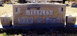
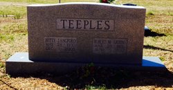
Robert Matthew “John” Teeples
| Birth | : | 23 Mar 1926 Tennessee, USA |
| Death | : | 5 Jun 2012 Celina, Clay County, Tennessee, USA |
| Burial | : | Fitzgerald Cemetery, Celina, Clay County, USA |
| Coordinate | : | 36.5518990, -85.4966965 |
| Description | : | Teeples, Robert Matthew "John" – age 86 of Celina, TN passed away on June 5th, 2012 due to complications of heart disease. After serving in the Navy in World War II, he graduated Tennessee Tech University with a degree in Biology. He was a retired teacher, coach, and principal with the Clay County School System. He was also a retired agent with State Farm Insurance. Over the years he served on various community boards and committees. He was a member of the Celina Lion's Club and the American Legion. He was a former Clay County Commissioner and an active member... Read More |
frequently asked questions (FAQ):
-
Where is Robert Matthew “John” Teeples's memorial?
Robert Matthew “John” Teeples's memorial is located at: Fitzgerald Cemetery, Celina, Clay County, USA.
-
When did Robert Matthew “John” Teeples death?
Robert Matthew “John” Teeples death on 5 Jun 2012 in Celina, Clay County, Tennessee, USA
-
Where are the coordinates of the Robert Matthew “John” Teeples's memorial?
Latitude: 36.5518990
Longitude: -85.4966965
Family Members:
Parent

Spouse
Siblings

Flowers:


Nearby Cemetories:
1. Hamilton Cemetery
Celina, Clay County, USA
Coordinate: 36.5517271, -85.4970509
2. Old Fitzgerald Cemetery
Celina, Clay County, USA
Coordinate: 36.5509750, -85.4958417
3. Green Cemetery
Celina, Clay County, USA
Coordinate: 36.5496418, -85.5024450
4. Free Hill Cemetery
Clay County, USA
Coordinate: 36.5628014, -85.4955978
5. Gates Cemetery
Celina, Clay County, USA
Coordinate: 36.5422640, -85.4891440
6. Tinsley Cemetery
Cave Springs, Clay County, USA
Coordinate: 36.5527992, -85.4800034
7. Page Family Cemetery
Free Hill, Clay County, USA
Coordinate: 36.5623018, -85.4844294
8. Peterman Bend Cemetery
Celina, Clay County, USA
Coordinate: 36.5370750, -85.4846300
9. Varney Andrews Cemetery
Celina, Clay County, USA
Coordinate: 36.5604650, -85.5209530
10. Stone Cemetery
Clay County, USA
Coordinate: 36.5713997, -85.5136032
11. Walker Cemetery
Celina, Clay County, USA
Coordinate: 36.5372009, -85.4728012
12. Robert Arms Cemetery
Pea Ridge, Clay County, USA
Coordinate: 36.5432790, -85.4657820
13. Plumlee Cemetery
Celina, Clay County, USA
Coordinate: 36.5694280, -85.5282830
14. Dale Davis Cemetery
Clay County, USA
Coordinate: 36.5143600, -85.4685300
15. Ray Williams Cemetery
Pea Ridge, Clay County, USA
Coordinate: 36.5856130, -85.4598120
16. Hamilton Cemetery
Clay County, USA
Coordinate: 36.5181007, -85.5338974
17. Edens-Smith Cemetery
Clay County, USA
Coordinate: 36.5979390, -85.4976300
18. Crawford Cemetery
Celina, Clay County, USA
Coordinate: 36.5979660, -85.4976660
19. Walker Reecer Cemetery
Celina, Clay County, USA
Coordinate: 36.5746290, -85.5480270
20. Dalton Cemetery
Arcott, Clay County, USA
Coordinate: 36.5429540, -85.5546170
21. Key Cemetery
Pea Ridge, Clay County, USA
Coordinate: 36.5875015, -85.4518967
22. Grover Rich Cemetery
Pea Ridge, Clay County, USA
Coordinate: 36.5946370, -85.4602970
23. Bowe Cemetery
Pea Ridge, Clay County, USA
Coordinate: 36.5833015, -85.4439011
24. Mabry Cemetery
Clay County, USA
Coordinate: 36.5139008, -85.5464020