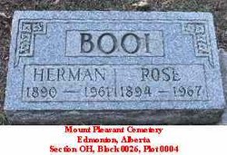
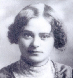
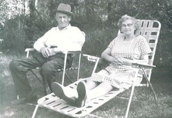
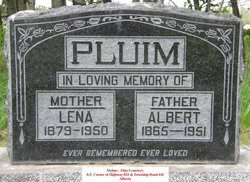
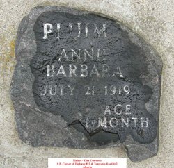
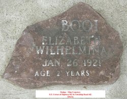
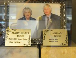
Roelofje “Rose” Pluim Booi
| Birth | : | 2 Aug 1894 Steenwijk, Steenwijkerland Municipality, Overijssel, Netherlands |
| Death | : | 28 Jan 1967 Edmonton, Edmonton Census Division, Alberta, Canada |
| Burial | : | Akatarawa Cemetery, Upper Hutt City, New Zealand |
| Coordinate | : | -41.0876320, 175.1025870 |
| Plot | : | H 0026 0004 |
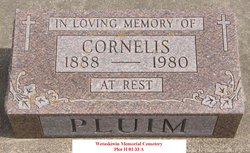
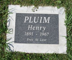
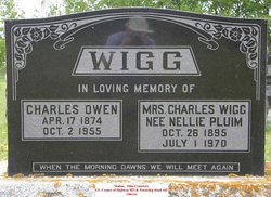
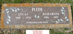
| Description | : | Rose was the daughter of Albert Pluim [1865-1951] & his first wife Elisabeth Bykerk [1864-1903]. Rose travelled to America with her father Albert Pluim & siblings Andries [1889-1966], Hendrik [1891-1967], Lieffert [1891-1949], Neeltje [1895-1970], Lukas [1898-1976], and Karst [1901-1990] - the family left Steenwijk in the Netherlands on 14 Feb 1907 destined to Springfield, South Dakota. (Her older two brothers Roelof [1887-1961] and Cornelis [1888-1980] had gone to Springfield the year before). The family arrived in the USA via the Port of New York on Holland-American Lines Steamer SYNDAM on 27 Feb 1907. Lammigje [Lena] Bakker, who was to... Read More |
frequently asked questions (FAQ):
-
Where is Roelofje “Rose” Pluim Booi's memorial?
Roelofje “Rose” Pluim Booi's memorial is located at: Akatarawa Cemetery, Upper Hutt City, New Zealand.
-
When did Roelofje “Rose” Pluim Booi death?
Roelofje “Rose” Pluim Booi death on 28 Jan 1967 in Edmonton, Edmonton Census Division, Alberta, Canada
-
Where are the coordinates of the Roelofje “Rose” Pluim Booi's memorial?
Latitude: -41.0876320
Longitude: 175.1025870
Family Members:
Parent
Spouse
Siblings
Children
Flowers:
Nearby Cemetories:
1. Akatarawa Cemetery
Upper Hutt City, New Zealand
Coordinate: -41.0876320, 175.1025870
2. St. Joseph's Church Cemetery
Upper Hutt, Upper Hutt City, New Zealand
Coordinate: -41.1243380, 175.0686570
3. Wallaceville Cemetery
Wallaceville, Upper Hutt City, New Zealand
Coordinate: -41.1359900, 175.0743300
4. St. John's Anglican Churchyard Cemetery
Trentham, Upper Hutt City, New Zealand
Coordinate: -41.1303100, 175.0443500
5. Battle Hill Burial Ground
Wellington, Wellington City, New Zealand
Coordinate: -41.0578590, 174.9352810
6. St Josephs Catholic Cemetery
Pauatahanui, Porirua City, New Zealand
Coordinate: -41.1135060, 174.9196220
7. Saint Albans Burial Ground
Pauatahanui, Porirua City, New Zealand
Coordinate: -41.1067240, 174.9179340
8. Pauatahanui Burial Ground
Pauatahanui, Porirua City, New Zealand
Coordinate: -41.1068190, 174.9173310
9. Christ Church Anglican Cemetery
Taita, Lower Hutt City, New Zealand
Coordinate: -41.1820960, 174.9600920
10. MacKay Family Cemetery
Kapiti Coast District, New Zealand
Coordinate: -40.9726800, 174.9833330
11. Taita Lawn Cemetery
Naenae, Lower Hutt City, New Zealand
Coordinate: -41.1968900, 174.9634900
12. Bradey Grave
Whitby, Porirua City, New Zealand
Coordinate: -41.1173161, 174.9056161
13. Mira Family Urupā
Paraparaumu, Kapiti Coast District, New Zealand
Coordinate: -40.9753380, 174.9643460
14. Taita Old Cemetery
Naenae, Lower Hutt City, New Zealand
Coordinate: -41.1945700, 174.9564000
15. Knox Presbyterian Church Cemetery
Lower Hutt, Lower Hutt City, New Zealand
Coordinate: -41.1965430, 174.9579920
16. Featherston Cemetery
Featherston, South Wairarapa District, New Zealand
Coordinate: -41.1217800, 175.3144160
17. Featherston Soldiers Cemetery
Featherston, South Wairarapa District, New Zealand
Coordinate: -41.1212630, 175.3147170
18. Pukerua Bay Urupā
Pukerua Bay, Porirua City, New Zealand
Coordinate: -41.0300425, 174.8969530
19. Awa Tapu Cemetery
Paraparaumu, Kapiti Coast District, New Zealand
Coordinate: -40.9328870, 175.0122070
20. Waiorongomai Cemetery
South Wairarapa District, New Zealand
Coordinate: -41.2535785, 175.1567108
21. Whenua Tapu Cemetery
Porirua, Porirua City, New Zealand
Coordinate: -41.0550200, 174.8757150
22. Boulcott Farm Cemetery
Lower Hutt, Lower Hutt City, New Zealand
Coordinate: -41.2030590, 174.9272750
23. Plimmerton Urupā
Plimmerton, Porirua City, New Zealand
Coordinate: -41.0822790, 174.8641890
24. Hongoeka Urupā
Plimmerton, Porirua City, New Zealand
Coordinate: -41.0651560, 174.8525070

