
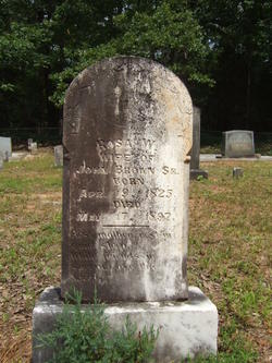
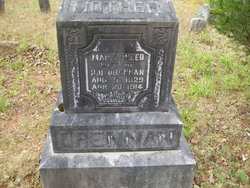
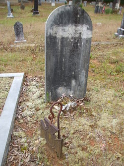
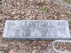
Rosa Ward Weed Brown
| Birth | : | 19 Apr 1825 South Carolina, USA |
| Death | : | 17 May 1897 South Carolina, USA |
| Burial | : | Pleasant Hill Cemetery, Jefferson County, USA |
| Coordinate | : | 40.1595910, -97.2573280 |
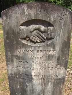
| Description | : | Her first name may have been Rebecca but she went by the name Rosa. Wife of John Brown, Sr. |
frequently asked questions (FAQ):
-
Where is Rosa Ward Weed Brown's memorial?
Rosa Ward Weed Brown's memorial is located at: Pleasant Hill Cemetery, Jefferson County, USA.
-
When did Rosa Ward Weed Brown death?
Rosa Ward Weed Brown death on 17 May 1897 in South Carolina, USA
-
Where are the coordinates of the Rosa Ward Weed Brown's memorial?
Latitude: 40.1595910
Longitude: -97.2573280
Family Members:
Parent
Spouse
Siblings
Children
Flowers:


Nearby Cemetories:
1. Pleasant Hill Cemetery
Jefferson County, USA
Coordinate: 40.1595910, -97.2573280
2. Zion United Church of Christ Cemetery
Gladstone, Jefferson County, USA
Coordinate: 40.1630000, -97.2910000
3. Moles Cemetery
Powell, Jefferson County, USA
Coordinate: 40.2015100, -97.2647950
4. George Winslow Gravesite
Fairbury, Jefferson County, USA
Coordinate: 40.2074800, -97.2061580
5. Grace Lutheran Cemetery
Gladstone, Jefferson County, USA
Coordinate: 40.1620670, -97.3522350
6. Powell Cemetery
Powell, Jefferson County, USA
Coordinate: 40.2332993, -97.2742004
7. Helvey Cemetery
Helvey, Jefferson County, USA
Coordinate: 40.2347354, -97.2533342
8. Richland Center Cemetery
Jefferson County, USA
Coordinate: 40.2186012, -97.1900024
9. Fairbury Cemetery
Fairbury, Jefferson County, USA
Coordinate: 40.1314011, -97.1557999
10. Hunt Family Plot
Reynolds, Jefferson County, USA
Coordinate: 40.0868380, -97.3115940
11. Meridian Presbyterian Cemetery
Meridian Township, Jefferson County, USA
Coordinate: 40.2178001, -97.3625031
12. Grandy Cemetery
Jansen, Jefferson County, USA
Coordinate: 40.1897011, -97.1324997
13. Silver Creek Cemetery
Jefferson County, USA
Coordinate: 40.0522003, -97.2367020
14. Woltemath Lone Grave
Alexandria, Thayer County, USA
Coordinate: 40.2343600, -97.3691800
15. Bartel Cemetery
Jansen, Jefferson County, USA
Coordinate: 40.1903000, -97.1141968
16. Union Cemetery
Gilead, Thayer County, USA
Coordinate: 40.1319008, -97.4047012
17. Catholic Cemetery
Alexandria, Thayer County, USA
Coordinate: 40.2202988, -97.3878021
18. Huber Cemetery
Reynolds, Jefferson County, USA
Coordinate: 40.0493000, -97.3085000
19. Rose Creek Cemetery
Rose Creek Township, Thayer County, USA
Coordinate: 40.0705986, -97.3694000
20. Jansen Cemetery
Jansen, Jefferson County, USA
Coordinate: 40.1903000, -97.0958023
21. Bower Cemetery
Jefferson County, USA
Coordinate: 40.2621994, -97.1517029
22. Mount Gilead Cemetery
Gilead, Thayer County, USA
Coordinate: 40.1906000, -97.4246500
23. Kennedy Lone Grave
Gilead, Thayer County, USA
Coordinate: 40.1715900, -97.4425500
24. Alexandria Cemetery
Alexandria, Thayer County, USA
Coordinate: 40.2489014, -97.4060974