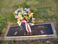
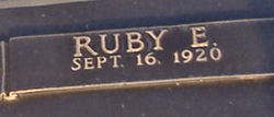
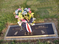
Ruby Edmonds Lee
| Birth | : | 16 Sep 1920 Spartanburg County, South Carolina, USA |
| Death | : | 26 Dec 2008 South Carolina, USA |
| Burial | : | Newton-le-Willows Cemetery, Newton-le-Willows, Metropolitan Borough of St Helens, England |
| Coordinate | : | 53.4471970, -2.6217090 |
| Plot | : | Left section |
| Description | : | Blacksburg -- Ruby Fay Edmonds Lee, 88, passed away Friday, December 26, 2008 at Upstate Carolina Medical Center. Born in Spartanburg county, Mrs. Lee was the wife of the late Clarence Benard Lee and the daughter of the late Gurley Roosevelt Edmonds and the late Sudie Mae Belcher Edmonds. Mrs. Lee retired from the Bantam Chef in Blacksburg, but also worked as a beautician. She was a member of the First Baptist Church of Blacksburg. Surviving Mrs. Lee are three daughters, Shirley Gray and husband, Gene, Diane Brown and husband, Edward, and Lorna McDaniel, all of Blacksburg; two sons, Frank... Read More |
frequently asked questions (FAQ):
-
Where is Ruby Edmonds Lee's memorial?
Ruby Edmonds Lee's memorial is located at: Newton-le-Willows Cemetery, Newton-le-Willows, Metropolitan Borough of St Helens, England.
-
When did Ruby Edmonds Lee death?
Ruby Edmonds Lee death on 26 Dec 2008 in South Carolina, USA
-
Where are the coordinates of the Ruby Edmonds Lee's memorial?
Latitude: 53.4471970
Longitude: -2.6217090
Family Members:
Parent
Spouse
Siblings
Children
Nearby Cemetories:
1. Newton-le-Willows Cemetery
Newton-le-Willows, Metropolitan Borough of St Helens, England
Coordinate: 53.4471970, -2.6217090
2. Emmanuel Wargrave
Newton-le-Willows, Metropolitan Borough of St Helens, England
Coordinate: 53.4454500, -2.6277060
3. St. Peter's Churchyard
Newton-le-Willows, Metropolitan Borough of St Helens, England
Coordinate: 53.4559330, -2.6143730
4. St. Mary and St. John RC Churchyard
Newton-le-Willows, Metropolitan Borough of St Helens, England
Coordinate: 53.4559410, -2.6323930
5. St. Oswald Churchyard
Winwick, Warrington Unitary Authority, England
Coordinate: 53.4309200, -2.5972200
6. Winwick Hospital Churchyard
Warrington Unitary Authority, England
Coordinate: 53.4265000, -2.6050000
7. All Saints Roman Catholic Churchyard
Golborne, Metropolitan Borough of Wigan, England
Coordinate: 53.4745130, -2.5991750
8. St James' Churchyard
Haydock, Metropolitan Borough of St Helens, England
Coordinate: 53.4679080, -2.6596350
9. St. Luke's Churchyard
Lowton Common, Metropolitan Borough of Wigan, England
Coordinate: 53.4752100, -2.5805770
10. St Thomas' Churchyard (Heath Road Extension)
Ashton-In-Makerfield, Metropolitan Borough of Wigan, England
Coordinate: 53.4850470, -2.6345810
11. St Thomas Churchyard
Ashton-In-Makerfield, Metropolitan Borough of Wigan, England
Coordinate: 53.4856362, -2.6402671
12. St. Thomas' Churchyard
Golborne, Metropolitan Borough of Wigan, England
Coordinate: 53.4837560, -2.5917430
13. St Mark Churchyard
Haydock, Metropolitan Borough of St Helens, England
Coordinate: 53.4658540, -2.6892980
14. St Peter's of Parr Churchyard
Parr, Metropolitan Borough of St Helens, England
Coordinate: 53.4543745, -2.7009772
15. Christ Church Churchyard
Warrington, Warrington Unitary Authority, England
Coordinate: 53.4376659, -2.5428132
16. Unitarian Chapel
Croft, Warrington Unitary Authority, England
Coordinate: 53.4345995, -2.5440079
17. St. Mary's Parish Churchyard
Lowton St Mary's, Metropolitan Borough of Wigan, England
Coordinate: 53.4763450, -2.5512350
18. St. Anne and Blessed Dominic Churchyard
St Helens, Metropolitan Borough of St Helens, England
Coordinate: 53.4330960, -2.7083700
19. St. Barnabas Churchyard
Warrington Unitary Authority, England
Coordinate: 53.3920038, -2.6121106
20. Christ Church Graveyard
Padgate, Warrington Unitary Authority, England
Coordinate: 53.4072619, -2.5565873
21. Risley Presbyterian Church Churchyard
Warrington Unitary Authority, England
Coordinate: 53.4322500, -2.5283880
22. Warrington Cemetery
Warrington, Warrington Unitary Authority, England
Coordinate: 53.3964660, -2.5730780
23. St. Mary's Churchyard
Great Sankey, Warrington Unitary Authority, England
Coordinate: 53.3912000, -2.6497000
24. Holy Trinity Churchyard
Ashton-In-Makerfield, Metropolitan Borough of Wigan, England
Coordinate: 53.4989280, -2.6688000


