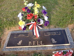
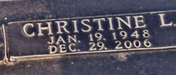
Christine Lee Bell
| Birth | : | 19 Jan 1948 Chesnee, Spartanburg County, South Carolina, USA |
| Death | : | 29 Dec 2006 |
| Burial | : | Welford Road Cemetery, Leicester, Leicester Unitary Authority, England |
| Coordinate | : | 52.6200104, -1.1295080 |
| Description | : | Blacksburg, S.c. — Mrs. Christine Lee Bell, 58, of Blacksburg, S.C., died Friday, Dec. 29, 2006, at her home. A native of Chesnee, S.C., she was a member and Sunday school teacher at Antioch Baptist Church and worked for Gordon Mortuary for many years. She is preceded in death by her father, Clarence Benard Lee. She is survived by her husband, Cecil Bell; mother, Ruby Edmonds Lee; son, Mike Bell and wife Kristy of Blacksburg; two brothers, Frank Lee and wife Mona and Douglas Lee and wife Sherri, all of Gaffney, S.C.; three sisters, Shirley Gray and husband Gene, Diane Brown and husband... Read More |
frequently asked questions (FAQ):
-
Where is Christine Lee Bell's memorial?
Christine Lee Bell's memorial is located at: Welford Road Cemetery, Leicester, Leicester Unitary Authority, England.
-
When did Christine Lee Bell death?
Christine Lee Bell death on 29 Dec 2006 in
-
Where are the coordinates of the Christine Lee Bell's memorial?
Latitude: 52.6200104
Longitude: -1.1295080
Family Members:
Parent
Nearby Cemetories:
1. Welford Road Cemetery
Leicester, Leicester Unitary Authority, England
Coordinate: 52.6200104, -1.1295080
2. St. john the Baptist
Leicester, Leicester Unitary Authority, England
Coordinate: 52.6181730, -1.1118790
3. St Peter's Church (Defunct)
Leicester, Leicester Unitary Authority, England
Coordinate: 52.6300260, -1.1164980
4. Church of the Annunciation of St. Mary
Leicester, Leicester Unitary Authority, England
Coordinate: 52.6308229, -1.1417201
5. St. Mary de Castro Churchyard
Leicester, Leicester Unitary Authority, England
Coordinate: 52.6322610, -1.1404000
6. St George's Church
Leicester, Leicester Unitary Authority, England
Coordinate: 52.6344300, -1.1267420
7. Leicester Cathedral
Leicester, Leicester Unitary Authority, England
Coordinate: 52.6347430, -1.1370210
8. Saint Mary Magdalene Churchyard
Knighton, Leicester Unitary Authority, England
Coordinate: 52.6054170, -1.1163730
9. St. Nicholas Church
Leicester, Leicester Unitary Authority, England
Coordinate: 52.6351400, -1.1408940
10. Great Meeting Unitarian Chapel
Leicester, Leicester Unitary Authority, England
Coordinate: 52.6379400, -1.1360390
11. All Saints Church
Leicester, Leicester Unitary Authority, England
Coordinate: 52.6381940, -1.1403170
12. St Margaret Churchyard
Leicester, Leicester Unitary Authority, England
Coordinate: 52.6403430, -1.1363440
13. St Andrew Churchyard
Aylestone, Leicester Unitary Authority, England
Coordinate: 52.6038420, -1.1568900
14. Saffron Hill Cemetery
Leicester, Leicester Unitary Authority, England
Coordinate: 52.5934120, -1.1310010
15. Leicester Abbey
Leicester, Leicester Unitary Authority, England
Coordinate: 52.6489600, -1.1369470
16. St Peter's Churchyard
Braunstone, Blaby District, England
Coordinate: 52.6208940, -1.1812900
17. St. Denys' Churchyard
Evington, Leicester Unitary Authority, England
Coordinate: 52.6193210, -1.0743860
18. Oadby Cemetery
Oadby, Oadby and Wigston Borough, England
Coordinate: 52.5961580, -1.0826170
19. St Wistan's Churchyard
Wigston, Oadby and Wigston Borough, England
Coordinate: 52.5866580, -1.1024700
20. St. Peter Churchyard
Oadby, Oadby and Wigston Borough, England
Coordinate: 52.5973900, -1.0805100
21. Wigston United Reformed Church
Wigston, Oadby and Wigston Borough, England
Coordinate: 52.5840900, -1.1071200
22. St. Peter's Churchyard
Belgrave, Leicester Unitary Authority, England
Coordinate: 52.6594208, -1.1255690
23. All Saints Churchyard
Wigston, Oadby and Wigston Borough, England
Coordinate: 52.5823880, -1.1096900
24. Gilroes Cemetery and Crematorium
Leicester, Leicester Unitary Authority, England
Coordinate: 52.6514359, -1.1721700


