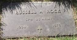
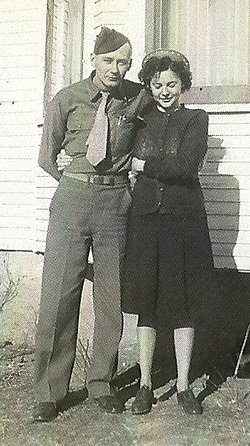
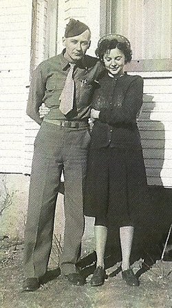
Russell Arthur Rock
| Birth | : | 3 Dec 1938 Aberdeen, Brown County, South Dakota, USA |
| Death | : | 28 Sep 1979 Robbinsdale, Hennepin County, Minnesota, USA |
| Burial | : | Saint John the Baptist, Stanton St John, South Oxfordshire District, England |
| Coordinate | : | 51.7800350, -1.1642830 |
| Plot | : | Garden of Devotion Lot 107 Block C, grave 1 |
| Description | : | Aberdeen American News, Aberdeen, SD, 10-1-1979 RUSSELL ROCK Ferney--Services for Russell A. Rock, 40, of 3838 Bryant Ave, Minneapolis, MN and a former Ferney-Groton resident, will be 10 a.m. Tuesday Oct. 2, at St. Paul's Lutheran Church in Ferney with the Rev. Dennis Huntington officiating. Burial will be in Sunset Memorial Gardens, Aberdeen. The Paetznick-Garness Funeral Home Chapel, Groton is in charge of the arrangements. Mr. Rock died Friday, September 28, at North Memorial Medical Center in Minneapolis. He was born Dec 3, 1938 at Aberdeen. He grew up in this area and married... Read More |
frequently asked questions (FAQ):
-
Where is Russell Arthur Rock's memorial?
Russell Arthur Rock's memorial is located at: Saint John the Baptist, Stanton St John, South Oxfordshire District, England.
-
When did Russell Arthur Rock death?
Russell Arthur Rock death on 28 Sep 1979 in Robbinsdale, Hennepin County, Minnesota, USA
-
Where are the coordinates of the Russell Arthur Rock's memorial?
Latitude: 51.7800350
Longitude: -1.1642830
Family Members:
Parent
Flowers:
Nearby Cemetories:
1. Saint John the Baptist
Stanton St John, South Oxfordshire District, England
Coordinate: 51.7800350, -1.1642830
2. Forest Hill Church Cemetery
Forest Hill, South Oxfordshire District, England
Coordinate: 51.7641700, -1.1567100
3. St. Nicholas' Church
Forest Hill, South Oxfordshire District, England
Coordinate: 51.7641400, -1.1567200
4. Oxford Crematorium
Headington, City of Oxford, England
Coordinate: 51.7719240, -1.1904020
5. Assumption of the Blessed Virgin Mary Churchyard
Beckley, South Oxfordshire District, England
Coordinate: 51.7972530, -1.1858920
6. Cornerstone Church Cemetery
Headington, City of Oxford, England
Coordinate: 51.7587275, -1.1995588
7. Holy Trinity Churchyard
Headington, City of Oxford, England
Coordinate: 51.7577500, -1.1979980
8. St Barnabas Churchyard
Horton-cum-Studley, Cherwell District, England
Coordinate: 51.8077260, -1.1409690
9. Studley Priory
Horton-cum-Studley, Cherwell District, England
Coordinate: 51.8054560, -1.1346920
10. The Priory
Headington, City of Oxford, England
Coordinate: 51.7638260, -1.2108100
11. St Andrew Churchyard
Headington, City of Oxford, England
Coordinate: 51.7647100, -1.2121400
12. St Thomas of Canterbury Churchyard
Elsfield, South Oxfordshire District, England
Coordinate: 51.7858680, -1.2178310
13. Headington Cemetery
Headington, City of Oxford, England
Coordinate: 51.7668050, -1.2179280
14. St Bartholomew Churchyard
Holton, South Oxfordshire District, England
Coordinate: 51.7529490, -1.1246510
15. St Mary the Virgin Churchyard
Wheatley, South Oxfordshire District, England
Coordinate: 51.7476020, -1.1366080
16. Wheatley War Memorial
Wheatley, South Oxfordshire District, England
Coordinate: 51.7468630, -1.1388780
17. St. Giles' Churchyard
Horspath, South Oxfordshire District, England
Coordinate: 51.7397190, -1.1738770
18. St. Aldate's Churchyard
Oxford, City of Oxford, England
Coordinate: 51.7497900, -1.2118500
19. Elsfield Road Cemetery
Old Marston, City of Oxford, England
Coordinate: 51.7752940, -1.2332640
20. Woodeaton Holy Rood Churchyard
Woodeaton, South Oxfordshire District, England
Coordinate: 51.8031620, -1.2257910
21. St Giles Churchyard
Noke, Cherwell District, England
Coordinate: 51.8145050, -1.2114790
22. St. Nicholas Churchyard
Old Marston, City of Oxford, England
Coordinate: 51.7761340, -1.2373130
23. St. Clements Churchyard
Oxford, City of Oxford, England
Coordinate: 51.7527790, -1.2369920
24. St. Andrew Churchyard
Oddington, Cherwell District, England
Coordinate: 51.8291010, -1.1996230


