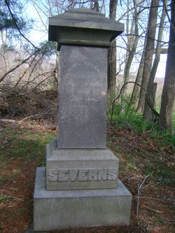
Samuel Severns
| Birth | : | 17 Oct 1794 Monongalia County, West Virginia, USA |
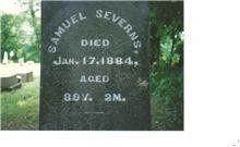
| Death | : | 17 Jan 1884 Coshocton County, Ohio, USA |
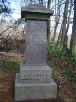
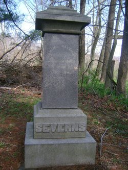
| Burial | : | Mohawk Baptist Church Cemetery, Nellie, Coshocton County, USA |
| Coordinate | : | 40.2941380, -82.1107120 |
| Description | : | From Chapter LXII New Castle Township of "History of Coshocton County, Ohio: Its Past and Present 1740–1881", by N. N. Hill, Jr., 1881, p. 569, http://www.archive.org/details/cu31924009823455 : "The congress land, which constitutes the southeastern quarter of the township, was surveyed into half sections, of 320 acres each, by Silas Bent, Jr., in 1803. Unlike congress land in many other townships this was settled in an early day. In 1810, Joseph Severns, emigrating from Bucks county, Pennsylvania, entered land in sections 11 and 20. His first cabin was built on the ridge in the northwest quarter of section 20. He... Read More |
frequently asked questions (FAQ):
-
Where is Samuel Severns's memorial?
Samuel Severns's memorial is located at: Mohawk Baptist Church Cemetery, Nellie, Coshocton County, USA.
-
When did Samuel Severns death?
Samuel Severns death on 17 Jan 1884 in Coshocton County, Ohio, USA
-
Where are the coordinates of the Samuel Severns's memorial?
Latitude: 40.2941380
Longitude: -82.1107120
Family Members:
Parent
Spouse
Siblings
Children
Flowers:
Nearby Cemetories:
1. Mohawk Baptist Church Cemetery
Nellie, Coshocton County, USA
Coordinate: 40.2941380, -82.1107120
2. Wilson Chapel Cemetery
Nellie, Coshocton County, USA
Coordinate: 40.3017690, -82.1207660
3. Mikesell Cemetery
West Bedford, Coshocton County, USA
Coordinate: 40.2882500, -82.0963240
4. Goshen Cemetery
Warsaw, Coshocton County, USA
Coordinate: 40.2728004, -82.1193008
5. Christian Church Cemetery
Warsaw, Coshocton County, USA
Coordinate: 40.3250000, -82.1230000
6. Mohawk Methodist Church Cemetery
Mohawk Village, Coshocton County, USA
Coordinate: 40.3182290, -82.0724610
7. West Bedford Cemetery #1
Bedford Township, Coshocton County, USA
Coordinate: 40.2636000, -82.0739000
8. New Guilford Cemetery
Coshocton County, USA
Coordinate: 40.2896996, -82.1699982
9. West Bedford Cemetery #2
Bedford Township, Coshocton County, USA
Coordinate: 40.2543110, -82.0736220
10. Winding Fork Evangelical Lutheran Church Cemetery
Coshocton County, USA
Coordinate: 40.2589240, -82.1589090
11. Saint Matthews Episcopal Church Cemetery
New Guilford, Coshocton County, USA
Coordinate: 40.2964170, -82.1820690
12. Scott Cemetery
Walhonding, Coshocton County, USA
Coordinate: 40.2964569, -82.1829250
13. Butler West Cemetery
Nellie, Coshocton County, USA
Coordinate: 40.3523620, -82.0961490
14. Mount Airy Cemetery
Coshocton County, USA
Coordinate: 40.3107310, -82.1854160
15. Newcastle Cemetery
Newcastle, Coshocton County, USA
Coordinate: 40.3333015, -82.1707993
16. Butler East Cemetery
Nellie, Coshocton County, USA
Coordinate: 40.3514580, -82.0818970
17. West Carlisle Cemetery
Coshocton, Coshocton County, USA
Coordinate: 40.2308100, -82.1177700
18. Giffen Cemetery
Coshocton County, USA
Coordinate: 40.3339005, -82.1769028
19. Darling Run Cemetery
Nellie, Coshocton County, USA
Coordinate: 40.3436012, -82.0505981
20. Union Cemetery
Tunnel Hill, Coshocton County, USA
Coordinate: 40.2400932, -82.0478745
21. Walhonding Cemetery
Walhonding, Coshocton County, USA
Coordinate: 40.3627800, -82.1411700
22. Jefferson Presbyterian Cemetery
Warsaw, Coshocton County, USA
Coordinate: 40.3200690, -82.0165291
23. Perry Chapel Baptist Cemetery
West Carlisle, Coshocton County, USA
Coordinate: 40.2470200, -82.1899500
24. Honey Run Cemetery
Walhonding, Coshocton County, USA
Coordinate: 40.3711014, -82.1175003

