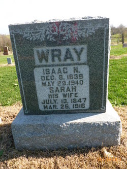
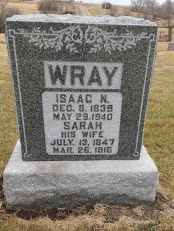
Sarah Crane Wray
| Birth | : | 13 Jul 1847 Seymour, Jackson County, Indiana, USA |
| Death | : | 26 Mar 1916 Pickering, Nodaway County, Missouri, USA |
| Burial | : | Towcester Road Cemetery, Far Cotton, Northampton Borough, England |
| Coordinate | : | 52.2178190, -0.9117050 |
| Description | : | DC #11413 Father: Jonas Crane, b: Kentucky Mother: Elizabeth Taylor, b: Kentucky Daily Democrat-Forum (Maryville, Missouri), Thursday, March 30, 1916, p. 7 Mrs. Isaac N. Wray – The esteem in which “Aunt Sally” Wray was held was shown at the funeral services which were held Monday afternoon at the Myrtle Tree church. During the services the business houses and schools of Pickering were closed and friends of “Aunt Sally” from all over the county and northwest Missouri attended. The Rev. J. J. Cokely of Rock Port, a former pastor of the Methodist church at Pickering, conducted the... Read More |
frequently asked questions (FAQ):
-
Where is Sarah Crane Wray's memorial?
Sarah Crane Wray's memorial is located at: Towcester Road Cemetery, Far Cotton, Northampton Borough, England.
-
When did Sarah Crane Wray death?
Sarah Crane Wray death on 26 Mar 1916 in Pickering, Nodaway County, Missouri, USA
-
Where are the coordinates of the Sarah Crane Wray's memorial?
Latitude: 52.2178190
Longitude: -0.9117050
Family Members:
Parent
Spouse
Children
Flowers:
Nearby Cemetories:
1. Towcester Road Cemetery
Far Cotton, Northampton Borough, England
Coordinate: 52.2178190, -0.9117050
2. Counties Crematorium
Northampton, Northampton Borough, England
Coordinate: 52.2058720, -0.9245220
3. Hardingstone Combined War Memorial
Hardingstone, Northampton Borough, England
Coordinate: 52.2137600, -0.8784700
4. Northampton County Goal Cemetery
Northampton, Northampton Borough, England
Coordinate: 52.2364470, -0.8945440
5. All Saints Church
Northampton, Northampton Borough, England
Coordinate: 52.2371129, -0.8964385
6. Cemetery of the Sisters of Notre Dame
Northampton Borough, England
Coordinate: 52.2399000, -0.8923333
7. St. Sepulchre Churchyard
Northampton, Northampton Borough, England
Coordinate: 52.2414600, -0.8973600
8. Northampton Gaol Cemetery
Northampton, Northampton Borough, England
Coordinate: 52.2418540, -0.8940440
9. St. Columba Cemetery
Collingtree, Northampton Borough, England
Coordinate: 52.1908900, -0.8990000
10. St Michael's Churchyard
Upton, Northampton Borough, England
Coordinate: 52.2356600, -0.9508160
11. Saint Luke Churchyard
Duston, Northampton Borough, England
Coordinate: 52.2428820, -0.9396550
12. Billing Road Cemetery
Northampton, Northampton Borough, England
Coordinate: 52.2387200, -0.8750900
13. St Peter and St Paul
Rothersthorpe, South Northamptonshire Borough, England
Coordinate: 52.2034651, -0.9566385
14. Rothersthorpe Extension
Rothersthorpe, South Northamptonshire Borough, England
Coordinate: 52.2046235, -0.9591382
15. Dallington Cemetery
Northampton, Northampton Borough, England
Coordinate: 52.2505200, -0.9287200
16. St Peter and St Paul Churchyard
Abington, Northampton Borough, England
Coordinate: 52.2461580, -0.8653790
17. Saint Mary
Great Houghton, Northampton Borough, England
Coordinate: 52.2233300, -0.8422800
18. St. Luke Churchyard
Kislingbury, South Northamptonshire Borough, England
Coordinate: 52.2307300, -0.9806300
19. Great Houghton Cemetery
Great Houghton, Northampton Borough, England
Coordinate: 52.2242120, -0.8386900
20. St Peter and St Paul
Quinton, South Northamptonshire Borough, England
Coordinate: 52.1934562, -0.8488287
21. Blisworth
Blisworth, South Northamptonshire Borough, England
Coordinate: 52.1751366, -0.9416729
22. St. Mary the Virgin Churchyard
Gayton, South Northamptonshire Borough, England
Coordinate: 52.1869000, -0.9687000
23. Weston Favel Cemetery
Weston Favell, Northampton Borough, England
Coordinate: 52.2492980, -0.8483410
24. Courteenhall
Courteenhall, South Northamptonshire Borough, England
Coordinate: 52.1695200, -0.8834900

