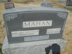
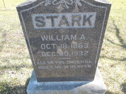
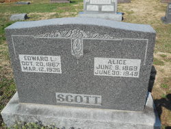
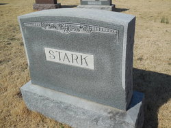
| Birth | : | 11 Dec 1857 Russellville, Cole County, Missouri, USA |
| Death | : | 6 Apr 1928 Cole County, Missouri, USA |
| Burial | : | Pleasant Hill Cemetery, Brazito, Cole County, USA |
| Coordinate | : | 38.4810300, -92.3224000 |
| Description | : | d/o Benjamin Amos & Sarah Ann (Scott) Stark w/o William Jefferson Scott |
frequently asked questions (FAQ):
-
Where is Sarah Ellen “Ellen” Stark Scott's memorial?
Sarah Ellen “Ellen” Stark Scott's memorial is located at: Pleasant Hill Cemetery, Brazito, Cole County, USA.
-
When did Sarah Ellen “Ellen” Stark Scott death?
Sarah Ellen “Ellen” Stark Scott death on 6 Apr 1928 in Cole County, Missouri, USA
-
Where are the coordinates of the Sarah Ellen “Ellen” Stark Scott's memorial?
Latitude: 38.4810300
Longitude: -92.3224000
Family Members:
Parent
Spouse
Siblings
Children
Flowers:
Nearby Cemetories:
1. Pleasant Hill Cemetery
Brazito, Cole County, USA
Coordinate: 38.4810300, -92.3224000
2. Johnston Cemetery
Brazito, Cole County, USA
Coordinate: 38.4928017, -92.2910995
3. Peace Lutheran Cemetery
Brazito, Cole County, USA
Coordinate: 38.4676600, -92.2889300
4. Arnhold Burial Ground
Brazito, Cole County, USA
Coordinate: 38.4478370, -92.3005870
5. Clarenbach and Wright Cemetery
Brazito, Cole County, USA
Coordinate: 38.4482400, -92.2968000
6. Raithel Cemetery
Brazito, Cole County, USA
Coordinate: 38.4420300, -92.3272400
7. Friedens Cemetery
Brazito, Cole County, USA
Coordinate: 38.4446182, -92.3035660
8. Hedler Cemetery
Jefferson City, Cole County, USA
Coordinate: 38.4814000, -92.2705700
9. Sommerer Farm Cemetery
Brazito, Cole County, USA
Coordinate: 38.4546500, -92.2801800
10. Colvin Strong Cemetery
Millbrook, Cole County, USA
Coordinate: 38.5025600, -92.3690400
11. Saint Johns Lutheran Church Cemetery
Stringtown, Cole County, USA
Coordinate: 38.5192986, -92.3526993
12. Old Catholic Cemetery
Jefferson City, Cole County, USA
Coordinate: 38.5358009, -92.3321991
13. Helton Farm Burial Ground
Hickory Hill, Cole County, USA
Coordinate: 38.4288500, -92.3464100
14. Saint Joseph Cemetery
Stringtown, Cole County, USA
Coordinate: 38.5361110, -92.3320720
15. Gordon Cemetery
Lohman, Cole County, USA
Coordinate: 38.5370900, -92.3158100
16. Mount Carmel Cemetery
Brazito, Cole County, USA
Coordinate: 38.4398499, -92.3734207
17. Clibourn Cemetery
Russellville, Cole County, USA
Coordinate: 38.4760500, -92.3973500
18. Fowler Farm Burial Ground
Bass, Cole County, USA
Coordinate: 38.4193750, -92.3235020
19. Eberhardt Cemetery
Cole County, USA
Coordinate: 38.5257988, -92.2668991
20. Islamic Cemetery of Mid Missouri
Jefferson City, Cole County, USA
Coordinate: 38.5117410, -92.2512620
21. Osage Bluff Methodist Cemetery
Osage Bluff, Cole County, USA
Coordinate: 38.4497910, -92.2513809
22. Saint Pauls Lutheran Cemetery
Lohman, Cole County, USA
Coordinate: 38.5388985, -92.3597031
23. Immanuel Lutheran Church Cemetery
Honey Creek, Cole County, USA
Coordinate: 38.4617500, -92.2432600
24. Duncan-Berry Family Cemetery
Eugene, Cole County, USA
Coordinate: 38.4255555, -92.3761111


