
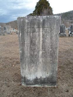
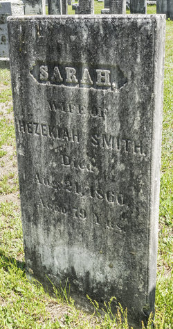
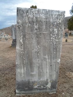
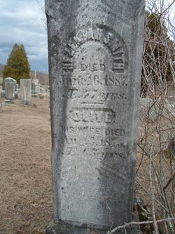
Sarah “Sally” Holland Smith
| Birth | : | 11 Jan 1781 Shelburne, Franklin County, Massachusetts, USA |
| Death | : | 21 Aug 1860 Colrain, Franklin County, Massachusetts, USA |
| Burial | : | Plainview Cemetery, Chula, Livingston County, USA |
| Coordinate | : | 39.9291992, -93.4744034 |
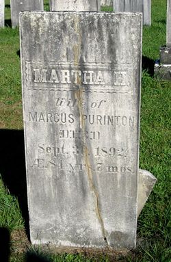
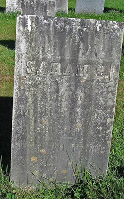
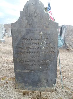
| Description | : | __________________________________________________ Children: Esther E Smith Willis, Mary Smith Purrington, Martha H Smith Johnson Purrington, Hezekiah Smith Jr, Sarah Cordelia Smith Purrington, Rhoda Smith, Nathaniel Smith, and Harriet L Smith. |
frequently asked questions (FAQ):
-
Where is Sarah “Sally” Holland Smith's memorial?
Sarah “Sally” Holland Smith's memorial is located at: Plainview Cemetery, Chula, Livingston County, USA.
-
When did Sarah “Sally” Holland Smith death?
Sarah “Sally” Holland Smith death on 21 Aug 1860 in Colrain, Franklin County, Massachusetts, USA
-
Where are the coordinates of the Sarah “Sally” Holland Smith's memorial?
Latitude: 39.9291992
Longitude: -93.4744034
Family Members:
Parent
Spouse
Siblings

Children
Flowers:


Nearby Cemetories:
1. Plainview Cemetery
Chula, Livingston County, USA
Coordinate: 39.9291992, -93.4744034
2. May Cemetery
Cream Ridge, Livingston County, USA
Coordinate: 39.9077100, -93.5124500
3. Wallace Cemetery
Chula, Livingston County, USA
Coordinate: 39.9319000, -93.4257965
4. Ward Cemetery
Farmersville, Livingston County, USA
Coordinate: 39.9324989, -93.5251999
5. Ricket Cemetery
Chula, Livingston County, USA
Coordinate: 39.8800011, -93.4289017
6. Stucker Cemetery
Grundy County, USA
Coordinate: 39.9939003, -93.4783020
7. Alpha Cemetery
Alpha, Grundy County, USA
Coordinate: 39.9834500, -93.4181100
8. Leopolis Cemetery
Livingston County, USA
Coordinate: 39.8646890, -93.4205510
9. Van Horne Cemetery
Livingston County, USA
Coordinate: 39.9528008, -93.3685989
10. Ross Cemetery
Chillicothe, Livingston County, USA
Coordinate: 39.8428001, -93.4649963
11. Tolle Cemetery
Grundy County, USA
Coordinate: 39.9707000, -93.5798700
12. Richardson Cemetery
Laredo, Grundy County, USA
Coordinate: 40.0231018, -93.4349976
13. Brooks Cemetery
Marion Township, Grundy County, USA
Coordinate: 40.0353500, -93.4983500
14. Resthaven Memorial Gardens
Chillicothe, Livingston County, USA
Coordinate: 39.8308900, -93.5457100
15. Merryman Cemetery
Grundy County, USA
Coordinate: 40.0210900, -93.3882400
16. Pleasant Hill Cemetery
Laredo, Grundy County, USA
Coordinate: 40.0473400, -93.4524600
17. Redenbaugh Cemetery
Grundy County, USA
Coordinate: 40.0395100, -93.5393900
18. Parsons Creek Cemetery
Linn County, USA
Coordinate: 39.8882800, -93.3237480
19. Anderson-Smith Cemetery
Chillicothe, Livingston County, USA
Coordinate: 39.8352500, -93.5828600
20. Smith Cemetery
Linn County, USA
Coordinate: 40.0003014, -93.3343964
21. Jones Cemetery
Chillicothe, Livingston County, USA
Coordinate: 39.7982800, -93.5009700
22. A.M.E. Church Cemetery
Chillicothe, Livingston County, USA
Coordinate: 39.8036500, -93.5330400
23. Saint Columban Catholic Cemetery
Chillicothe, Livingston County, USA
Coordinate: 39.8043700, -93.5361870
24. Forest Park Cemetery
Chillicothe, Livingston County, USA
Coordinate: 39.8073800, -93.5575800