
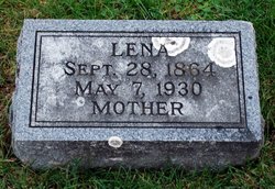


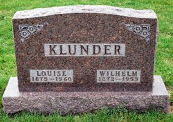
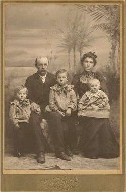
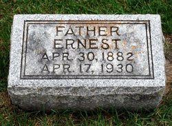
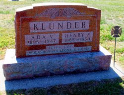
Sophie Wilhelmine Caroline “Lena” Klunder Deike
| Birth | : | 28 Sep 1864 Schessinghausen, Landkreis Nienburg, Lower Saxony (Niedersachsen), Germany |
| Death | : | 7 May 1930 Plainfield, Bremer County, Iowa, USA |
| Burial | : | Howell Memorial Park Cemetery, Pomona, Howell County, USA |
| Coordinate | : | 36.8460007, -91.9181976 |
| Plot | : | W.S. Lot 58 |
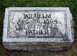
| Description | : | She is the wife of Wilhelm Deike. |
frequently asked questions (FAQ):
-
Where is Sophie Wilhelmine Caroline “Lena” Klunder Deike's memorial?
Sophie Wilhelmine Caroline “Lena” Klunder Deike's memorial is located at: Howell Memorial Park Cemetery, Pomona, Howell County, USA.
-
When did Sophie Wilhelmine Caroline “Lena” Klunder Deike death?
Sophie Wilhelmine Caroline “Lena” Klunder Deike death on 7 May 1930 in Plainfield, Bremer County, Iowa, USA
-
Where are the coordinates of the Sophie Wilhelmine Caroline “Lena” Klunder Deike's memorial?
Latitude: 36.8460007
Longitude: -91.9181976
Family Members:
Parent
Spouse
Siblings
Children
Flowers:


Nearby Cemetories:
1. Howell Memorial Park Cemetery
Pomona, Howell County, USA
Coordinate: 36.8460007, -91.9181976
2. Mount Zion Cemetery
Dry Creek Township, Howell County, USA
Coordinate: 36.8299200, -91.9486000
3. Mackey Cemetery
Pomona, Howell County, USA
Coordinate: 36.8659554, -91.8659134
4. Sadie Brown Cemetery
West Plains, Howell County, USA
Coordinate: 36.7967186, -91.8965530
5. Epps Cemetery
Pomona, Howell County, USA
Coordinate: 36.9057999, -91.9203033
6. Dripping Springs Cemetery
West Plains, Howell County, USA
Coordinate: 36.8175583, -91.8487625
7. Dry Creek Cemetery
Pomona, Howell County, USA
Coordinate: 36.8776800, -91.9886100
8. Lone Pine Cemetery
West Plains, Howell County, USA
Coordinate: 36.7813988, -91.9057999
9. Antioch Cemetery
Pomona, Howell County, USA
Coordinate: 36.8725200, -91.8307400
10. Burnham Cemetery
Burnham, Howell County, USA
Coordinate: 36.9207993, -91.9496994
11. Lost Camp Cemetery
Pomona, Howell County, USA
Coordinate: 36.9105988, -91.8566971
12. New Liberty Baptist Cemetery
Grimmet, Howell County, USA
Coordinate: 36.7775002, -91.9869003
13. Buff Cemetery
West Plains, Howell County, USA
Coordinate: 36.8633003, -92.0261002
14. Oak Grove Cemetery
West Plains, Howell County, USA
Coordinate: 36.8633838, -92.0262578
15. Pleasant View Cemetery
West Plains, Howell County, USA
Coordinate: 36.7900009, -91.8257980
16. Campbell Cemetery
West Plains, Howell County, USA
Coordinate: 36.7563600, -91.8721200
17. Collins Cemetery
Siloam Springs, Howell County, USA
Coordinate: 36.7858009, -92.0139008
18. Galloway Cemetery
West Plains, Howell County, USA
Coordinate: 36.7529106, -91.8682175
19. Saint Joseph Cemetery
White Church, Howell County, USA
Coordinate: 36.8517100, -91.7876100
20. Hopes Rest Cemetery
West Plains, Howell County, USA
Coordinate: 36.7452500, -91.9557700
21. Bolin Cemetery
Hutton Valley, Howell County, USA
Coordinate: 36.9443100, -91.8530200
22. Moffitt Cemetery
Willow Springs, Howell County, USA
Coordinate: 36.9625015, -91.9111023
23. Cantrell Cemetery
Hutton Valley, Howell County, USA
Coordinate: 36.9270300, -91.8112900
24. Pleasant Hill Cemetery
Pottersville, Howell County, USA
Coordinate: 36.7310982, -91.9606018