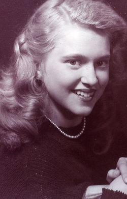
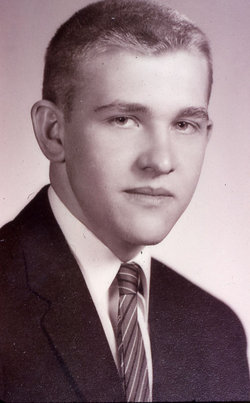
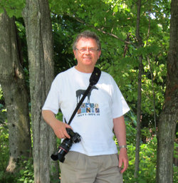
Sylvia Florence Boyce Murphy
| Birth | : | 21 Mar 1931 Poultney, Rutland County, Vermont, USA |
| Death | : | 9 Nov 2006 Rutland, Rutland County, Vermont, USA |
| Burial | : | Randwick General Cemetery, South Coogee, Randwick City, Australia |
| Coordinate | : | -33.9295780, 151.2549810 |
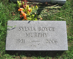
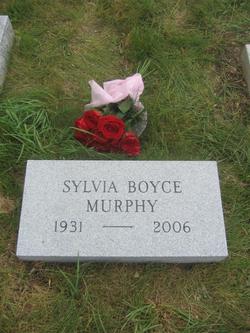
| Inscription | : | SYLVIA BOYCE MURPHY 1931 - 2006 |
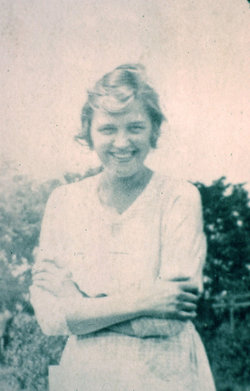
| Description | : | Sylvia was the 3rd child of 9, born to George Potter Boyce and Mary Emma Bree. . On August 1, 1954, she married Dr. Nicholas Martin Murphy of Granville, Washington, NY, in St. Raphael's Church, in Poultney. They worked together for many years in his dental practice in Granville, spending part of the year there and summers at Lake St. Catherine, VT. After retirment, they moved full-time to the Lake, where their home was the hub of many Boyce family gatherings. . |
frequently asked questions (FAQ):
-
Where is Sylvia Florence Boyce Murphy's memorial?
Sylvia Florence Boyce Murphy's memorial is located at: Randwick General Cemetery, South Coogee, Randwick City, Australia.
-
When did Sylvia Florence Boyce Murphy death?
Sylvia Florence Boyce Murphy death on 9 Nov 2006 in Rutland, Rutland County, Vermont, USA
-
Where are the coordinates of the Sylvia Florence Boyce Murphy's memorial?
Latitude: -33.9295780
Longitude: 151.2549810
Family Members:
Parent
Spouse
Siblings
Flowers:
Nearby Cemetories:
1. Randwick General Cemetery
South Coogee, Randwick City, Australia
Coordinate: -33.9295780, 151.2549810
2. Holy Trinity Church
Kingsford, Randwick City, Australia
Coordinate: -33.9267060, 151.2321180
3. Saint Jude's Cemetery
Randwick, Randwick City, Australia
Coordinate: -33.9115460, 151.2417130
4. Eastern Suburbs Memorial Park
Matraville, Randwick City, Australia
Coordinate: -33.9732410, 151.2297940
5. Botany Wesleyan Cemetery (Defunct)
Botany Bay, Bayside Council, Australia
Coordinate: -33.9421070, 151.1961480
6. Coast Hospital Cemetery
La Perouse, Randwick City, Australia
Coordinate: -33.9906780, 151.2503300
7. Botany Bay National Park
Sydney, City of Sydney, Australia
Coordinate: -33.9881750, 151.2321090
8. Devonshire Street Cemetery (Defunct)
Sydney, City of Sydney, Australia
Coordinate: -33.8828080, 151.2066180
9. St. Peters Cooks River Cemetery
Saint Peters, Inner West Council, Australia
Coordinate: -33.9139390, 151.1775670
10. Saint Mary's Cathedral
Sydney, City of Sydney, Australia
Coordinate: -33.8708540, 151.2135820
11. Old Sydney Burial Ground
Sydney, City of Sydney, Australia
Coordinate: -33.8731750, 151.2063850
12. Parish Church of Saint James
Sydney, City of Sydney, Australia
Coordinate: -33.8693760, 151.2111540
13. Camperdown Cemetery
Newtown, City of Sydney, Australia
Coordinate: -33.8942220, 151.1804900
14. Garden Island
Potts Point, City of Sydney, Australia
Coordinate: -33.8613635, 151.2280308
15. Royal Botanic Gardens
Sydney, City of Sydney, Australia
Coordinate: -33.8647440, 151.2170610
16. St Luke's Anglican Church
Enmore, Inner West Council, Australia
Coordinate: -33.8989218, 151.1700724
17. Rawson Park
Mosman, Mosman Municipality, Australia
Coordinate: -33.8350640, 151.2504980
18. Pioneers Memorial Park
Leichhardt, Inner West Council, Australia
Coordinate: -33.8780800, 151.1575000
19. St Thomas Becket Churchyard
Lewisham, Inner West Council, Australia
Coordinate: -33.8928760, 151.1480490
20. Balmain Catholic Cemetery (Defunct)
Leichhardt, Inner West Council, Australia
Coordinate: -33.8797270, 151.1523730
21. Rockdale Uniting Church Cemetery
Rockdale, Bayside Council, Australia
Coordinate: -33.9533350, 151.1381840
22. Mary MacKillop Memorial Chapel
North Sydney, North Sydney Council, Australia
Coordinate: -33.8388250, 151.2049160
23. St David’s Presbyterian Cemetery
Haberfield, Inner West Council, Australia
Coordinate: -33.8823220, 151.1378500
24. St. Paul's Anglican Church Cemetery
Canterbury, Canterbury-Bankstown Council, Australia
Coordinate: -33.9081600, 151.1236000

