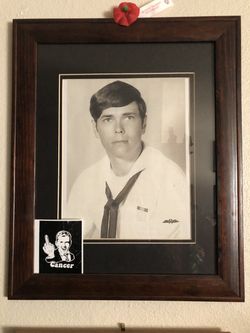
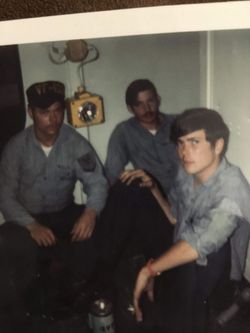
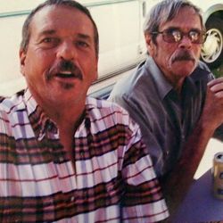
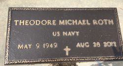
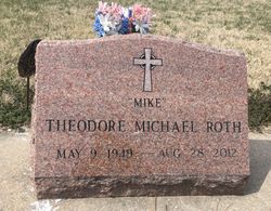
Theodore Michael “Mike” Roth
| Birth | : | 9 May 1949 Newton, Harvey County, Kansas, USA |
| Death | : | 28 Aug 2012 Wichita, Sedgwick County, Kansas, USA |
| Burial | : | Whitewater Cemetery, Harvey County, USA |
| Coordinate | : | 37.9550018, -97.1699982 |
| Plot | : | West of west drive on south end |
| Description | : | Theodore Michael Roth, affectionately known as Mike, was born May 9, 1949, at the Bethel Hospital in Newton, Kansas, and lost his battle with cancer on August 28, 2012, at the age of 63 years, 3 months, and 19 days. Mike was the son of Theodore E. Roth, Jr. and Lois Maxine Wilson Roth. Mike had a wonderful childhood growing up in the town of Whitewater. It was a common sight to see Mike and his sisters Jeannie and Margie racing down Oak Street on their tricycles along with cousin Gary who was Mike's constant companion and best... Read More |
frequently asked questions (FAQ):
-
Where is Theodore Michael “Mike” Roth's memorial?
Theodore Michael “Mike” Roth's memorial is located at: Whitewater Cemetery, Harvey County, USA.
-
When did Theodore Michael “Mike” Roth death?
Theodore Michael “Mike” Roth death on 28 Aug 2012 in Wichita, Sedgwick County, Kansas, USA
-
Where are the coordinates of the Theodore Michael “Mike” Roth's memorial?
Latitude: 37.9550018
Longitude: -97.1699982
Family Members:
Parent
Siblings
Flowers:
Nearby Cemetories:
1. Whitewater Cemetery
Harvey County, USA
Coordinate: 37.9550018, -97.1699982
2. Swiss Cemetery
Whitewater, Butler County, USA
Coordinate: 37.9799995, -97.1343994
3. Harder Cemetery
Brainerd, Butler County, USA
Coordinate: 37.9593800, -97.1161600
4. Emmaus Mennonite Church South Cemetery
Brainerd, Butler County, USA
Coordinate: 37.9569000, -97.0951000
5. Old Grace Hill Mennonite Church Cemetery
Harvey County, USA
Coordinate: 38.0128870, -97.1859870
6. Brainerd Cemetery
Brainerd, Butler County, USA
Coordinate: 37.9566994, -97.0932999
7. Joseph Golden Gravesite
Annelly, Harvey County, USA
Coordinate: 37.9698700, -97.2456600
8. Emmaus Mennonite Church Cemetery
Whitewater, Butler County, USA
Coordinate: 37.9855200, -97.0989400
9. Green Valley Cemetery
Furley, Sedgwick County, USA
Coordinate: 37.8842010, -97.1694031
10. Grace Hill Mennonite Church Cemetery
Harvey County, USA
Coordinate: 38.0289800, -97.1803300
11. Horace Hayes Gravesite
Newton, Harvey County, USA
Coordinate: 38.0435950, -97.1757810
12. Missionary Church Cemetery
Harvey County, USA
Coordinate: 38.0581017, -97.1622009
13. Pleasant View Cemetery
Elbing, Butler County, USA
Coordinate: 38.0499992, -97.1153030
14. Shafer Cemetery
Potwin, Butler County, USA
Coordinate: 37.9075012, -97.0483017
15. Adams Family Cemetery
Butler County, USA
Coordinate: 37.9850311, -97.0330963
16. Potwin Cemetery
Potwin, Butler County, USA
Coordinate: 37.9423027, -97.0250702
17. Lorraine Avenue Mennonite Church Cemetery
Valley Center, Sedgwick County, USA
Coordinate: 37.8408012, -97.1977997
18. Fairmount Lonestar Cemetery
Butler County, USA
Coordinate: 38.0285500, -97.0514200
19. McGill Cemetery
Potwin, Butler County, USA
Coordinate: 37.9188995, -97.0246964
20. Harvey County Memorial
Newton, Harvey County, USA
Coordinate: 38.0716090, -97.2184190
21. Union Cemetery
Benton, Butler County, USA
Coordinate: 37.8314018, -97.1331024
22. Zion Cemetery
Elbing, Butler County, USA
Coordinate: 38.0783005, -97.1160965
23. Haldeman Cemetery
Butler County, USA
Coordinate: 37.9989014, -97.0132980
24. 101 Club Cemetery
Valley Center, Sedgwick County, USA
Coordinate: 37.8697132, -97.3141009

