

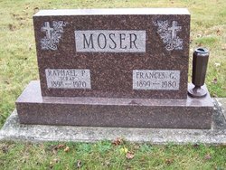
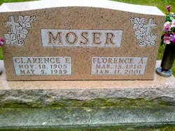
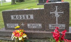
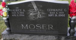
Verona A Moser McDowell
| Birth | : | 3 Nov 1909 Ohio, USA |
| Death | : | 9 Dec 1987 Orange County, California, USA |
| Burial | : | St. John the Baptist Churchyard, Frome, Mendip District, England |
| Coordinate | : | 51.2296780, -2.3209480 |
| Plot | : | Lot 145 Plt B |
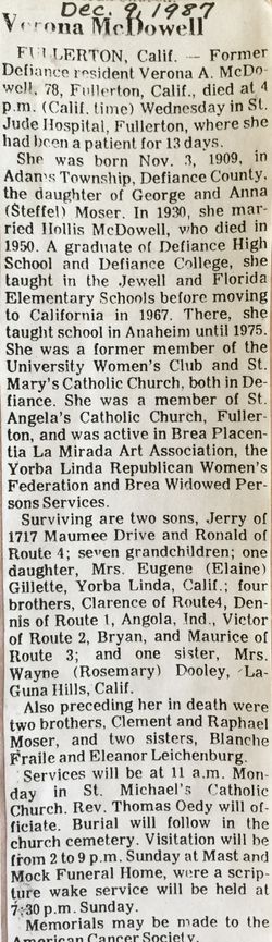
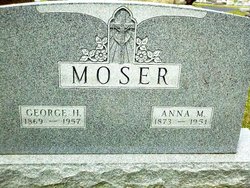
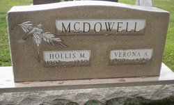
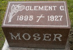
| Description | : | Defiance Crescent News Obituary Former Defiance resident Verona A. McDowell, 78, Fullerton, Califl., died at 4 p.m. (Calif. time) Wednesday, Dec. 9, 1987 in St. Jude Hospital, Fullerton, where she had been a patient for 13 days. She was born Nov. 3, 1909, in Adams Township, Defiance County, the daughter of Geroge and Anna (Steffel) Moser. In 1930, she married Hollis McDowell, who died in 1950. A graduate of Defiance High School and Defiance College, she taught in the Jewell and Florida Elementary Schools before moving to California in 1967. There, she taught school in Anaheim until 1975. ... Read More |
frequently asked questions (FAQ):
-
Where is Verona A Moser McDowell's memorial?
Verona A Moser McDowell's memorial is located at: St. John the Baptist Churchyard, Frome, Mendip District, England.
-
When did Verona A Moser McDowell death?
Verona A Moser McDowell death on 9 Dec 1987 in Orange County, California, USA
-
Where are the coordinates of the Verona A Moser McDowell's memorial?
Latitude: 51.2296780
Longitude: -2.3209480
Family Members:
Parent

Spouse
Siblings
Children


Flowers:


Nearby Cemetories:
1. St. John the Baptist Churchyard
Frome, Mendip District, England
Coordinate: 51.2296780, -2.3209480
2. Frome Dissenters' Cemetery
Frome, Mendip District, England
Coordinate: 51.2317000, -2.3215000
3. Sheppards Barton Meeting House Burial Ground
Frome, Mendip District, England
Coordinate: 51.2300570, -2.3247620
4. Christ Church Churchyard
Frome, Mendip District, England
Coordinate: 51.2295340, -2.3260130
5. Holy Trinity Church
Frome, Mendip District, England
Coordinate: 51.2341720, -2.3275820
6. East Hill Cemetery
Frome, Mendip District, England
Coordinate: 51.2275940, -2.3030250
7. East Hill
Frome St Quintin, West Dorset District, England
Coordinate: 51.2272132, -2.3024896
8. All Saints Churchyard
Rodden, Mendip District, England
Coordinate: 51.2283600, -2.2892740
9. St Mary the Virgin Churchyard
Orchardleigh, Mendip District, England
Coordinate: 51.2576210, -2.3259440
10. St Leonard Church
Marston Magna, South Somerset District, England
Coordinate: 51.2058070, -2.3488020
11. Saint Mary Magdalene Churchyard
Great Elm, Mendip District, England
Coordinate: 51.2426040, -2.3647230
12. St. Leonard's Churchyard
Mendip District, England
Coordinate: 51.2033660, -2.3512620
13. St. Mary's Berkley
Berkley, Mendip District, England
Coordinate: 51.2435080, -2.2720990
14. St. Katherine's Churchyard
Frome, Mendip District, England
Coordinate: 51.1957520, -2.3012529
15. Saint Michael & All Angels Churchyard
Buckland Dinham, Mendip District, England
Coordinate: 51.2600540, -2.3522580
16. All Saints Churchyard
Lullington, Mendip District, England
Coordinate: 51.2661940, -2.3121800
17. Beckington Baptist Chapel Burial Ground
Beckington, Mendip District, England
Coordinate: 51.2610760, -2.2897000
18. St George's Churchyard
Whatley, Mendip District, England
Coordinate: 51.2270030, -2.3822140
19. Byfields Cemetery
Nunney, Mendip District, England
Coordinate: 51.2077210, -2.3722630
20. St George Churchyard
Beckington, Mendip District, England
Coordinate: 51.2635260, -2.2856810
21. All Saints Churchyard
Nunney, Mendip District, England
Coordinate: 51.2098694, -2.3772340
22. St Andrew Churchyard
Mells, Mendip District, England
Coordinate: 51.2420710, -2.3912060
23. St Mary's Churchyard
Laverton, Mendip District, England
Coordinate: 51.2757380, -2.3195910
24. St. Margaret Churchyard Extension
Corsley, Wiltshire Unitary Authority, England
Coordinate: 51.2191491, -2.2469419