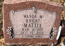
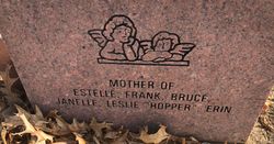
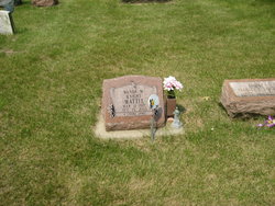
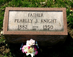
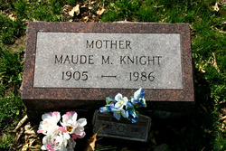
Wanda M Knight Mattix
| Birth | : | 11 Mar 1927 Iowa, USA |
| Death | : | 25 Oct 2005 Maquoketa, Jackson County, Iowa, USA |
| Burial | : | Hamilton Road Cemetery, Deal, Dover District, England |
| Coordinate | : | 51.2140870, 1.3923380 |
| Description | : | http://www.carsonandson.com/obituary/2873/Wanda-M-Mattix// Wanda M. Mattix Wanda M. Mattix age 78 of Monmouth Iowa died on Tuesday morning October 252005.0 at the Jackson County Public Hospital in Maquoketa Iowa. A celebration of her life will be held at 2 P.M. Saturday October 292005.0 from the Carson & Son Funeral And Cremation Services in Maquoketa Iowa with Chaplain/Celebrant Rev. Ruth Ann Scott of Carson & Son Funeral And Cremation Services in Maquoketa officiating. Visitation will be held from 6 to 8 P.M. on Friday October 282005.0 from the Carson & Son Funeral And Cremation Services in Maquoketa Iowa. Burial will be in the Oakview Cemetery Welton... Read More |
frequently asked questions (FAQ):
-
Where is Wanda M Knight Mattix's memorial?
Wanda M Knight Mattix's memorial is located at: Hamilton Road Cemetery, Deal, Dover District, England.
-
When did Wanda M Knight Mattix death?
Wanda M Knight Mattix death on 25 Oct 2005 in Maquoketa, Jackson County, Iowa, USA
-
Where are the coordinates of the Wanda M Knight Mattix's memorial?
Latitude: 51.2140870
Longitude: 1.3923380
Family Members:
Parent
Spouse
Flowers:
Nearby Cemetories:
1. Hamilton Road Cemetery
Deal, Dover District, England
Coordinate: 51.2140870, 1.3923380
2. St Leonard Churchyard
Deal, Dover District, England
Coordinate: 51.2169940, 1.3817700
3. St. Nicholas Churchyard
Sholden, Dover District, England
Coordinate: 51.2198600, 1.3769300
4. Old St Mary's Churchyard
Walmer, Dover District, England
Coordinate: 51.2032261, 1.3870063
5. Deal Congregational Church
Deal, Dover District, England
Coordinate: 51.2264163, 1.4024282
6. St Martin Churchyard
Great Mongeham, Dover District, England
Coordinate: 51.2145160, 1.3581010
7. St Mary the Virgin Churchyard
Ripple, Dover District, England
Coordinate: 51.2027080, 1.3629570
8. St John the Evangelist Churchyard
Deal, Dover District, England
Coordinate: 51.1862200, 1.4016700
9. St John Churchyard
Kingsdown, Dover District, England
Coordinate: 51.1860700, 1.4023200
10. St. Nicholas' Churchyard
Ringwould, Dover District, England
Coordinate: 51.1853300, 1.3754880
11. St Augustine Churchyard
Northbourne, Dover District, England
Coordinate: 51.2221700, 1.3403500
12. St. Peter and St. Paul Churchyard
Sutton, Dover District, England
Coordinate: 51.1955800, 1.3397700
13. Church of Saint George at Ham
Eastry, Dover District, England
Coordinate: 51.2444830, 1.3319350
14. St Mary the Virgin Churchyard
Betteshanger, Dover District, England
Coordinate: 51.2251200, 1.3118800
15. St Augustine's Church
East Langdon, Dover District, England
Coordinate: 51.1654990, 1.3357270
16. St Mary the Virgin Churchyard
Eastry, Dover District, England
Coordinate: 51.2453000, 1.3100000
17. Saint Andrew Churchyard
Tilmanstone, Dover District, England
Coordinate: 51.2159790, 1.2950400
18. St. Margaret of Antioch Churchyard
St Margarets at Cliffe, Dover District, England
Coordinate: 51.1534950, 1.3714350
19. Saint Peters Church
Westcliffe, Dover District, England
Coordinate: 51.1542430, 1.3573340
20. St Clement's Church
Sandwich, Dover District, England
Coordinate: 51.2736510, 1.3427270
21. St. Peter's Churchyard
Sandwich, Dover District, England
Coordinate: 51.2747680, 1.3405120
22. St .Mary's Churchyard
Sandwich, Dover District, England
Coordinate: 51.2771930, 1.3386580
23. All Saints Churchyard
Waldershare, Dover District, England
Coordinate: 51.1875170, 1.2857870
24. Saint Mary The Virgin Churchyard
Woodnesborough, Dover District, England
Coordinate: 51.2628240, 1.3073810

