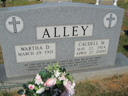
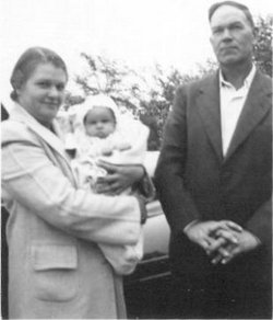
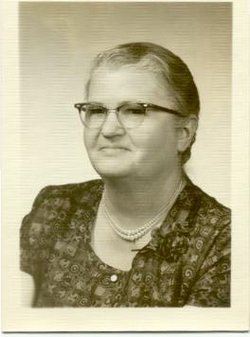
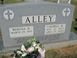
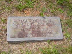
Wartha Delano Alley
| Birth | : | 29 Mar 1921 |
| Death | : | 31 Aug 2017 |
| Burial | : | Mount Liberty Cemetery, Tanner, Gilmer County, USA |
| Coordinate | : | 39.0086390, -80.9616440 |
| Description | : | Mr. Wartha Delano Alley, 96, of Madison, NC, died on Thursday, August 31, 2017 at Brian Center in Eden. Wartha was born March 29, 1921, in Rockingham County, to the late Robert Ernest Alley and Lillie Jane Case Alley. Wartha attended Madison High School. He then worked for Washington Mills in Mayodan until 1954, when he became an insurance agent for Metropolitan Life, retiring in 1982. Wartha was very active in his church, First Baptist of Mayodan, where he was the oldest male member at the time of his death. He led the Royal Ambassadors with his wife, Caudell. He taught Sunday... Read More |
frequently asked questions (FAQ):
-
Where is Wartha Delano Alley's memorial?
Wartha Delano Alley's memorial is located at: Mount Liberty Cemetery, Tanner, Gilmer County, USA.
-
When did Wartha Delano Alley death?
Wartha Delano Alley death on 31 Aug 2017 in
-
Where are the coordinates of the Wartha Delano Alley's memorial?
Latitude: 39.0086390
Longitude: -80.9616440
Family Members:
Parent
Spouse
Siblings
Flowers:
Nearby Cemetories:
1. Mount Liberty Cemetery
Tanner, Gilmer County, USA
Coordinate: 39.0086390, -80.9616440
2. Roseville Church Cemetery
Gilmer County, USA
Coordinate: 39.0207880, -80.9547600
3. Cooper Family Cemetery
Tanner, Gilmer County, USA
Coordinate: 39.0083050, -80.9255920
4. Tanner Baptist Church Cemetery
Gilmer County, USA
Coordinate: 38.9814310, -80.9480630
5. Goff Cemetery
Burnt House, Ritchie County, USA
Coordinate: 39.0361530, -80.9774200
6. Good Shepherd Catholic Cemetery
Tanner, Gilmer County, USA
Coordinate: 38.9811830, -80.9447050
7. Cooper Chapel Cemetery
Tanner, Gilmer County, USA
Coordinate: 39.0057800, -80.9161500
8. New Mount Olive Cemetery
Burnt House, Ritchie County, USA
Coordinate: 39.0446100, -80.9340200
9. Trace Fork United Methodist Church Cemetery
Gilmer County, USA
Coordinate: 38.9743580, -81.0005560
10. Burnt House United Methodist Church Cemetery
Burnt House, Ritchie County, USA
Coordinate: 39.0487301, -80.9904470
11. Three Poplar Cemetery
Glenville, Gilmer County, USA
Coordinate: 38.9628600, -80.9445500
12. Mount Olive Cemetery
Burnt House, Ritchie County, USA
Coordinate: 39.0531006, -80.9257965
13. Wilson Cemetery
Lucerne, Gilmer County, USA
Coordinate: 38.9744900, -80.9013700
14. Abraham Bush Cemetery
Lucerne, Gilmer County, USA
Coordinate: 39.0184000, -80.8856806
15. Matthews Cemetery
Lucerne, Gilmer County, USA
Coordinate: 39.0112200, -80.8839100
16. N.H. Frederick Cemetery
Burnt House, Ritchie County, USA
Coordinate: 39.0525520, -81.0169120
17. Woodford Farm Cemetery
Lucerne, Gilmer County, USA
Coordinate: 38.9819600, -80.8880900
18. Nobe Cemetery
Nobe, Calhoun County, USA
Coordinate: 38.9813000, -81.0380300
19. Bush Cemetery
Gilmer County, USA
Coordinate: 39.0203018, -80.8783035
20. Holbert Cemetery
Gilmer County, USA
Coordinate: 38.9686012, -80.8944016
21. Union Baptist Church Cemetery
Lucerne, Gilmer County, USA
Coordinate: 39.0200800, -80.8779200
22. Newberne Cemetery
Gilmer County, USA
Coordinate: 39.0465510, -80.8910940
23. Riddle Cemetery
Gilmer County, USA
Coordinate: 38.9547005, -80.9049988
24. Pisgah United Methodist Church Cemetery
De Kalb, Gilmer County, USA
Coordinate: 38.9425160, -80.9219560

