
| Birth | : | 23 Oct 1905 Aurora, Cloud County, Kansas, USA |
| Death | : | 2 Jan 1997 Concordia, Cloud County, Kansas, USA |
| Burial | : | Mount Pleasant Baptist Church Cemetery, Snipesville, Jeff Davis County, USA |
| Coordinate | : | 31.7219980, -82.8118520 |
| Plot | : | Row 2 North Side |
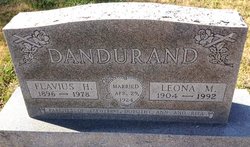
| Inscription | : | Married October 27, 1925 Parents of Lloyd - 1930 and Jerome - 1938 |
| Description | : | Salina Journal - January 4, 1997 William "Wig" Letourneau CONCORDIA - William "Wig" Letourneau, 91, Concordia, died Thursday, Jan. 2, 1997, at Cloud County Health Center, Concordia. Mr. Letourneau was born Oct. 23, 1905, at Aurora and was a Concordia resident since 1973, moving from Aurora. He was a farmer and a member of Our Lady "of Perpetual Help Catholic Church, Concordia High School Panther Backers, Century Club at Cloud County Community College and Knights of Columbus of Aurora. He was preceded in death by his wife, Eda M., in 1989, and a great-grandson. Survivors include two sons, Jerome of... Read More |
frequently asked questions (FAQ):
-
Where is William Aldemor “Wig” Letourneau's memorial?
William Aldemor “Wig” Letourneau's memorial is located at: Mount Pleasant Baptist Church Cemetery, Snipesville, Jeff Davis County, USA.
-
When did William Aldemor “Wig” Letourneau death?
William Aldemor “Wig” Letourneau death on 2 Jan 1997 in Concordia, Cloud County, Kansas, USA
-
Where are the coordinates of the William Aldemor “Wig” Letourneau's memorial?
Latitude: 31.7219980
Longitude: -82.8118520
Family Members:
Parent

Spouse
Siblings
Children
Flowers:


Nearby Cemetories:
1. Mount Pleasant Baptist Church Cemetery
Snipesville, Jeff Davis County, USA
Coordinate: 31.7219980, -82.8118520
2. Carver Chapel Cemetery
Denton, Jeff Davis County, USA
Coordinate: 31.6945160, -82.8036650
3. Saint Andrews Cemetery
Coffee County, USA
Coordinate: 31.7514000, -82.8442001
4. Williams Chapel Cemetery
Snipesville, Jeff Davis County, USA
Coordinate: 31.7154700, -82.7562800
5. Mary's Chapel Methodist Cemetery
Broxton, Coffee County, USA
Coordinate: 31.6706800, -82.8388350
6. Piney Grove Baptist Church Cemetery
Hazlehurst, Jeff Davis County, USA
Coordinate: 31.7818800, -82.8050700
7. Smith Family Cemetery
Pridgen, Coffee County, USA
Coordinate: 31.7667410, -82.8651950
8. Rocky Creek Cemetery
Coffee County, USA
Coordinate: 31.7572002, -82.8786011
9. Creech Cemetery
Snipesville, Jeff Davis County, USA
Coordinate: 31.7752060, -82.7480360
10. Providence Baptist Church Cemetery
Douglas, Coffee County, USA
Coordinate: 31.6455970, -82.8121950
11. Ashley-Manning-Pace Cemetery
Kirkland, Jeff Davis County, USA
Coordinate: 31.7907800, -82.8516800
12. Candacy Cato Cemetery
Coffee County, USA
Coordinate: 31.7082996, -82.9060974
13. Union Springs Baptist Church Cemetery
Snipesville, Jeff Davis County, USA
Coordinate: 31.7936470, -82.7640810
14. Cato Cemetery
Broxton, Coffee County, USA
Coordinate: 31.6368999, -82.8514023
15. Pridgen Baptist Church Cemetery
Coffee County, USA
Coordinate: 31.6972008, -82.9227982
16. Frier Cemetery
Pridgen, Coffee County, USA
Coordinate: 31.7649000, -82.9150400
17. Frier Cemetery
Jeff Davis County, USA
Coordinate: 31.7646999, -82.9163971
18. Annie Reed Cemetery
Jeff Davis County, USA
Coordinate: 31.7225417, -82.6895083
19. Reedy Branch Cemetery
Broxton, Coffee County, USA
Coordinate: 31.6518993, -82.9030991
20. Denton Cemetery
Denton, Jeff Davis County, USA
Coordinate: 31.7260200, -82.6887500
21. Broxton City Cemetery
Broxton, Coffee County, USA
Coordinate: 31.6327991, -82.8767014
22. Broxton Church of God Cemetery
Broxton, Coffee County, USA
Coordinate: 31.6459290, -82.9033470
23. Oak Grove Methodist Church Cemetery
Coffee County, USA
Coordinate: 31.7616997, -82.9338989
24. Old Broxton Cemetery
Broxton, Coffee County, USA
Coordinate: 31.6285450, -82.8882610