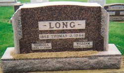
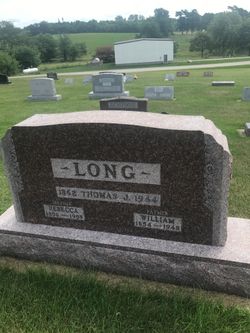
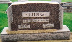
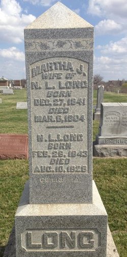
William Edward Long
| Birth | : | 29 Oct 1854 Washington, Washington County, Iowa, USA |
| Death | : | 8 Apr 1948 Crawfordsville, Washington County, Iowa, USA |
| Burial | : | St. Mary the Virgin Churchyard, Garforth, Metropolitan Borough of Leeds, England |
| Coordinate | : | 53.7926270, -1.3788540 |
| Description | : | Married 02/26/1878 Washington Washington Co IA |
frequently asked questions (FAQ):
-
Where is William Edward Long's memorial?
William Edward Long's memorial is located at: St. Mary the Virgin Churchyard, Garforth, Metropolitan Borough of Leeds, England.
-
When did William Edward Long death?
William Edward Long death on 8 Apr 1948 in Crawfordsville, Washington County, Iowa, USA
-
Where are the coordinates of the William Edward Long's memorial?
Latitude: 53.7926270
Longitude: -1.3788540
Family Members:
Parent
Spouse
Siblings
Children
Flowers:
Nearby Cemetories:
1. St. Mary the Virgin Churchyard
Garforth, Metropolitan Borough of Leeds, England
Coordinate: 53.7926270, -1.3788540
2. Garforth Cemetery
Garforth, Metropolitan Borough of Leeds, England
Coordinate: 53.7915382, -1.3770570
3. St Mary the Virgin Churchyard
Kippax, Metropolitan Borough of Leeds, England
Coordinate: 53.7676520, -1.3686680
4. St. Mary the Virgin Churchyard
Micklefield, Metropolitan Borough of Leeds, England
Coordinate: 53.7971300, -1.3313700
5. St Mary Churchyard
Swillington, Metropolitan Borough of Leeds, England
Coordinate: 53.7689620, -1.4173580
6. All Saints Churchyard
Barwick in Elmet, Metropolitan Borough of Leeds, England
Coordinate: 53.8313830, -1.3924350
7. St. Ricarius Churchyard
Aberford, Metropolitan Borough of Leeds, England
Coordinate: 53.8287190, -1.3435890
8. St. Mary's Churchyard
Whitkirk, Metropolitan Borough of Leeds, England
Coordinate: 53.7972870, -1.4496760
9. Whitkirk Church Cemetery
Whitkirk, Metropolitan Borough of Leeds, England
Coordinate: 53.7960380, -1.4527700
10. Lotherton Hall Chapel
Leeds, Metropolitan Borough of Leeds, England
Coordinate: 53.8186380, -1.3189740
11. Whitkirk Cemetery
Whitkirk, Metropolitan Borough of Leeds, England
Coordinate: 53.7970800, -1.4532000
12. St. James the Great Churchyard
Manston, Metropolitan Borough of Leeds, England
Coordinate: 53.8114230, -1.4467820
13. St Mary the Less Churchyard
Allerton Bywater, Metropolitan Borough of Leeds, England
Coordinate: 53.7452000, -1.3673620
14. All Saints Churchyard
Ledsham, Metropolitan Borough of Leeds, England
Coordinate: 53.7622160, -1.3091920
15. St James
Seacroft, Metropolitan Borough of Leeds, England
Coordinate: 53.8185600, -1.4593000
16. Whinmoor Cemetery
Seacroft, Metropolitan Borough of Leeds, England
Coordinate: 53.8359600, -1.4371000
17. Killingbeck Roman Catholic Cemetery
Killingbeck, Metropolitan Borough of Leeds, England
Coordinate: 53.8066600, -1.4734900
18. St. Oswald Churchyard
Methley, Metropolitan Borough of Leeds, England
Coordinate: 53.7345120, -1.4086560
19. St. John the Evangelist Churchyard
Oulton, Metropolitan Borough of Leeds, England
Coordinate: 53.7480340, -1.4560300
20. All Saints Churchyard
Castleford, Metropolitan Borough of Wakefield, England
Coordinate: 53.7264590, -1.3563080
21. Rothwell Cemetery
Rothwell, Metropolitan Borough of Leeds, England
Coordinate: 53.7545200, -1.4734100
22. All Saints Churchyard
Saxton, Selby District, England
Coordinate: 53.8261760, -1.2787060
23. St. Peter's Churchyard
Fryston, Metropolitan Borough of Wakefield, England
Coordinate: 53.7355400, -1.3151100
24. Castleford New Extension Cemetery
Castleford, Metropolitan Borough of Wakefield, England
Coordinate: 53.7277600, -1.3391000

