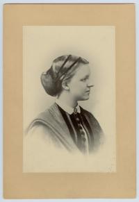
William Erasmus “Uncle William” Darwin
| Birth | : | 27 Dec 1839 Greater London, England |
| Death | : | 8 Sep 1914 Sedbergh, South Lakeland District, Cumbria, England |
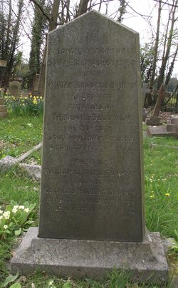
| Burial | : | St Nicolas Churchyard, North Stoneham, Eastleigh Borough, England |
| Coordinate | : | 50.9535160, -1.3741760 |
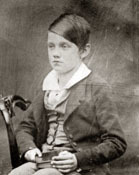
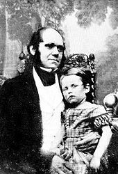
| Description | : | William Erasmus Darwin was the first-born son of Charles and Emma Darwin, and the subject of psychological studies by his father. He was educated at Rugby School and Christ's College Cambridge, and later became a banker at Grant and Maddison's Union Banking Company in Southampton. On the 29th of November 1877 he married an American Sara Price Ashburner Sedgwick (1839 – 1902). William was a great believer in university education being available to all, and championed the establishment of a university college in Southampton in 1902. The Darwins had no children of their own, and after his wife died, William... Read More |
frequently asked questions (FAQ):
-
Where is William Erasmus “Uncle William” Darwin's memorial?
William Erasmus “Uncle William” Darwin's memorial is located at: St Nicolas Churchyard, North Stoneham, Eastleigh Borough, England.
-
When did William Erasmus “Uncle William” Darwin death?
William Erasmus “Uncle William” Darwin death on 8 Sep 1914 in Sedbergh, South Lakeland District, Cumbria, England
-
Where are the coordinates of the William Erasmus “Uncle William” Darwin's memorial?
Latitude: 50.9535160
Longitude: -1.3741760
Family Members:
Parent
Spouse
Siblings
Flowers:
Nearby Cemetories:
1. St Nicolas Churchyard
North Stoneham, Eastleigh Borough, England
Coordinate: 50.9535160, -1.3741760
2. Southampton Crematorium and Garden of Remembrance
Southampton, Southampton Unitary Authority, England
Coordinate: 50.9471770, -1.3899120
3. South Stoneham Cemetery
Swaythling, Southampton Unitary Authority, England
Coordinate: 50.9401030, -1.3660260
4. St. Mary's Churchyard
Swaythling, Southampton Unitary Authority, England
Coordinate: 50.9367800, -1.3752300
5. Hampshire Fire and Rescue Garden of Remembrance
Eastleigh, Eastleigh Borough, England
Coordinate: 50.9728200, -1.3710200
6. Eastleigh Cemetery
Eastleigh, Eastleigh Borough, England
Coordinate: 50.9724710, -1.3612860
7. Highfield Churchyard
Portswood, Southampton Unitary Authority, England
Coordinate: 50.9295400, -1.3949800
8. West End Cemetery and Memorial Gardens
West End, Eastleigh Borough, England
Coordinate: 50.9342600, -1.3316300
9. St Mary Churchyard
Bishopstoke, Eastleigh Borough, England
Coordinate: 50.9760650, -1.3358720
10. St. Deny's Churchyard
Chilworth, Test Valley Borough, England
Coordinate: 50.9669770, -1.4226050
11. St James Churchyard
West End, Eastleigh Borough, England
Coordinate: 50.9243200, -1.3382300
12. St. James' Church Cemetery
West End, Eastleigh Borough, England
Coordinate: 50.9267690, -1.3326580
13. Bishopstoke Cemetery
Bishopstoke, Eastleigh Borough, England
Coordinate: 50.9777740, -1.3272020
14. Ramalley Cemetery
Chandlers Ford, Eastleigh Borough, England
Coordinate: 50.9912950, -1.3914870
15. Redcote Convent Cemetery
Bitterne, Southampton Unitary Authority, England
Coordinate: 50.9168600, -1.3510700
16. Holy Saviour Churchyard
Bitterne, Southampton Unitary Authority, England
Coordinate: 50.9138840, -1.3583560
17. Hollybrook Cemetery
Southampton, Southampton Unitary Authority, England
Coordinate: 50.9340680, -1.4312970
18. Hollybrook War Memorial
Southampton, Southampton Unitary Authority, England
Coordinate: 50.9337420, -1.4311350
19. Southampton Old Cemetery
Southampton, Southampton Unitary Authority, England
Coordinate: 50.9202900, -1.4130650
20. St. James by the Park Cemetery
Southampton Unitary Authority, England
Coordinate: 50.9267988, -1.4283898
21. St James by the Park Churchyard
Shirley, Southampton Unitary Authority, England
Coordinate: 50.9266800, -1.4285800
22. Pine Road Cemetery
Chandlers Ford, Eastleigh Borough, England
Coordinate: 50.9969590, -1.3904110
23. Wessex Vale Crematorium
West End, Eastleigh Borough, England
Coordinate: 50.9376550, -1.3054100
24. St John the Baptist Churchyard
North Baddesley, Test Valley Borough, England
Coordinate: 50.9858300, -1.4283100

