
| Birth | : | 20 Oct 1832 Thurmont, Frederick County, Maryland, USA |
| Death | : | 18 May 1906 Council Bluffs, Pottawattamie County, Iowa, USA |
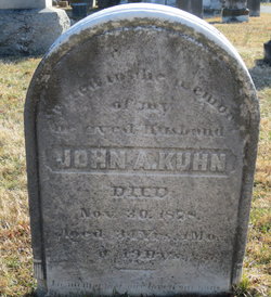
| Burial | : | Garner Cemetery, Council Bluffs, Pottawattamie County, USA |
| Coordinate | : | 41.2956161, -95.8001709 |
| Description | : | Middle name provided by member #48279606. Omaha Daily Bee, May 19, 1906: Council Bluffs News - W. H. Kuhn, a resident of Pottawattamie county since 1857, died yesterday morning at his home in Garner township, aged 73 years. He leaves a widow, three sons -- Frank of this city, Brick of Cleveland, O., and William, jr., of Garner -- and one daughter -- Mrs. Albert Downs of this city -- besides two brothers -- Rev. D. A. Kuhn of Fort Wayne, Ind., and L. H. Kuhn of Hancock, Md. Mr. Kuhn is said to have driven the first... Read More |
frequently asked questions (FAQ):
-
Where is William Henry Kuhn's memorial?
William Henry Kuhn's memorial is located at: Garner Cemetery, Council Bluffs, Pottawattamie County, USA.
-
When did William Henry Kuhn death?
William Henry Kuhn death on 18 May 1906 in Council Bluffs, Pottawattamie County, Iowa, USA
-
Where are the coordinates of the William Henry Kuhn's memorial?
Latitude: 41.2956161
Longitude: -95.8001709
Family Members:
Parent

Spouse
Siblings
Children
Flowers:


Nearby Cemetories:
1. Garner Cemetery
Council Bluffs, Pottawattamie County, USA
Coordinate: 41.2956161, -95.8001709
2. Green Valley Cemetery
Council Bluffs, Pottawattamie County, USA
Coordinate: 41.2743988, -95.8225021
3. Saint Joseph Cemetery
Council Bluffs, Pottawattamie County, USA
Coordinate: 41.2722015, -95.8208008
4. Cedar Lawn Cemetery
Council Bluffs, Pottawattamie County, USA
Coordinate: 41.2694016, -95.8182983
5. Walnut Hill Cemetery
Council Bluffs, Pottawattamie County, USA
Coordinate: 41.2719002, -95.8255997
6. Bikhor Cholim Cemetery
Council Bluffs, Pottawattamie County, USA
Coordinate: 41.2703670, -95.8229350
7. Oak Hill Cemetery
Council Bluffs, Pottawattamie County, USA
Coordinate: 41.2700900, -95.8226400
8. Ridgewood Cemetery
Council Bluffs, Pottawattamie County, USA
Coordinate: 41.2694016, -95.8272018
9. Memorial Park Cemetery
Council Bluffs, Pottawattamie County, USA
Coordinate: 41.2644005, -95.8261032
10. Gregg Cemetery
Weston, Pottawattamie County, USA
Coordinate: 41.3330000, -95.7931000
11. Evans Cemetery
Crescent, Pottawattamie County, USA
Coordinate: 41.3255997, -95.8368988
12. Clark Cemetery
Pottawattamie County, USA
Coordinate: 41.2551610, -95.8223390
13. Fairview Cemetery
Council Bluffs, Pottawattamie County, USA
Coordinate: 41.2703018, -95.8480988
14. Stoker-Graybill Cemetery
Council Bluffs, Pottawattamie County, USA
Coordinate: 41.2532620, -95.7751770
15. Hazel Dell Cemetery
Council Bluffs, Pottawattamie County, USA
Coordinate: 41.3489723, -95.7939911
16. Saint Columbanus Cemetery
Weston, Pottawattamie County, USA
Coordinate: 41.3429440, -95.7435260
17. Maple Grove Cemetery
Council Bluffs, Pottawattamie County, USA
Coordinate: 41.2265560, -95.8187100
18. Crescent Cemetery
Crescent, Pottawattamie County, USA
Coordinate: 41.3664894, -95.8566208
19. Lewis Township Cemetery
Council Bluffs, Pottawattamie County, USA
Coordinate: 41.2117004, -95.7938995
20. Downsville Cemetery
Pottawattamie County, USA
Coordinate: 41.3502998, -95.7039032
21. Council Point Cemetery
Council Bluffs, Pottawattamie County, USA
Coordinate: 41.2110830, -95.8788610
22. Pottawattamie County Home Cemetery
McClelland, Pottawattamie County, USA
Coordinate: 41.3269400, -95.6691738
23. Trinity Cathedral Columbarium
Omaha, Douglas County, USA
Coordinate: 41.2603900, -95.9393660
24. Hardin Township Cemetery
McClelland, Pottawattamie County, USA
Coordinate: 41.2949982, -95.6513977