
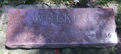
William Henry Wolken
| Birth | : | 5 Dec 1882 Iowa, USA |
| Death | : | 18 Jun 1968 Marshalltown, Marshall County, Iowa, USA |
| Burial | : | Saint Mary Cemetery, Saint Bernard, Hamilton County, USA |
| Coordinate | : | 39.1664009, -84.4880981 |
| Description | : | Services for William H Wolken 512 Bromely St. who died at Mercy Hospital Tuesday Morning were from the Chapel of Estel-Perrin Funeral Home at 2 p.m. Thursday with elder Charles Shobe of the Seventh Day Adventist Church of Des Moines in charge. Burial atthe Albion Cemetery William a Wolken is the son of Henry Wolken and Mother Cassa Meeuw. William marrried Cora Mae Essen on Feburary 10, 1912. Cora Mae Essen is the daughter of George Essen and Addie (Canfield) Essen Bearers were Eugene Shaw, Henry Stahl, Edward Peterson, Manning Wilson, Ronald and Morris Wooten |
frequently asked questions (FAQ):
-
Where is William Henry Wolken's memorial?
William Henry Wolken's memorial is located at: Saint Mary Cemetery, Saint Bernard, Hamilton County, USA.
-
When did William Henry Wolken death?
William Henry Wolken death on 18 Jun 1968 in Marshalltown, Marshall County, Iowa, USA
-
Where are the coordinates of the William Henry Wolken's memorial?
Latitude: 39.1664009
Longitude: -84.4880981
Family Members:
Parent

Spouse

Siblings
Children
Flowers:


Nearby Cemetories:
1. Saint John Cemetery
Saint Bernard, Hamilton County, USA
Coordinate: 39.1643982, -84.5053024
2. First German Protestant Cemetery
Avondale, Hamilton County, USA
Coordinate: 39.1492004, -84.4863968
3. Vine Street Hill Cemetery
Cincinnati, Hamilton County, USA
Coordinate: 39.1516991, -84.5091019
4. Longview Hospital Cemetery
Roselawn, Hamilton County, USA
Coordinate: 39.1887730, -84.4691660
5. Spring Grove Cemetery
Cincinnati, Hamilton County, USA
Coordinate: 39.1647900, -84.5231500
6. Walnut Hills Jewish Cemetery
Evanston, Hamilton County, USA
Coordinate: 39.1403700, -84.4731300
7. Calvary Cemetery
Cincinnati, Hamilton County, USA
Coordinate: 39.1403008, -84.4697037
8. Walnut Hills Cemetery
Cincinnati, Hamilton County, USA
Coordinate: 39.1355950, -84.4809040
9. Methodist Protestant Cemetery (Defunct)
Cincinnati, Hamilton County, USA
Coordinate: 39.1324770, -84.4983160
10. Clifton United Jewish Cemetery
Cincinnati, Hamilton County, USA
Coordinate: 39.1470871, -84.5292816
11. Fulton Cemetery
Hyde Park, Hamilton County, USA
Coordinate: 39.1406364, -84.4506302
12. Old Finneytown Cemetery
Finneytown, Hamilton County, USA
Coordinate: 39.1962220, -84.5206120
13. Hillside Chapel Crematory and Columbarium
Cincinnati, Hamilton County, USA
Coordinate: 39.1393509, -84.5247192
14. Griffins Station Cemetery
Carthage, Hamilton County, USA
Coordinate: 39.2047000, -84.4770730
15. Convent of the Good Shepherd Cemetery (Defunct)
Carthage, Hamilton County, USA
Coordinate: 39.2055250, -84.5042780
16. Pleasant Ridge Presbyterian Cemetery
Pleasant Ridge, Hamilton County, USA
Coordinate: 39.1794014, -84.4332962
17. Knox Presbyterian Church
Cincinnati, Hamilton County, USA
Coordinate: 39.1378980, -84.4415180
18. Wesleyan Cemetery
Cincinnati, Hamilton County, USA
Coordinate: 39.1599998, -84.5468979
19. City Infirmary Cemetery
Hartwell, Hamilton County, USA
Coordinate: 39.2123500, -84.4806700
20. Joseph of Arimethea Columbarium
Cincinnati, Hamilton County, USA
Coordinate: 39.1389470, -84.4336500
21. Third Quaker Cemetery (Defunct)
Cincinnati, Hamilton County, USA
Coordinate: 39.1542400, -84.5523720
22. Hyde Park Community UMC Columbarium
Hyde Park, Hamilton County, USA
Coordinate: 39.1363820, -84.4326970
23. Bishop Cemetery (Defunct)
College Hill, Hamilton County, USA
Coordinate: 39.1910210, -84.5489570
24. All Saints Episcopal Church Memorial Garden
Pleasant Ridge, Hamilton County, USA
Coordinate: 39.1856910, -84.4241000