
| Birth | : | 19 Jul 1861 Iowa, USA |
| Death | : | 26 Feb 1932 Des Moines, Polk County, Iowa, USA |
| Burial | : | Chapel of the Chimes Columbarium and Mausoleum, Oakland, Alameda County, USA |
| Coordinate | : | 37.8318863, -122.2456894 |
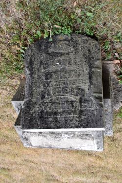
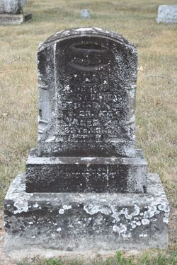
| Description | : | Aged 70y Obituary From Ottumwa Courier, February 27, 1932: W.J. BERRY DIES AT DES MOINES ONCE MEMBER OF OTTUMWA CITY COUNCIL; FUNERAL SUNDAY. William Jefferson Berry, 70 years old, former resident of Ottumwa and brother of E.S. Berry; 213 South Ransom street, and John Berry, 302 Hamilton street, died at his home in Des Moines Friday. Berry was a member of the city council here at the time Fred H. Carter was mayor, 1915-16-17, and also served a number of years as justice of the peace here. He was active in the affairs of the Willard Street Methodist Episcopal church. He is survived by... Read More |
frequently asked questions (FAQ):
-
Where is William Jefferson Berry's memorial?
William Jefferson Berry's memorial is located at: Chapel of the Chimes Columbarium and Mausoleum, Oakland, Alameda County, USA.
-
When did William Jefferson Berry death?
William Jefferson Berry death on 26 Feb 1932 in Des Moines, Polk County, Iowa, USA
-
Where are the coordinates of the William Jefferson Berry's memorial?
Latitude: 37.8318863
Longitude: -122.2456894
Family Members:
Parent
Spouse

Siblings
Children
Flowers:


Nearby Cemetories:
1. Chapel of the Chimes Columbarium and Mausoleum
Oakland, Alameda County, USA
Coordinate: 37.8318863, -122.2456894
2. Home of Eternity Cemetery
Oakland, Alameda County, USA
Coordinate: 37.8322970, -122.2448270
3. Chapel of Memories Columbarium
Oakland, Alameda County, USA
Coordinate: 37.8310471, -122.2480927
4. Saint Mary's Cemetery
Oakland, Alameda County, USA
Coordinate: 37.8349991, -122.2418976
5. Mountain View Cemetery
Oakland, Alameda County, USA
Coordinate: 37.8327600, -122.2395200
6. Cathedral of Christ the Light Mausoleum
Oakland, Alameda County, USA
Coordinate: 37.8105316, -122.2633896
7. Saint Paul Lutheran Church
Oakland, Alameda County, USA
Coordinate: 37.8020820, -122.2222780
8. Home of Peace Cemetery
Oakland, Alameda County, USA
Coordinate: 37.7790604, -122.2036285
9. Northbrae Community Church Columbarium
Berkeley, Alameda County, USA
Coordinate: 37.8905500, -122.2763200
10. Sunnyside Cemetery
Oakland, Alameda County, USA
Coordinate: 37.7806260, -122.1822410
11. Golden Gate Fields
Albany, Alameda County, USA
Coordinate: 37.8854000, -122.3117000
12. Evergreen Cemetery
Oakland, Alameda County, USA
Coordinate: 37.7719002, -122.1782990
13. Golden Gate Mausoleum and Columbaria
El Cerrito, Contra Costa County, USA
Coordinate: 37.9073150, -122.2857220
14. Sunset View Cemetery
El Cerrito, Contra Costa County, USA
Coordinate: 37.9077721, -122.2871017
15. Lafayette-Orinda Presbyterian Church Garden
Contra Costa County, USA
Coordinate: 37.8866040, -122.1606950
16. Saint Stephens Episcopal Church Memorial Garden
Orinda, Contra Costa County, USA
Coordinate: 37.8982650, -122.1729170
17. Yerba Buena Island Cemetery (Defunct)
San Francisco, San Francisco County, USA
Coordinate: 37.8127420, -122.3707880
18. Gan Shalom Cemetery
Contra Costa County, USA
Coordinate: 37.9528122, -122.1975098
19. Saint Anselms Episcopal Church Columbarium
Lafayette, Contra Costa County, USA
Coordinate: 37.8737230, -122.0933820
20. First Street Cemetery (Defunct)
San Francisco, San Francisco County, USA
Coordinate: 37.7906170, -122.3991770
21. Bush Street Cemetery (Defunct)
San Francisco, San Francisco County, USA
Coordinate: 37.7907950, -122.4011960
22. Old Saint Marys Cathedral Crypt
San Francisco, San Francisco County, USA
Coordinate: 37.7929010, -122.4058220
23. Lafayette Cemetery
Lafayette, Contra Costa County, USA
Coordinate: 37.8964005, -122.0986023
24. Grace Cathedral Columbarium
San Francisco, San Francisco County, USA
Coordinate: 37.7921110, -122.4133220