
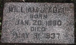
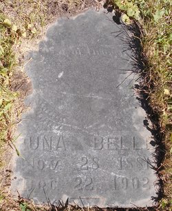
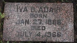
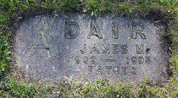
William John Adair
| Birth | : | 20 Jan 1880 Polk County, Minnesota, USA |
| Death | : | 31 May 1937 Grand Forks County, North Dakota, USA |
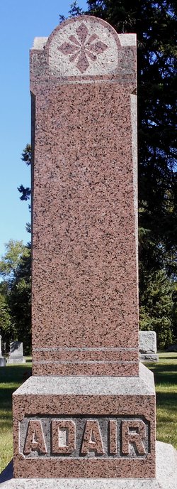
| Burial | : | Hardin Township Cemetery, McClelland, Pottawattamie County, USA |
| Coordinate | : | 41.2949982, -95.6513977 |
| Description | : | Grand Forks Herald Thursday, June 3, 1937 Page 6, Column 6, Section titled "East Side Briefs": Adair Services Funeral services for William J. Adair, 57, of East Grand Forks, who died here Monday, were Wednesday afternoon in the Mendenhall Presbyterian Church in East Grand Forks, with Rev. W. J. Brown officiating for a church service and A. E. Hallen, past worshipful master of the East Side Masonic Lodge, in charge of Masonic Services at the church and at the grave in Memorial Park cemetery. |
frequently asked questions (FAQ):
-
Where is William John Adair's memorial?
William John Adair's memorial is located at: Hardin Township Cemetery, McClelland, Pottawattamie County, USA.
-
When did William John Adair death?
William John Adair death on 31 May 1937 in Grand Forks County, North Dakota, USA
-
Where are the coordinates of the William John Adair's memorial?
Latitude: 41.2949982
Longitude: -95.6513977
Family Members:
Parent
Spouse
Children
Flowers:


Nearby Cemetories:
1. Hardin Township Cemetery
McClelland, Pottawattamie County, USA
Coordinate: 41.2949982, -95.6513977
2. Pottawattamie County Home Cemetery
McClelland, Pottawattamie County, USA
Coordinate: 41.3269400, -95.6691738
3. Saint Paul Lutheran Cemetery
Treynor, Pottawattamie County, USA
Coordinate: 41.2322000, -95.6380000
4. Downsville Cemetery
Pottawattamie County, USA
Coordinate: 41.3502998, -95.7039032
5. Zion Congregational Cemetery
Treynor, Pottawattamie County, USA
Coordinate: 41.2325090, -95.6079200
6. Fairview Pioneer Cemetery
Treynor, Pottawattamie County, USA
Coordinate: 41.2812843, -95.5555267
7. Saint Columbanus Cemetery
Weston, Pottawattamie County, USA
Coordinate: 41.3429440, -95.7435260
8. H G Fisher Cemetery
Underwood, Pottawattamie County, USA
Coordinate: 41.3838997, -95.6889038
9. Jones - Williams Cemetery
Pottawattamie County, USA
Coordinate: 41.3761000, -95.5846000
10. Stoker-Graybill Cemetery
Council Bluffs, Pottawattamie County, USA
Coordinate: 41.2532620, -95.7751770
11. Keg Creek Township Cemetery
Treynor, Pottawattamie County, USA
Coordinate: 41.1913986, -95.6893997
12. Garner Cemetery
Council Bluffs, Pottawattamie County, USA
Coordinate: 41.2956161, -95.8001709
13. Gregg Cemetery
Weston, Pottawattamie County, USA
Coordinate: 41.3330000, -95.7931000
14. Hazel Dell Cemetery
Council Bluffs, Pottawattamie County, USA
Coordinate: 41.3489723, -95.7939911
15. Castor Cemetery
Underwood, Pottawattamie County, USA
Coordinate: 41.4127040, -95.6887490
16. Cedar Lawn Cemetery
Council Bluffs, Pottawattamie County, USA
Coordinate: 41.2694016, -95.8182983
17. Saint Joseph Cemetery
Council Bluffs, Pottawattamie County, USA
Coordinate: 41.2722015, -95.8208008
18. Green Valley Cemetery
Council Bluffs, Pottawattamie County, USA
Coordinate: 41.2743988, -95.8225021
19. Zion Cemetery
Pottawattamie County, USA
Coordinate: 41.1778000, -95.7272000
20. Oak Hill Cemetery
Council Bluffs, Pottawattamie County, USA
Coordinate: 41.2700900, -95.8226400
21. Bikhor Cholim Cemetery
Council Bluffs, Pottawattamie County, USA
Coordinate: 41.2703670, -95.8229350
22. Walnut Hill Cemetery
Council Bluffs, Pottawattamie County, USA
Coordinate: 41.2719002, -95.8255997
23. Clark Cemetery
Pottawattamie County, USA
Coordinate: 41.2551610, -95.8223390
24. Ridgewood Cemetery
Council Bluffs, Pottawattamie County, USA
Coordinate: 41.2694016, -95.8272018