
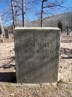
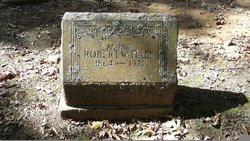
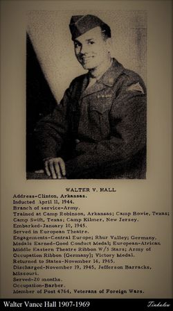
William M Hall
| Birth | : | 4 Nov 1871 Van Buren County, Arkansas, USA |
| Death | : | 30 Dec 1951 Van Buren County, Arkansas, USA |
| Burial | : | Holy Trinity Churchyard, Eccleshall, Stafford Borough, England |
| Coordinate | : | 52.8596600, -2.2575600 |
frequently asked questions (FAQ):
-
Where is William M Hall's memorial?
William M Hall's memorial is located at: Holy Trinity Churchyard, Eccleshall, Stafford Borough, England.
-
When did William M Hall death?
William M Hall death on 30 Dec 1951 in Van Buren County, Arkansas, USA
-
Where are the coordinates of the William M Hall's memorial?
Latitude: 52.8596600
Longitude: -2.2575600
Family Members:
Parent
Spouse
Siblings

Children
Flowers:


Nearby Cemetories:
1. Holy Trinity Churchyard
Eccleshall, Stafford Borough, England
Coordinate: 52.8596600, -2.2575600
2. St Mary Churchyard
Ellenhall, Stafford Borough, England
Coordinate: 52.8360140, -2.2372270
3. St. Chad's Church, Slindon, Staffordshire
Stafford Borough, England
Coordinate: 52.8870960, -2.2579986
4. All Saints Churchyard
Chebsey, Stafford Borough, England
Coordinate: 52.8546150, -2.2098560
5. Ronton Priory
Ellenhall, Stafford Borough, England
Coordinate: 52.8157600, -2.2414900
6. Ranton All Saints
Ranton, Stafford Borough, England
Coordinate: 52.8151300, -2.2156400
7. All Saints Churchyard
Standon, Stafford Borough, England
Coordinate: 52.9119000, -2.2699000
8. St Michael and All Angels Churchyard
Adbaston, Stafford Borough, England
Coordinate: 52.8482630, -2.3545010
9. Church of St Peter
Norbury, Stafford Borough, England
Coordinate: 52.8084000, -2.3184000
10. St Peter Churchyard
Broughton, Stafford Borough, England
Coordinate: 52.9003430, -2.3491340
11. St. Lawrence Churchyard
Gnosall, Stafford Borough, England
Coordinate: 52.7853010, -2.2533270
12. Stone Cemetery
Stone, Stafford Borough, England
Coordinate: 52.8874860, -2.1369430
13. Christ Church Churchyard
Stone, Stafford Borough, England
Coordinate: 52.9042670, -2.1477510
14. Stone Priory
Stone, Stafford Borough, England
Coordinate: 52.9013610, -2.1441120
15. St. Michael and St. Wulfad Churchyard
Stone, Stafford Borough, England
Coordinate: 52.9016030, -2.1433420
16. St Saviour Churchyard
Aston-by-Stone, Stafford Borough, England
Coordinate: 52.8841410, -2.1283140
17. St Giles Churchyard
Haughton, Stafford Borough, England
Coordinate: 52.7817750, -2.2005140
18. St Dominic's Convent Churchyard
Stone, Stafford Borough, England
Coordinate: 52.9106500, -2.1407000
19. St John the Baptist Churchyard
Ashley, Newcastle-Under-Lyme Borough, England
Coordinate: 52.9247740, -2.3541570
20. St Peter Churchyard
Maer, Newcastle-Under-Lyme Borough, England
Coordinate: 52.9419660, -2.3099140
21. St Luke Churchyard
Tittensor, Stafford Borough, England
Coordinate: 52.9407830, -2.1889820
22. Eccleshall Road Cemetery
Stafford, Stafford Borough, England
Coordinate: 52.8158760, -2.1252976
23. St John the Evangelist
Oulton, Stafford Borough, England
Coordinate: 52.9159400, -2.1330400
24. Forton All Saints Churchyard
Newport, Telford and Wrekin Unitary Authority, England
Coordinate: 52.7876210, -2.3640430