| Memorials | : | 39 |
| Location | : | Russellville, Brown County, USA |
| Coordinate | : | 38.8594360, -83.7610016 |
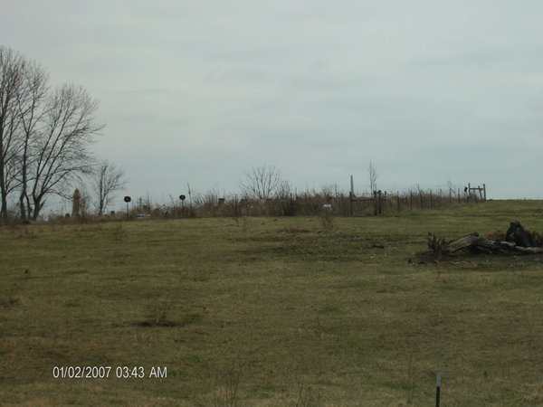
| Description | : | The BAIRD Family Graveyard or BAIRD Family Burial Ground, as it was better known in earlier years was originaly set aside by Abraham SHEPHERD on a land grant taken up by him in then Adams County, Ohio, shortly after 1800. About the year 1812 Shepherd sold the farm to George BAIRD and from that date on the burial ground took the BAIRD name. The total number of person buried there is uncertain. At one time is was claimed to be more than 300 graves, many without markers so they cannot be identified. In 1861 when all... Read More |
frequently asked questions (FAQ):
-
Where is Baird Cemetery?
Baird Cemetery is located at Russellville, Brown County ,Ohio ,USA.
-
Baird Cemetery cemetery's updated grave count on graveviews.com?
39 memorials
-
Where are the coordinates of the Baird Cemetery?
Latitude: 38.8594360
Longitude: -83.7610016
Nearby Cemetories:
1. Associated Reformed Churchyard
Russellville, Brown County, USA
Coordinate: 38.8596110, -83.7554720
2. Linwood Cemetery
Russellville, Brown County, USA
Coordinate: 38.8671989, -83.7671967
3. Associated Reformed Churchyard
Russellville, Brown County, USA
Coordinate: 38.8657990, -83.7822037
4. Old Russellville Cemetery
Russellville, Brown County, USA
Coordinate: 38.8513985, -83.7878036
5. Shaw Cemetery
Russellville, Brown County, USA
Coordinate: 38.8737950, -83.7898490
6. West-Evans Cemetery
Russellville, Brown County, USA
Coordinate: 38.8332750, -83.7333830
7. Gardner Cemetery
Russellville, Brown County, USA
Coordinate: 38.8330200, -83.7884300
8. Glaze Cemetery
Jefferson Township, Brown County, USA
Coordinate: 38.8342300, -83.8029280
9. Evans Cemetery
Decatur, Brown County, USA
Coordinate: 38.8177470, -83.7354080
10. Eckman Cemetery
Decatur, Brown County, USA
Coordinate: 38.8453903, -83.7043152
11. Liberty Chapel Cemetery
Decatur, Brown County, USA
Coordinate: 38.8171997, -83.7350006
12. Rickey Cemetery
Jackson Township, Brown County, USA
Coordinate: 38.8913994, -83.7166977
13. Ashridge Cemetery
Ash Ridge, Brown County, USA
Coordinate: 38.9164009, -83.7536011
14. Bennington Cemetery
Russellville, Brown County, USA
Coordinate: 38.8986015, -83.7007980
15. Decatur Cemetery
Decatur, Brown County, USA
Coordinate: 38.8181000, -83.7011032
16. Reeves Family Cemetery
Redoak, Brown County, USA
Coordinate: 38.7961000, -83.7608300
17. Bohrer Cemetery
Franklin Township, Brown County, USA
Coordinate: 38.9019012, -83.8257980
18. Wardlow Cemetery
Franklin Township, Brown County, USA
Coordinate: 38.8944016, -83.8358002
19. Abbott Burying Ground
Arnheim, Brown County, USA
Coordinate: 38.8944360, -83.8361210
20. Red Oak Presbyterian Church Cemetery
Redoak, Brown County, USA
Coordinate: 38.7967682, -83.7957916
21. Reeves Cemetery
Decatur, Brown County, USA
Coordinate: 38.7913780, -83.7370450
22. Dye Cemetery
Brown County, USA
Coordinate: 38.8586006, -83.8516998
23. Devore Family Cemetery
Union Township, Brown County, USA
Coordinate: 38.8053017, -83.8199997
24. Old Redoak Cemetery
Redoak, Brown County, USA
Coordinate: 38.8072014, -83.8289032


