
| Memorials | : | 0 |
| Location | : | High Wycombe, Wycombe District, England |
| Coordinate | : | 51.6298810, -0.7507090 |
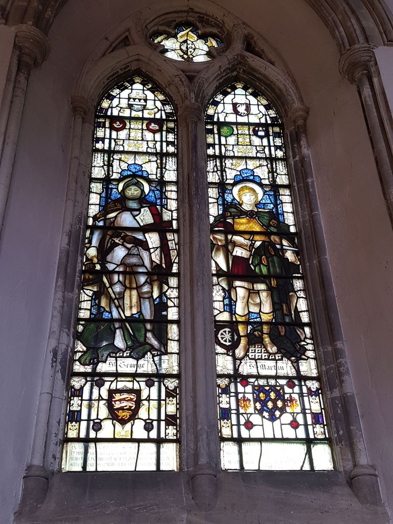
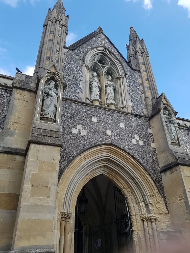
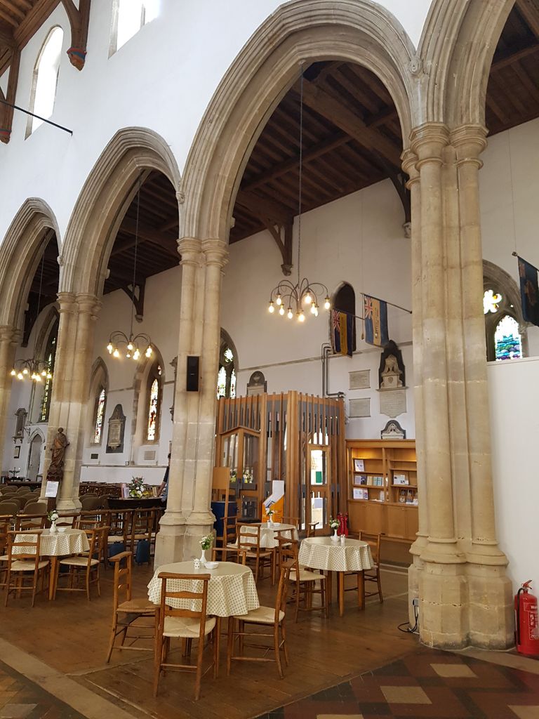
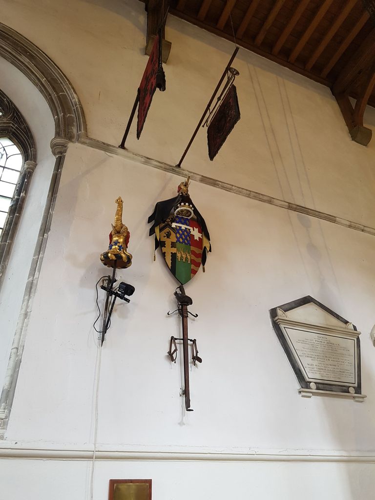
| Description | : | Located in the old centre of the town, there has been a church on this site for over 900 years. Originally Norman, it was rebuilt in 1273, then heightened and altered in the 15th century. The church contains many monuments commemorating the great and the good of High Wycombe. The churchyard surrounding the parish church was closed to burials following legislation in 1853. |
frequently asked questions (FAQ):
-
Where is All Saints Churchyard?
All Saints Churchyard is located at High Wycombe, Wycombe District ,Buckinghamshire ,England.
-
All Saints Churchyard cemetery's updated grave count on graveviews.com?
0 memorials
-
Where are the coordinates of the All Saints Churchyard?
Latitude: 51.6298810
Longitude: -0.7507090


Nearby Cemetories:
1. High Wycombe Friends Burial Ground
High Wycombe, Wycombe District, England
Coordinate: 51.6282800, -0.7428870
2. High Wycombe Cemetery
High Wycombe, Wycombe District, England
Coordinate: 51.6383160, -0.7432510
3. St. Michael and All Angels Churchyard
Hughenden, Wycombe District, England
Coordinate: 51.6518960, -0.7522470
4. Holy Trinity Churchyard
Hazlemere, Wycombe District, England
Coordinate: 51.6492680, -0.7168260
5. Cock Lane Cemetery
High Wycombe, Wycombe District, England
Coordinate: 51.6322236, -0.7045250
6. Four Ashes Garden of Rest
Hughenden, Wycombe District, England
Coordinate: 51.6614724, -0.7389121
7. St Margaret Churchyard
Tylers Green, Wycombe District, England
Coordinate: 51.6353110, -0.6960490
8. Cryers Hill Methodist Cemetery
Cryers Hill, Wycombe District, England
Coordinate: 51.6646790, -0.7349370
9. Dashwood Mausoleum
West Wycombe, Wycombe District, England
Coordinate: 51.6471210, -0.8047420
10. St. Lawrence Churchyard
West Wycombe, Wycombe District, England
Coordinate: 51.6479900, -0.8060200
11. Altona Road Cemetery
Chepping Wycombe, Wycombe District, England
Coordinate: 51.6102200, -0.6938200
12. Atlona Road Cemetery
Loudwater, Wycombe District, England
Coordinate: 51.6101490, -0.6932680
13. Fern Lane Cemetery
Little Marlow, Wycombe District, England
Coordinate: 51.5887390, -0.7273880
14. Holy Trinity Churchyard
Penn, Chiltern District, England
Coordinate: 51.6310240, -0.6774510
15. St. John the Baptist Churchyard
Little Marlow, Wycombe District, England
Coordinate: 51.5826450, -0.7398600
16. St. Botolph Churchyard
Bradenham, Wycombe District, England
Coordinate: 51.6668380, -0.8041850
17. Christ Church Churchyard
Holmer Green, Chiltern District, England
Coordinate: 51.6680370, -0.6914780
18. Marlow Cemetery
Marlow, Wycombe District, England
Coordinate: 51.5773094, -0.7761266
19. Holy Trinity Churchyard
Lane End, Wycombe District, England
Coordinate: 51.6176000, -0.8368900
20. Holy Trinity Churchyard Extension
Lane End, Wycombe District, England
Coordinate: 51.6172700, -0.8382920
21. Holy Trinity Churchyard
Marlow, Wycombe District, England
Coordinate: 51.5750000, -0.7768000
22. Little Kingshill Baptist Churchyard
High Wycombe, Wycombe District, England
Coordinate: 51.6821322, -0.7087242
23. Holy Trinity Churchyard
Penn Street, Chiltern District, England
Coordinate: 51.6571500, -0.6661430
24. Holy Trinity Churchyard
Prestwood, Chiltern District, England
Coordinate: 51.6888000, -0.7367300