
| Memorials | : | 34 |
| Location | : | Leverstock Green, Dacorum Borough, England |
| Coordinate | : | 51.7466800, -0.4295770 |
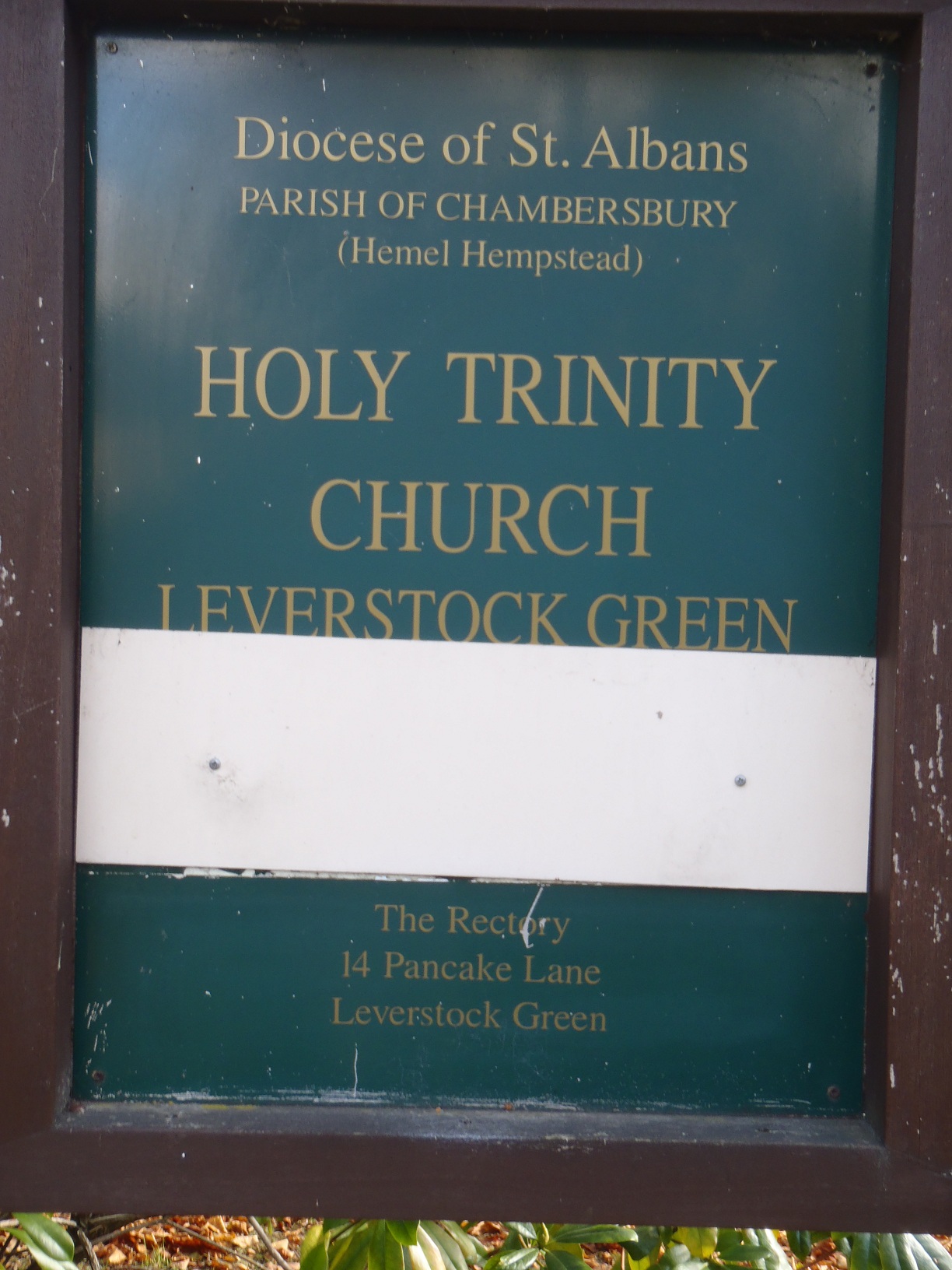
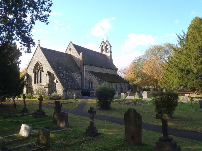
| Description | : | Leverstock Green is a suburb in Hemel Hempstead, in the Leverstock Green contains a village school (Leverstock Green Church of England Primary School), village cricket club, village football club (Leverstock Green FC), village hall, village shops, village pubs and Holy Trinity church. Despite its recent amalgamation with Hemel Hempstead, the old names remain in memory of historical times. Leverstock Green is a "modern" parish, formed about 1849 from parts of the parishes of St Michael's (St Albans), Abbots Langley and Hemel Hempstead. Leverstock Green was affected by the 2005 Buncefield oil depot explosion (the largest explosion in peacetime Europe), causing... Read More |
frequently asked questions (FAQ):
-
Where is Holy Trinity Churchyard?
Holy Trinity Churchyard is located at Bedmond Road Leverstock Green, Dacorum Borough ,Hertfordshire ,England.
-
Holy Trinity Churchyard cemetery's updated grave count on graveviews.com?
34 memorials
-
Where are the coordinates of the Holy Trinity Churchyard?
Latitude: 51.7466800
Longitude: -0.4295770
Nearby Cemetories:
1. Woodwells Cemetery
Hemel Hempstead, Dacorum Borough, England
Coordinate: 51.7576500, -0.4280300
2. St Mary's Church Apsley End
Apsley, Dacorum Borough, England
Coordinate: 51.7347710, -0.4659480
3. Burma Star Association Memorial
Hemel Hempstead, Dacorum Borough, England
Coordinate: 51.7583610, -0.4727390
4. St. Mary's Churchyard
Hemel Hempstead, Dacorum Borough, England
Coordinate: 51.7590330, -0.4722730
5. Hemel Hempstead War Memorial
Hemel Hempstead, Dacorum Borough, England
Coordinate: 51.7444960, -0.4772990
6. St John the Evangelist
Boxmoor, Dacorum Borough, England
Coordinate: 51.7444530, -0.4782000
7. Heath Lane Cemetery
Hemel Hempstead, Dacorum Borough, England
Coordinate: 51.7512350, -0.4785220
8. All Saints Churchyard
Kings Langley, Dacorum Borough, England
Coordinate: 51.7109030, -0.4479280
9. Kings Langley Priory
Kings Langley, Dacorum Borough, England
Coordinate: 51.7130000, -0.4603000
10. St Lawrence the Martyr Churchyard
Abbots Langley, Three Rivers District, England
Coordinate: 51.7077650, -0.4170030
11. East Lane Cemetery
Leavesden, Three Rivers District, England
Coordinate: 51.7084796, -0.4036263
12. St Michael’s Churchyard
St Albans, St Albans District, England
Coordinate: 51.7529540, -0.3560640
13. St. Mary's Churchyard
Redbourn, St Albans District, England
Coordinate: 51.7916200, -0.4066100
14. St. Stephen's Churchyard
St Albans, St Albans District, England
Coordinate: 51.7417450, -0.3483370
15. Romeland Hill Garden of Rest
St Albans, St Albans District, England
Coordinate: 51.7514540, -0.3438830
16. St. Paul Churchyard
Kings Langley, Dacorum Borough, England
Coordinate: 51.6931700, -0.4383900
17. West Herts Crematorium
Watford, Watford Borough, England
Coordinate: 51.7004195, -0.3847509
18. Saint Alban's Cathedral
St Albans, St Albans District, England
Coordinate: 51.7504425, -0.3423680
19. Spicer Street Chapel Burial Ground
St Albans, St Albans District, England
Coordinate: 51.7523288, -0.3423231
20. Dagnall Lane Baptist Chapel
St Albans, St Albans District, England
Coordinate: 51.7526990, -0.3405156
21. All Saints Churchyard
Watford Borough, England
Coordinate: 51.6954810, -0.3885560
22. St Peter's Churchyard
St Albans, St Albans District, England
Coordinate: 51.7555400, -0.3350270
23. Childwickbury Manor
Childwickbury, St Albans District, England
Coordinate: 51.7809460, -0.3499100
24. St. John the Evangelist Churchyard
Bourne End, Dacorum Borough, England
Coordinate: 51.7481590, -0.5296080