
| Memorials | : | 7 |
| Location | : | St Albans, St Albans District, England |
| Coordinate | : | 51.7529540, -0.3560640 |
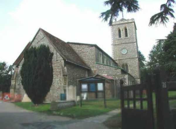
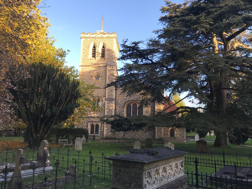
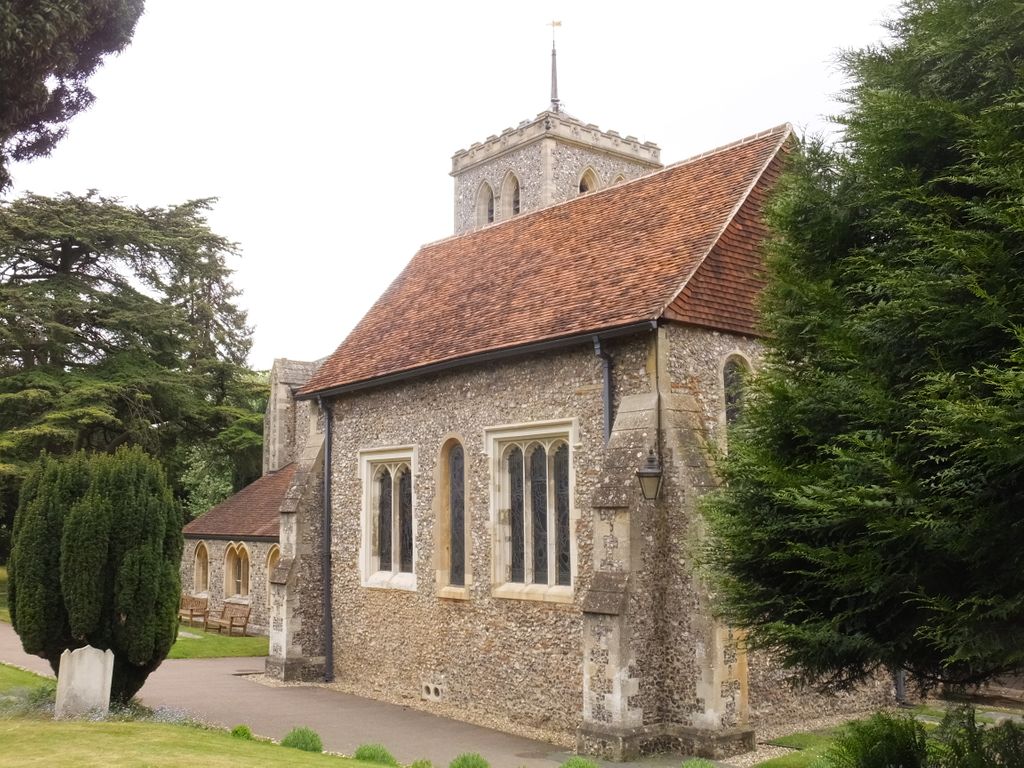
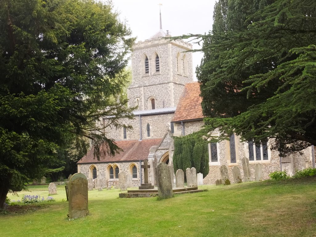
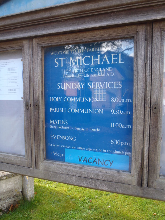
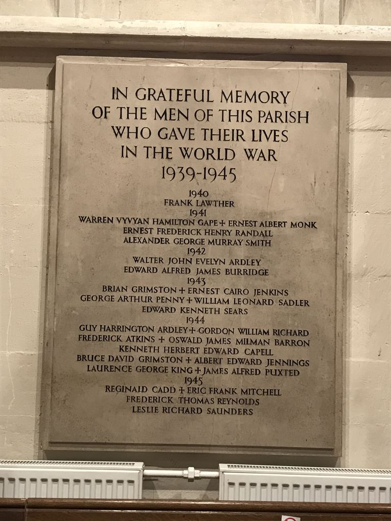
| Description | : | St Michael’s church is situated near the centre of Roman Verulamium to the west of St Albans. One of the three daughter churches of St Alban’s Abbey, it was built partly with Roman bricks in 948 AD, enlarged in the 12th century and a lady chapel added in the 13th century. It is the most significant Anglo-Saxon building in Hertfordshire. After the dissolution of the monasteries, its’ patronage passed to the nearby Gorhambury Estate. A memorial to politician Sir Francis Bacon, one of the owners of Gorhambury, stands within the church. The churchyard surrounding the building... Read More |
frequently asked questions (FAQ):
-
Where is St Michael’s Churchyard?
St Michael’s Churchyard is located at St Albans, St Albans District ,Hertfordshire ,England.
-
St Michael’s Churchyard cemetery's updated grave count on graveviews.com?
7 memorials
-
Where are the coordinates of the St Michael’s Churchyard?
Latitude: 51.7529540
Longitude: -0.3560640
Nearby Cemetories:
1. Romeland Hill Garden of Rest
St Albans, St Albans District, England
Coordinate: 51.7514540, -0.3438830
2. Spicer Street Chapel Burial Ground
St Albans, St Albans District, England
Coordinate: 51.7523288, -0.3423231
3. Saint Alban's Cathedral
St Albans, St Albans District, England
Coordinate: 51.7504425, -0.3423680
4. Dagnall Lane Baptist Chapel
St Albans, St Albans District, England
Coordinate: 51.7526990, -0.3405156
5. St. Stephen's Churchyard
St Albans, St Albans District, England
Coordinate: 51.7417450, -0.3483370
6. St Peter's Churchyard
St Albans, St Albans District, England
Coordinate: 51.7555400, -0.3350270
7. Hatfield Road Cemetery
St Albans, St Albans District, England
Coordinate: 51.7523003, -0.3192620
8. Childwickbury Manor
Childwickbury, St Albans District, England
Coordinate: 51.7809460, -0.3499100
9. St Mary Churchyard
Childwickbury, St Albans District, England
Coordinate: 51.7836980, -0.3473020
10. Frogmore Holy Trinity Burial Ground
St Albans District, England
Coordinate: 51.7197598, -0.3365342
11. London Road Cemetery
St Albans, St Albans District, England
Coordinate: 51.7333610, -0.3066110
12. Holy Trinity Churchyard
St Albans, St Albans District, England
Coordinate: 51.7170354, -0.3334244
13. St Leonard Churchyard & Extension
Sandridge, St Albans District, England
Coordinate: 51.7813690, -0.3036580
14. Woodwells Cemetery
Hemel Hempstead, Dacorum Borough, England
Coordinate: 51.7576500, -0.4280300
15. Holy Trinity Churchyard
Leverstock Green, Dacorum Borough, England
Coordinate: 51.7466800, -0.4295770
16. St. Mary's Churchyard
Redbourn, St Albans District, England
Coordinate: 51.7916200, -0.4066100
17. Sir David Yule Mausoleum
St Albans, St Albans District, England
Coordinate: 51.7024660, -0.3505190
18. East Lane Cemetery
Leavesden, Three Rivers District, England
Coordinate: 51.7084796, -0.4036263
19. West Herts Crematorium
Watford, Watford Borough, England
Coordinate: 51.7004195, -0.3847509
20. St Lawrence the Martyr Churchyard
Abbots Langley, Three Rivers District, England
Coordinate: 51.7077650, -0.4170030
21. All Saints Churchyard
Watford Borough, England
Coordinate: 51.6954810, -0.3885560
22. St Nicholas Churchyard
Harpenden, St Albans District, England
Coordinate: 51.8169470, -0.3583300
23. Saint Bololph's Churchyard
Shenley, Hertsmere Borough, England
Coordinate: 51.7030296, -0.2890460
24. Hill End Hospital Cemetery
St Albans, St Albans District, England
Coordinate: 51.6982051, -0.2901128